
The epzik8 Webpage
Pennsylvania Route 61 north - Reading to Frackville

In the Tuckerton area of Berks County, Pennsylvania, just north of the city of Reading, Pennsylvania Route 61 (Pottsville Pike) meets U.S. Route 222 at a freeway interchange. The overhead sign here points the way toward US 222 south and its control city of Lancaster, which is accessed from northbound PA 61 through a cloverleaf ramp. (6-14-2026)

PA 61 signage follows its junction with US 222 and as it heads into the village of Cross Keys. (6-14-2026)

To the right, there is a vertical bridge height clearance of 7 feet, 10 inches along West Huller Lane. (6-14-2026)

A traffic signal is soon reached at Cross Keys Road (left) and West Huller Lane (right). (6-14-2026)

PA 61 subsequently goes under the historic Blue Mountain and Reading Railroad. (6-14-2026)

The next traffic signal is at Berkeley Road (left) and Energy Lane (right). (6-14-2026)

After easing its way downhill, PA 61 crosses Willow Creek, a tributary of the Schuylkill River. (6-14-2026)

This is followed by a traffic signal at Snyder Road. (6-14-2026)

As it prepares to curve left, PA 61 approaches an intersection with Berkley Park Road. (6-14-2026)

The highway goes on over Maiden Creek. (6-14-2026)

After the Maiden Creek bridge, there is a spot along the highway that is a deer crossing area. (6-14-2026)

Soon, PA 61 comes upon its junction with Pennsylvania Route 73 (Lake Shore Drive). (6-14-2026)

This is the western terminus of PA 73, which goes 3 miles from here to Maidencreek and 10 to Oley, and parallels a part of the shoreline of Lake Ontelaunee while at it. (6-14-2026)

Each turn movement at the PA 73 signal, including the left turn onto Berks Products Drive (the entry road to the Berks Foods meat processing plant), has its own dedicated turn lane from PA 61 north. (6-14-2026)

Shortly afterward, at a signal at Cherry Street, PA 61 enters the borough of Leesport. (6-14-2026)

A block later, the route intersects Peach Street. (6-14-2026)

Near the center of the borough, East Wall Street is intersected. (6-14-2026)

Close to the north end of Leesport, there is PA 61 reassurance. (6-14-2026)

The route's speed limit for now is 40 miles per hour. (6-14-2026)

Up ahead, trucks are prohibited on Belleman's Church Road beginning 2,000 feet west of its intersection with PA 61. (6-14-2026)

PA 61 has a crossroads with and signal at Belleman's Church (SR 4026), which soon afterward has a railroad crossing to the left (the reason for the truck restriction). (6-14-2026)

Belleman's Church leads west one mile to Dauberville. (6-14-2026)

The Belleman's Church signal. (6-14-2026)

Afterward, PA 61 goes uphill and intersects one-way northbound Indian Manor Drive. (6-14-2026)

Soon, the route approaches an intersection with Mohrsville Road (SR 4017). (6-14-2026)

Mohrsville Road leads one mile to Mohrsville and 3 to Centreport. (6-14-2026)

Mohrsville Road is another intersection with a traffic signal. (6-14-2026)

The state route makes its way uphill after Mohrsville. (6-14-2026)

A staggered intersection with two legs of Birch Hill Road sits ahead. (6-14-2026)

Another instance of PA 61 reassurance soon occurs. (6-14-2026)

The next half-mile of PA 61 is another deer crossing area. (6-14-2026)

A defunct railroad crossing sits ahead beside the Glen-Gery plant. (6-14-2026)

The railroad crossing is seen here. Vehicles that would ordinarily need to stop at railroad crossings do not need to do so at this particular crossing. (6-14-2026)

A sign and accompanying set of flashers on the right warns of an approaching crossroads which is situated on a hillcrest. (6-14-2026)

The intersecting road is Shoemakersville Road, which leads southeast to Kindts Corner Road beside Lake Ontelaunee. (6-14-2026)

More PA 61 reassurance is located at the crest of the hill. (6-14-2026)

Up ahead, the route curves left and intersects Church Avenue (left) and Ridge Road (right). (6-14-2026)

Soon, PA 61 makes its way into the borough of Shoemakersville. (6-14-2026)

Upon reaching Shoemakersville, PA 61 approaches a junction with Pennsylvania Route 662 (Moselem Springs Road). (6-14-2026)

PA 662 goes south 7 miles from here to Moselem Springs. (6-14-2026)

The other portion of the PA 662 signal is Noble Avenue, which goes straight into downtown Shoemakersville. (6-14-2026)

The borough of Hamburg and the city of Pottsville are 3 and 21 miles away respectively. (6-14-2026)

The route soon crosses into Perry Township. (6-14-2026)

Intersected up ahead is Bellevue Avenue. (6-14-2026)

A very slight curve to the right follows Bellevue. (6-14-2026)

Soon thereafter comes a traffic signal at Zweizig Road (left) and Logistics Drive (right). (6-14-2026)

The route's speed limit is now 45 MPH. (6-14-2026)

On the right is a side entrance to the Hamburg Commerce Park (HCP). (6-14-2026)

The highway now makes its way downward once again. (6-14-2026)

Near the bottom of the hill, PA 61 enters Windsor Township and the village of Ridge Lawn. (6-14-2026)

Schappell Road is intersected up ahead. (6-14-2026)

A variable message sign to the right states PA 61's interchange with Interstate 81 as being 27 miles and 37 minutes away. (6-14-2026)

PA 61 reassurance is then seen on the right. (6-14-2026)

The borough of Hamburg can be reached from the next right turn. (6-14-2026)

Through traffic for PA 61 north is advised to keep left at the forthcoming intersection. (6-14-2026)

The road leading to Hamburg from here is 4th Street. (6-14-2026)

Construction at the time these photos were taken necessitated mandatory zipper merges for traffic entering northbound PA 61 on the right. (6-14-2026)

PA 61's interchange with Interstate 78 and U.S. Route 22, which go east toward Allentown and west toward state capital Harrisburg, is ¾ mile away. (6-14-2026)

A traffic signal prior to the interchange is situated at Grand Street. (6-14-2026)

PA 61 crosses the Schuylkill River as it heads toward I-78. A blue sign to the right at the beginning of the bridge touts the river's status as a Pennsylvania Scenic River. (6-14-2026)

The ramps to both directions of I-78 from northbound PA 61 are on the left. Meanwhile, just before the interchange, PA 61 enters Tilden Township. (6-14-2026)

The onramp from PA 61 to eastbound I-78 is straight on the left. In the distance sits the Hamburg outlet of the outdoor retailer Cabela's. (6-14-2026)

An I-78 route marker sits opposite the beginning of the onramp. (6-14-2026)

PA 61 crosses I-78 and then approaches the westbound onramp. (6-14-2026)

This traffic signal sits at the onramp to the westbound lanes of the Interstate. 4th Street has its own interchange with I-78 just to the east, at exit 30. (6-14-2026)

Now in a fairly busy retail hub, PA 61 has a traffic signal at Jetson Drive (right) and Cabela Drive (left). (6-14-2026)

PA 61's final signal before leaving Hamburg is Lowland Road. (6-14-2026)

With roadwork continuing, PA 61 makes its way downhill out of Hamburg. (6-14-2026)

Blue Mountain Road is intersected 900 feet away, just past another bridge over the Schuylkill. (6-14-2026)

The route's northbound left lane ends soon after the bridge. (6-14-2026)

PA 61 goes slightly uphill and curves right before the left lane ends. (6-14-2026)

The route's speed limit is about to drop to 35 MPH. (6-14-2026)

PA 61 crosses from Berks County into Schuylkill County, and then Broad Street is intersected on the left. (6-14-2026)

PA 61 now makes its way into the borough of Port Clinton. (6-14-2026)

There is a crossing of Rattling Run, a tributary of the Little Schuylkill River, just over the borough line. (6-14-2026)

After PA 61 leaves Port Clinton, its speed limit increases back up from 35, though the new speed is not specified. (6-14-2026)

Following the course of the Little Schuylkill, PA 61 curves right, then widely left, and passes an entrance to the Weiser State Forest. (6-14-2026)

As surrounding tree cover abates, PA 61 crosses the Little Schuylkill. (6-14-2026)

Up ahead, PA 61 will intersect eastbound Pennsylvania Route 895 (Summer Valley Road) Westbound PA 895 begins an overlap with northbound PA 61 at this junction. (6-14-2026)

From here, eastbound PA 895 goes 5 miles to McKeansburg and 7 to New Ringgold. PA 895 west follows PA 61 north 2 miles to Deer Lake. (6-14-2026)

As it approaches PA 895, PA 61 curves left and its center concrete barrier begins to make way for a left-turn lane. (6-14-2026)

The road intersected on the left side of this junction is Rolling Mill Road. (6-14-2026)

PA 61 and 895 reassurance sit to the right as the highway pulls away from the signal. (6-14-2026)

Deer Lake and Pottsville are respectively 2 and 14 miles away from here. (6-14-2026)

After curving left, the highway becomes straight and concrete-surfaced. (6-14-2026)
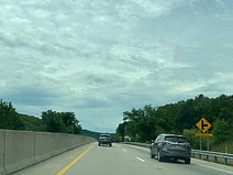
Coal Mountain Road will soon be intersected on the right. (6-14-2026)

A descent with a 7% vertical grade is a mile away. (6-14-2026)

PA 895 is about to part with PA 61. (6-14-2026)

A U-turn movement to PA 61 south is available at the PA 895 split. (6-14-2026)

A yellow sign on the right warns of a traffic signal that is located half a mile ahead. (6-14-2026)

The center of Deer Lake can be reached by making a right onto westbound PA 895 at the upcoming signal. (6-14-2026)

There is an overhead signal indicator approaching the signal which notifies drivers whenever it is red. (6-14-2026)

PA 61 enters Deer Lake borough as it approaches the right turn for the PA 895 split. Westbound PA 895 can be taken from here to the borough of Auburn a few miles away. (6-14-2026)

After PA 895 departs the corridor, no turns in either direction are permitted at the signal, which intersects Market Street. (6-14-2026)

PA 61 is left on its own again as it makes its way out of Deer Lake. At this point, the highway's two carriageways split further apart. (6-14-2026)

Soon afterward, PA 61 enters West Brunswick Township. (6-14-2026)

Up ahead, all turns at the Municipal Road intersection, including the U-turn to PA 61 south, are from the right lane. (6-14-2026)

The Deer Lake Industrial Park is half a mile down Municipal Road up ahead. (6-14-2026)

These signs point toward the Municipal Road turnoff. (6-14-2026)

The Municipal Road turn is to the right. (6-14-2026)

Intersected on the right soon afterward is Pine View Lane. (6-14-2026)

Another traffic signal awaits drivers in 1,000 feet. (6-14-2026)

The right turn ahead puts drivers on Brick Hill Road, which leads to Orwigsburg. (6-14-2026)

This intersection contains another U-turn to PA 61 south. (6-14-2026)

After the highway's next signal, located at Paramount Boulevard, the northbound left lane ends. (6-14-2026)

Intersected up ahead are South Liberty Street at a crossroads, followed by Adamsdale Road at a forked intersection on the left. (6-14-2026)

The route goes on into North Manheim Township. (6-14-2026)

Then, with PA 61 reassurance, the route starts going uphill. (6-14-2026)

During its ascent, PA 61 intersects Raring Drive. (6-14-2026)

The highway's left lane again ends at this hillcrest. (6-14-2026)

At the bottom of the hill, PA 61 comes across Greenview Road (SR 2011). (6-14-2026)

Greenview Road goes south to Adamsdale and one mile to Landingville, and north one mile to Orwigsburg. (6-14-2026)

Afterward comes more PA 61 reassurance. (6-14-2026)

The route will soon reach a junction with Pennsylvania Route 443 (Market Street). (6-14-2026)

Westbound PA 443 forms a concurrency with northbound PA 61 at this junction. (6-14-2026)

Eastbound PA 443, meanwhile, heads eastward into the borough of Orwigsburg. (6-14-2026)

The route's speed limit drops to 40 MPH at the PA 443 junction. (6-14-2026)

PA 61/443 signage is situated a few feet past the eastbound PA 443 junction. (6-14-2026)

About half a mile later, the highway intersects Sharon Valve Drive (left) and University Drive (right) which leads into the campus of Penn State Schuylkill. (6-14-2026)

Soon afterward, PA 61/443 enter the borough of Schuylkill Haven. (6-14-2026)

The route eases its way rightward along a row of houses. (6-14-2026)

PA 443 will diverge onto Dock Street at the signal up ahead. The left turn arrow for westbound PA 443 is displayed by an electronic sign. (6-14-2026)

PA 61 continues through Schuylkill Haven on its own again. (6-14-2026)

Another access point to westbound PA 443 is located straight ahead. (6-14-2026)

PA 61 is now about to have a junction with Pennsylvania Route 183 (Pottsville Street). (6-14-2026)

PA 61 is marked going straight ahead at PA 183 (it is the through route here), but in reality curves sharply to the right. (6-14-2026)

The movement from PA 61 north to PA 183 south is a jughandle (like those found in New Jersey) beside the Cressona Mall. (6-14-2026)

PA 61 then intersects Cressona Mall Drive (left) and Seven Stars Road (right). (6-14-2026)

Seven Stars is a parallel service road that has a return slip ramp to northbound PA 61 to the right. (6-14-2026)

The highway's next traffic signal, which is along a hill, is located at an additional pair of jughandle turns. (6-14-2026)

The route goes on to intersects the northern end of Seven Stars Road. (6-14-2026)

A pair of sharp curves greets drivers up ahead. (6-14-2026)

The highway curves left as it nears the top of the hill. (6-14-2026)

A 40 MPH curve to the right subsequently appears. (6-14-2026)

The right turn up ahead provides access to the Mount Carbon area. (6-14-2026)

This turn contains its own set of traffic lights. (6-14-2026)
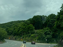
Soon, PA 61 intersects Tumbling Run Road, which parallels the Tumbling Run Reservoir. (6-14-2026)

A sign to the right warns of fallen rocks along the adjoining hillside. (6-14-2026)

At the top of the hill, a billboard from the local Yuengling Brewery welcomes northbound drivers to Pottsville, the seat of Schuylkill County. (6-14-2026)

Before Pottsville, though, PA 61 passes through the adjoining borough of Palo Alto. (6-14-2026)

Bacon Street provides the connection to the center of Palo Alto from PA 61 north. (6-14-2026)
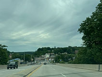
Now named Claude A. Lord Boulevard, PA 61 crosses a CSX railroad track. (6-14-2026)

Moving into downtown Pottsville, PA 61 approaches a junction with U.S. Route 209. (6-14-2026)

At a third crossing of the Schuylkill River, which PA 61 has been paralleling for the past few miles, there is signage stating that US 209 goes south 12 miles to Tremont and north 16 miles to Tamaqua. (6-14-2026)

The US 209 junction is here. (6-14-2026)

Following US 209 is PA 61 reassurance. (6-14-2026)

A few blocks to the north sits a signal at Norwegian Street. (6-14-2026)

The following signal, the last before PA 61 leaves the immediate Pottsville area, is Arch Street. (6-14-2026)

As it pulls out of downtown Pottsville, PA 61 curves wide right and climbs a hill. (6-14-2026)

After a quarter mile or so, the highway straightens and levels out. (6-14-2026)

A traffic signal lies ahead at Mill Creek Avenue (SR1004). (6-14-2026)

There is a crossroads soon afterward at Nichols Street, with a 10-ton weight limit for vehicles turning left. (6-14-2026)
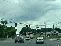
The Mill Creek signal up close. (6-14-2026)

After Mill Creek, PA 61 leaves Pottsville borough for Norwegian Township. (6-14-2026)

The route has a hillcrest, followed by another traffic signal. (6-14-2026)

This signal is placed at Mall Drive (left) and Tunnel Road (right). (6-14-2026)

A wide curve to the left and a slight descent follow the light. (6-14-2026)

Ann Street is intersected ahead on the left. (6-14-2026)

At Ann Street, PA 61 enters the borough of St. Clair. (6-14-2026)

Russel Street is intersected soon afterward at a right turn. (6-14-2026)

From here, the borough of Frackville is 6 miles to the north, and Port Carbon is 2 miles to the right. (6-14-2026)

A PA 61 shield follows Russel Street. (6-14-2026)

Near the center of St. Clair, PA 61 intersects Wade Road (left), which leads 5 miles to Minersville, and Hancock Street (right), which becomes Burma Road, leading 10 miles to Mahanoy City, as well as Locust Lake State Park. (6-14-2026)

Frackville and Ashland are a respective 5 and 12 miles' drive from here. (6-14-2026)

A subsequent traffic signal at Terry Rich Boulevard is located in the middle of a construction zone. (6-14-2026)

Lane shifts and closures lined this portion of PA 61 during this work. (6-14-2026)

The route soon reaches another light at Darkwater Road. (6-14-2026)

Soon, there is a sharp, 30 MPH curve to the left. (6-14-2026)

The route's two carriageways have split apart to a considerable distance, and the northbound carriageway makes its way downward and curves to the right ahead. A second northbound lane is seen under construction to the left. (6-14-2026)

Northbound traffic makes its curve along newly-placed gravel. (6-14-2026)

The highway is now in a fog area. (6-14-2026)

An S-curve to the left follows. (6-14-2026)

Soon, PA 61 comes upon half-mile advance signage for the defunct Schuylkill Mall. (6-14-2026)

The Schuylkill Mall exit is ahead on the right. (6-14-2026)

The Mall Road exit gore point. (6-14-2026)

PA 61 is now coming up on its interchange with Interstate 81. (6-14-2026)

I-81 leads north from here to Hazleton (as well as the Wilkes-Barre/Scranton area) and south to Harrisburg. (6-14-2026)