
The epzik8 Webpage
Interstate 81 north - Frackville to Hazleton

Interstate 81 goes northward from its interchange (exit 124) with Pennsylvania Route 61 in the area of Frackville, Schuylkill County. (6-14-2026)

The cities of Hazleton and Wilkes-Barre are a respective 20 and 45 miles from here. (6-14-2026)

I-81 is now making its way through a fog area. (6-14-2026)

Soon, at mile marker 125.8, the northbound carriageway goes downhill while surrounded by considerable tree cover on both sides. (6-14-2026)

At the bottom of the hill, the Interstate crosses a tributary of Mill Creek, which reaches its source just to the north at a lake which sits beside the hamlet of Morea. (6-14-2026)

At mile 126.9, I-81's two carriageways come back together after a wide median spanning several miles. (6-14-2026)

Exit 131, intersecting Pennsylvania Route 54 and bearing control cities of Hometown and Mahanoy City, is 2 miles away. (6-14-2026)

A patched-up blue sign on the right claims there are no services at exit 131 in either direction. (6-14-2026)

Exit 131A can be used to reach the borough of Tamaqua along with the Tuscarora and Locust Lake state parks. (6-14-2026)

Drivers are advised to watch for deer along this portion of I-81. (6-14-2026)

Before exit 131, I-81 crosses Burma Road. (6-14-2026)

A blue sign situated before the exit shows that the previous blue sign is false, as it displays logos for the Conoco gas station and Comfort Inn located off exit 131B. (6-14-2026)

Exit 131A (old 37A) to PA 54 east is on the right, located ¼ mile prior to exit 131B. (6-14-2026)

Northbound I-81 then receives traffic from a cloverleaf onramp from eastbound PA 54. (6-14-2026)

At exactly mile marker 131, I-81 crosses PA 54, an 82-mile thoroughfare between Clinton Township, north of Williamsport in the mid-Susquehanna Valley in Lycoming County, and the borough of Nesquehoning in Carbon County, in the process passing through Danville and some of the boroughs and townships of the Coal Region. (6-14-2026)

Exit 131B to PA 54 west then appears. (6-14-2026)

A weigh station is located half a mile after exit 131. (6-14-2026)

All trucks and buses must exit at the weigh station when this sign is flashing. (6-14-2026)

Exit 134, serving the community of Delano, is 1¾ miles away. (6-14-2026)

The weigh station exit is on the right. (6-14-2026)

Exit 134 sits on the right along a lefthand curve. (6-14-2026)

The exit 134 gore sign. (6-14-2026)

The road intersected at exit 134 is Grier Avenue (SR 1012). (6-14-2026)

Next, the highway crosses a defunct freight railroad track. (6-14-2026)

I-81 reassurance follows exit 134 as the Interstate's median widens once again. (6-14-2026)

Hazel Street soon passes overhead along an angled overpass. (6-14-2026)

Exit 138, intersecting Pennsylvania Route 309 with control cities of McAdoo and Tamaqua, is 2 miles from this green sign. (6-14-2026)

The highway crosses Lofty Creek before the exit. (6-14-2026)

The exit 138 gore sign is seen on the right. (6-14-2026)

I-81 makes its way over PA 309, a 134-mile thoroughfare between the northern fringes of Philadelphia and Monroe Township in Wyoming County, northwest of Scranton. (6-14-2026)

Just past exit 138, I-81 goes past walls of exposed rock, a result of mountain blasting done during construction of this segment of I-81. (6-14-2026)

Ahead, the highway curves fairly widely to the right. (6-14-2026)

In 2 miles, I-81 will meet Pennsylvania Route 424 (Greater Hazleton Chamber of Commerce Beltway) at exit 141. (6-14-2026)

The three exits serving Hazleton (141, 143 and 145) are displayed on a big green sign to the right. (6-14-2026)

One mile before exit 141, I-81 passes under Haul Road. (6-14-2026)

An AM radio frequency to which to tune for travel information is posted on the right. It is also right around here where I-81 crosses from Schuylkill County into Luzerne County. (6-14-2026)

Exit 141 looms in the distance on the right. (6-14-2026)
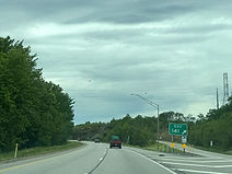
The exit 141 gore sign. (6-14-2026)

The next exit directly serves Hazleton's central business district. (6-14-2026)

PA 424 crosses I-81 along this overpass. (6-14-2026)

Exit 143, at Pennsylvania Route 924, is ¾ mile away. (6-14-2026)

At mile marker 142, I-81 passes over a CSX freight railroad track that goes into a West Hazleton rail yard. (6-14-2026)

This green sign points the way to exit 143. (6-14-2026)

PA 924's overpass over I-81 is marked with two signs. (6-14-2026)

Foodservice options available at exit 145 up ahead are displayed on the right. (6-14-2026)

Exit 145 can be taken to the borough of Conyngham. (6-14-2026)

The Hazleton campus of the Pennsylvania State University (Penn State) is also off this exit. (6-14-2026)

Hotels available at exit 145 are posted by a blue sign to the right. (6-14-2026)

Exit 145 intersects Pennsylvania Route 93, with a control city of West Hazleton, and is a mile away. (6-14-2026)

Truckers bound for westbound Interstate 80 up ahead are directed to use exit 151B. (6-14-2026)

The Interstate soon crosses Black Creek. (6-14-2026)

Exit 145 is ahead on the right. (6-14-2026)

PA 93 is known as Valmont Parkway. (6-14-2026)

The Interstate picks up an onramp from PA 93 on the right. (6-14-2026)

Up ahead is a curve to the left where the recommended speed is 45 MPH. (6-14-2026)

Within the curve, the highway goes over West Foothills Drive. (6-14-2026)

The Interstate subsequently straightens back out. (6-14-2026)

West Butler Drive (SR 3034) then passes overhead. (6-14-2026)

Exit 151, at Interstate 80, is 2 miles away. From this interchange, I-80 goes east to Stroudsburg and west to Bloomsburg. (6-14-2026)

In the meantime, I-81 crosses Nescopeck Creek. (6-14-2026)

Soon afterward, the Interstate passes over St. Johns Road (SR 3040). (6-14-2026)

At I-80, I-81's control city becomes Wilkes-Barre. (6-14-2026)

Exit 151A (I-80 east) serves interests to the Pocono community of Mountain Top. (6-14-2026)

Exit 151A sits ahead to the right. I-81's northbound right lane is marked for traffic exiting onto I-80 west at 151B. (6-14-2026)

The exit 151A gore sign. (6-14-2026)

The eastbound carriageway of I-80 passes over I-81 along a fairly tall overpass. (6-14-2026)

Subsequently, northbound I-81 crosses westbound I-80 right at mile marker 151. (6-14-2026)

Exit 151B is a tight cloverleaf ramp leading to I-80 west. (6-14-2026)
