
The epzik8 Webpage
Interstate 95 north - Between the Beltways

Northbound Interstate 95 splits from the Capital Beltway (Interstate 495) between College Park and Beltsville in Prince George's County, Maryland and heads northeast toward Baltimore. To the left, a separate exit ramp leads to a park and ride in the former right-of-way of what was to be the portion of I-95 inside the Beltway before its scrapping in 1977. Photo taken 04-30-2025.

There is a long curve as I-95 pulls away from the Beltway. Photo taken 04-30-2025.

At left, traffic coming from the inner loop of the Beltway merges with that coming off the outer loop. Photo taken 04-30-2025.

In one mile, I-95 will intersect Maryland Route 212, with control cities of Beltsville and Calverton, at exit 29. To the left, a sign displaying an AM radio frequency for obtaining Route 200 travel and toll info is posted. Photo taken 04-30-2025.

Cherry Hill Road soon passes overhead. Cherry Hill Road connects U.S. Route 1 at the north end of College Park with U.S. Route 29 in the Fairland area of Montgomery County, where it becomes Randolph Road. Photo taken 04-30-2025.

There is an I-95 reassurance shield before exit 29. Photo taken 04-30-2025.

Exit 29 lies straight ahead. A collector-distributor lane acts as the movement between I-95 itself and exits 29A and B. Photo taken 04-30-2025.

The signs to the right point toward each direction of MD 212. MD 212 emerges from northwest Washington, DC as Riggs Road, then becomes Powder Mill Road and shoots northeast to US 1 in Beltsville. Photo taken 04-30-2025.

The next three exits, in their current configuration, are effectively one large interchange complex as they are all accessed from a single collector-distributor. These exits are 31 (Maryland Route 200, the Inter-County Connector), Konterra Drive, and Maryland Route 198 (Sandy Spring Road). Photo taken 04-30-2025.

MD 212 passes over I-95 in the meantime. Photo taken 04-30-2025.

Both directions of exit 33 contain driver services in gas, food and lodging, while just beforehand, exit 32 leads to the UM Laurel Medical Center. There is return access to I-95 north available from both exits. Photo taken 04-30-2025.

The Interstate receives entering traffic from MD 212 on the right. Photo taken 04-30-2025.

To reach interstates 370 and 270 in the Gaithersburg area of Montgomery County, drivers should follow westbound MD 200. Interests to the city of Laurel, meanwhile, should exit I-95 at MD 198. Photo taken 04-30-2025.

Two lanes (one through and one exit-only) are designated for traffic bound for exits 31-33. Photo taken 04-30-2025.

Toll rates from I-95 to each terminus of MD 200 are displayed on this sign. The discrepancy between each rate is attributed to MD 200's east end at US 1 being less than a mile and a half to the east, versus the 16-plus miles separating I-95 from MD 200's west end at I-370. MD 200 itself opened in phases between 2011 and 2014 after decades of planning and hurdles. Photo taken 04-30-2025.

The exit 31-33 C-D begins on the right. Photo taken 04-30-2025.

Six miles away, there is a Maryland welcome center along each direction of the Interstate. Photo taken 04-30-2025.

Up ahead, a pair of flyover ramps run between I-95 and MD 200. Photo taken 04-30-2025.

The Baltimore/Washington International Airport (BWI Marshall) can be reached via Interstate 195, 15 miles ahead. Photo taken 04-30-2025.

At left, an onramp from MD 200 west reaches I-95 north. Photo taken 04-30-2025.

I-95 reassurance greets drivers who just came in from MD 200. Photo taken 04-30-2025.

Konterra Drive next passes overhead at exit 32, a four-ramp folded cloverleaf interchange. Photo taken 04-30-2025.

At right, the C-D lanes are approaching exit 33A, which leads to MD 198 east and Laurel. Photo taken 04-30-2025.

The Interstate goes on past Maryland mile marker 32. Photo taken 04-30-2025.

Half a mile past exit 33A, exit 33B leads to MD 198 west and the Burtonsville area of Montgomery County. Photo taken 04-30-2025.

Exit 33A's gore sign is seen to the right. Photo taken 04-30-2025.
Seen going over the Interstate here, the onramp from MD 198 west to I-95 south is so long that it has its own mile markers. Photo taken 04-30-2025.

MD 198 itself passes over the highway at exit 33 proper. Photo taken 04-30-2025.

I-95 curves right before it receives incoming traffic from all three exits. Photo taken 04-30-2025.

To the right, there is a blank lodging sign for exit 35. Photo taken 04-30-2025.

Mile marker 34 of the Interstate is attached to an I-95 shield. Photo taken 04-30-2025.

Below the Brooklyn Bridge Road overpass sits a one-mile advance sign for exit 35, which intersects Maryland Route 216 with control cities of Laurel and Scaggsville. Photo taken 04-30-2025.

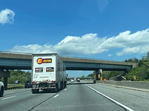
Meanwhile, 6 miles away off exit 41A there is a truck stop. Truck drivers may also wish to wait until exit 57 in the Canton area of east Baltimore, 22 miles from this sign and 16 after exit 41. Photo taken 04-30-2025.

I-95 proceeds over the Patuxent River into Howard County. To the immediate west sits the T. Howard Duckett Dam marking the east end of the Rocky Gorge Reservoir. Photo taken 04-30-2025.

Exit 35A to MD 216 east and Laurel is "next right". Photo taken 04-30-2025.

Stansfield Road is crossed just prior to exit 35. Photo taken 04-30-2025.

Exit 35A is half a mile before exit 35B. Photo taken 04-30-2025.

Exit 35B, to MD 216 west and Scaggsville, comes one mile before the rest area entrance. Photo taken 04-30-2025.

The exit 35B gore sign. Photo taken 04-30-2025.

The onramp from MD 216 west to I-95 north enters on the right. Photo taken 04-30-2025.

Up ahead, exit 38A provides access to the historic Savage Mill via southbound US 1. Photo taken 04-30-2025.

The rest area is situated ahead on the right. A separate but adjacent rest area is present southbound. Photo taken 04-30-2025.

Gorman Road makes its way over the Interstate before the rest area. Photo taken 04-30-2025.

The next rest area along I-95 is the median Maryland House travel plaza about 45 miles to the northeast, near mile marker 82 near Aberdeen in Harford County. Photo taken 04-30-2025.

I-95 goes downhill, collects traffic exiting the rest area, then encounters a sign displaying the distances to Baltimore, Philadelphia and New York City, the last of which is still more than 200 miles away. Photo taken 04-30-2025.

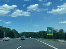
In one mile, at exit 38, I-95 will encounter Maryland Route 32 (Patuxent Freeway) which runs between Fort Meade and Columbia. Photo taken 04-30-2025.

In the meantime, the highway crosses the Middle Patuxent River. Photo taken 04-30-2025.

Vollmerhausen Road then passes overhead. Photo taken 04-30-2025.

The Interstate then passes over the Little Patuxent River at mile marker 38. Photo taken 04-30-2025.

Exit 38A now departs the highway for eastbound MD 32 and the U.S. Army's Fort Meade. Exit 38B for MD 32 west and Columbia follows in half a mile. Photo taken 04-30-2025.

The northbound carriageway then goes over MD 32 east. Photo taken 04-30-2025.

As a left entrance ramp from MD 32 east enters, exit 38B prepares to depart the northbound lanes on the right. Photo taken 04-30-2025.
The exit 38B gore sign, complete with a MD 32 shield. Photo taken 04-30-2025.

After MD 32, I-695 - the Baltimore Beltway - is 9 miles and as many minutes away. Photo taken 04-30-2025.

After climbing uphill, the highway crosses an old CSX rail line spur. Photo taken 04-30-2025.

At right, some of the services at the forthcoming exit 41 are posted. Photo taken 04-30-2025.

Exit 41 intersects Maryland Route 175 (Waterloo Road) toward Columbia and Jessup in half a mile. Photo taken 04-30-2025.

Exit 41 - a six-ramp, fully access-controlled interchange with two cloverleaf and two flyover ramps - is in the distance. Photo taken 04-30-2025.

At exit 41, northbound I-95 has dual posted control cities of Baltimore and New York. Photo taken 04-30-2025.

To the west of here, MD 175 leads straight into the Columbia Town Center as Little Patuxent Parkway. Photo taken 04-30-2025.

MD 175 east passes overhead before sending a cloverleaf entrance ramp to I-95 north. Photo taken 04-30-2025.

The distances to the next three exits (MD 100, I-895, I-195) are displayed overhead here. Photo taken 04-30-2025.

The Stoney Run and Arundel Mills districts of the BWI Region can be reached from MD 100 east up ahead. Photo taken 04-30-2025.

Exit 43 with Maryland Route 100, which has control cities of Glen Burnie and Ellicott City, is half a mile ahead. Photo taken 04-30-2025.

In the meantime, the travel times to each of the tunnels under the Patapsco River in Baltimore on I-95 and I-895 are displayed by this variable message sign. Photo taken 04-30-2025.

Meadow Ridge Road passes under the Interstate right before exit 43. Photo taken 04-30-2025.

Exits 43A and B are situated half a mile apart. 20 miles long, the entirety of MD 100 with the exception of two at-grade intersections at its east end in Jacobsville in Anne Arundel County is a freeway. Photo taken 04-30-2025.

The exit 43A gore sign. Photo taken 04-30-2025.

Exit 43B to MD 100 west and Howard County seat Ellicott City comes afterward. Photo taken 04-30-2025.

I-95's next three exits all intersect fellow Interstates: I-895, I-195 and I-695. Photo taken 04-30-2025.

Posted at right are the exits to take to each terminal of the Port of Baltimore. Photo taken 04-30-2025.

The 2024 collapse of the Francis Scott Key Bridge has left a gap over the Patapsco River along I-695 with a temporary western/southern terminus at exit 1 at Hawkins Point in southeast Baltimore. Photo taken 04-30-2025.

Hazmats are prohibited in both Baltimore tunnels. With no Patapsco crossing currently along I-695, drivers of such vehicles must take a lengthy clockwise trip on the Beltway through Baltimore County's inner ring. Photo taken 04-30-2025.

Montgomery Road, a local arterial through the Elkridge area, crosses I-95 between exits. Photo taken 04-30-2025.

Exit 46 is the southern terminus of Interstate 895, the Baltimore Harbor Tunnel Thruway. This can only be accessed northbound. The Harbor Tunnel, which I-895 traverses, is the older of Baltimore's two tunnels under the Patapsco, having opened in 1957. Photo taken 04-30-2025.

At exit 46, there is one-mile advance signage for exit 47 with eastbound Interstate 195 toward BWI, and northbound Maryland Route 166 (Rolling Road) toward Catonsville. Photo taken 04-30-2025.

Almost all of I-895's interchanges are partial ones that make it impossible for drivers not to pay the toll and go through the tunnel. Photo taken 04-30-2025.

The southbound carriageway of I-895 passes overhead here in leading to southbound I-95. I-895 will return to I-95 at its northern terminus on the eastern Baltimore city/county line about 15 miles to the northeast. Photo taken 04-30-2025.

Exit 47 is now half a mile away, and the Halethorpe MARC commuter rail station is noted as being off this exit via I-195 east and US 1 north. Photo taken 04-30-2025.

I-95's crossing of the non-tidal Patapsco here takes it from Howard County into southwestern Baltimore County. Photo taken 04-30-2025.

The West Nursery District of the BWI Region can be reached by taking I-195 east to MD 295 north to West Nursery. Photo taken 04-30-2025.

The campus of the University of Maryland Baltimore County (UMBC) can be reached from exit 47B, MD 166 north. Photo taken 04-30-2025.

Two miles after exit 47, I-95 intersects I-695 at exit 49. Here, I-695 is marked as going east (outer loop) toward Glen Burnie and west (inner loop) toward Towson. Photo taken 04-30-2025.

The exit 47 gore sign. Photo taken 04-30-2025.

As it receives entering traffic from MD 166 south, I-95 crosses over I-195. Photo taken 04-30-2025.

There is about to be a wide curve to the right. Photo taken 04-30-2025.

On the next I-95 reassurance shield, the directional banner is at the bottom. Photo taken 04-30-2025.

On the next overhead gantry, exit 49B is revealed to be a left exit. Photo taken 04-30-2025.

The Interstate takes time to pass over Oakland Road. Photo taken 04-30-2025.

The next crossing is over the west branch of Herbert Run and Oregon Avenue. Photo taken 04-30-2025.

As the highway climbs uphill, it receives half-mile advance notice for exit 49A, where "Key Bridge" has been greened out. Photo taken 04-30-2025.

Southwestern Boulevard (US 1) and Potomac Avenue are crossed over by I-95 before it reaches I-695. Photo taken 04-30-2025.

The inner loop of the I-695 can be used from here to get to Interstates 70 and 83 to respectively reach points west and north of Baltimore. Photo taken 04-30-2025.

Once again, exits 49A and B are half a mile apart from one another. This is the southern of I-95's two interchanges with the Beltway; the other is north of Baltimore, at exit 64 in Rosedale. Photo taken 04-30-2025.

The exit 49A gore sign. Photo taken 04-30-2025.

Here, I-95 crosses over the ramp leading from the outer loop to I-95 north, which merges with the corresponding ramp from the inner loop before reaching I-95. Photo taken 04-30-2025.

Just before exit 49B, the distances to two of the first four exits in Baltimore (Caton Avenue and I-395) are displayed overhead. Photo taken 04-30-2025.

Exit 49B now appears on the left. Photo taken 04-30-2025.
