
The epzik8 Webpage
Interstate 76 west - Pennsylvania line to Akron

After running east to west for 351 miles across the Commonwealth of Pennsylvania, Interstate 76 enters Ohio and changes over from the Pennsylvania Turnpike to the Ohio Turnpike. (4-9-2026)

The first Ohio county that I-76 passes through is Mahoning. (4-9-2026)

The Interstate soon crosses East Garfield Road, which heads into the small town of Petersburg to the southwest. (4-9-2026)

The Mahoning Valley Service Plaza (the easternmost on the Ohio Turnpike), is 3 miles from the blue sign to the right. (4-9-2026)

In front of the highway's Ohio State Route 170 overpass, there is one-mile advance overhead signage for the upcoming state entry toll plaza. E-ZPass is accepted in both lanes, with only the right lane taking cash or credit. (4-9-2026)

The westbound carriageway splits in two approaching the toll plaza, with the E-ZPass carriageway containing two lanes. (4-9-2026)

The E-ZPass scanners are seen here. Because Ohio still takes cash tolls, there is no widespread usage of toll-by-plate in the state. (4-9-2026)

The two carriageways consolidate back into one after the toll plaza. (4-9-2026)

The service plaza now sits a mile away. (4-9-2026)

First, the Turnpike crosses Columbiana Road. (4-9-2026)

Just like the Pennsylvania Turnpike, the Ohio Turnpike has Sunoco as its fuel provider along with 7-Eleven convenience stores, which are conversions of Sunoco's A-Plus-branded stores. (4-9-2026)

The first I-76 reassurance shield in Ohio also contains Ohio Turnpike signage. (4-9-2026)

Those who missed the toll at the preceding toll plaza have 7 days to pay it online. (4-9-2026)

The Mahoning Valley service plaza is just ahead. (4-9-2026)

The service plaza entrance is to the right. (4-9-2026)

More I-76 reassurance is after the service plaza in front of the Beard Road overpass. (4-9-2026)

In 2 miles, I-76 intersects northbound Interstate 680, which leads to Youngstown, at exit 234. There is no return to westbound I-76 at this interchange. (4-9-2026)

The highway goes on to pass under Springfield Road. (4-9-2026)

A mile after exit 234, I-76 intersects Ohio State Route 7 at exit 232. (4-9-2026)

On approach to exit 234, the Interstate crosses Yellow Creek. (4-9-2026)

Exit 234 is ahead on the right. I-680 goes northwest 16 miles through downtown Youngstown to its end at parent Interstate 80. I-76's westbound control city is now Cleveland via I-80. (4-9-2026)

Exit 232 now is a mile away. (4-9-2026)

Two hotels are located off exit 232. (4-9-2026)

Ohio State Route 164 (South Avenue) uses this overpass to cross I-76. (4-9-2026)

Exit 232 is straight ahead on the right. (4-9-2026)

I-76 crosses its connector road to OH 7 here. (4-9-2026)

The junction where the Turnpike swaps out I-76 for I-80 is 13 miles away. Akron is 52 miles away via I-76, and Cleveland 75 miles via I-80. (4-9-2026)

The Turnpike soon crosses Sharrott Road. (4-9-2026)

The next crossing is Western Reserve Road. (4-9-2026)

Then, the Turnpike goes over Indian Run, followed by Tippecanoe Road. (4-9-2026)

Continuing to make its way northwest, the highway passes under Raccoon Road. (4-9-2026)

With the water tower of the city of Canfield in view, I-76 goes under Ohio State Route 11, another freeway. (4-9-2026)

A closer look at the Canfield water tower. (4-9-2026)

The Turnpike then passes under U.S. Route 62 and Herbert Road in quick succession. (4-9-2026)

I-76 subsequently crosses Kirk Road and Turner Road just northeast of where those two roads intersect. (4-9-2026)

At mile marker 222, the Interstate curves slightly left, then right. (4-9-2026)

The I-80 junction is 3 miles away. (4-9-2026)

Meanwhile, the Turnpike crosses the Meander Reservoir, part of Meander Creek. (4-9-2026)

Approaching exit 218, I-76's westbound control cities are Akron and Canton. (4-9-2026)

I-80's eastbound control cities at the interchange is Youngstown. For a few miles between there and the Pennsylvania line, this role belongs to New York City, more than 400 miles to the east. (4-9-2026)

Lipkey Road crosses the Interstate along this overpass. (4-9-2026)

One-mile advance signage for exit 218 sits here. (4-9-2026)

The next crossing is of Mahoning Avenue. (4-9-2026)

Mahoning Avenue (CR 18) can also be reached from exit 218. (4-9-2026)

Half-mile advance signage for exit 218 is in front of the overpass for the connector road to Mahoning Avenue. (4-9-2026)

I-76 crosses I-80 at this bridge. (4-9-2026)

I-76 now leaves the Ohio Turnpike, while I-80 joins it. (4-9-2026)

After leaving the Turnpike, I-76 becomes a free highway. (4-9-2026)

The highway's Bailey Road interchange is 2 miles away, and Akron is 37 miles away. (4-9-2026)

Bailey Road, which leads to Ohio State Route 45 and has a control city of Warren, meets I-76 at exit 57 a mile away. (4-9-2026)

Before the exit, the Interstate crosses a freight railroad track. (4-9-2026)

Exit 57 can also be used to backtrack to Mahoning Avenue and reach the cities of Salem and Lordstown. (4-9-2026)

Gas and food options at exit 57 are posted on the blue sign to the right. (4-9-2026)

Exit 57 is just ahead on the right. (4-9-2026)

The gore sign for exit 57. (4-9-2026)

Past exit 57, an interchange with Ohio State Route 534 is 2 miles away, and Akron 34. (4-9-2026)

Exit 54, intersecting OH 534 with control cities Lake Milton and Newton Falls, is a mile away, and leads to camping facilities. (4-9-2026)

Said campground is located at Lake Milton State Park beside Berlin Lake. (4-9-2026)

Before exit 54, a sound barrier with a "Lake Milton" engraving begins along the westbound carriageway. (4-9-2026)

This overhead sign points the way to exit 54. (4-9-2026)

The exit 54 gore sign. (4-9-2026)

OH 534 then crosses I-76. (4-9-2026)

After exit 54, there is I-76 reassurance. (4-9-2026)

Akron now lies 31 miles away. (4-9-2026)
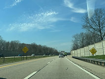
Drivers are warned to watch for ice (in the winter months) on the bridge ahead. (4-9-2026)

The bridge, named the Peter J. Delucia Memorial Bridge, is over Lake Milton. (4-9-2026)

At the end of the bridge, the sound barriers resume for a brief moment longer. (4-9-2026)

Grandview Road, which parallels the west side of Lake Milton, then passes overhead. (4-9-2026)

At the Milton Newton Road overpass soon afterward, I-76 enters Portage County. (4-9-2026)

Just over the county line, I-76 crosses Kale Creek. (4-9-2026)

At the highway's McClintocksburg Road overpass, there is one-mile advance signage for exit 48 with Ohio State Route 225 toward Alliance. (4-9-2026)

The next two exits can both be used to reach West Branch State Park, with the second of these (43) containing camping. (4-9-2026)
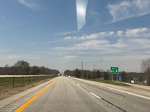
The exit 48 gore sign. (4-9-2026)

At the Wayland Road overpass just past exit 48, Akron is 26 miles away. (4-9-2026)

A rest area sits one mile away. (4-9-2026)
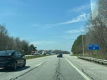
The rest area entrance is ahead on the right. (4-9-2026)

Afterward, Porter Road crosses the Interstate. (4-9-2026)

Exit 43, intersecting Ohio State Route 14 with control cities of Alliance and Ravenna, is one mile away. (4-9-2026)

A park and ride is available at the next exit. (4-9-2026)

Exit 43 also leads to Hiram College and the University of Mount Union. (4-9-2026)
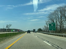
Exit 43 lies just ahead on the right. (4-9-2026)

I-76 crosses OH 14 here. (4-9-2026)

I-76 reassurance, with no directional banner, follows exit 43. (4-9-2026)

After curving slightly left and going downhill, I-76 crosses Barrel Run. (4-9-2026)

At Industry Road, I-76 enters Rootstown Township. (4-9-2026)

Exit 38, intersecting Ohio State Routes 5 and 44 toward Ravenna, is 2 miles away. (4-9-2026)

The highway crosses New Milford Road on a bridge that was undergoing construction when these photos were taken. (4-9-2026)

Exit 38 leads to the Northeast Ohio Medical University. (4-9-2026)

The exit 38 gore. (4-9-2026)

I-76 reassurance follows exit 38. (4-9-2026)

There is subsequently a crossing of Hudson Ditch. (4-9-2026)

Lakewood Road passes overhead at the next overpass. (4-9-2026)

The next exit can be used to reach Brimfield. (4-9-2026)

A single hotel is located at the forthcoming exit 33. (4-9-2026)
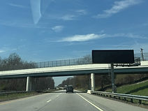
A variable message sign sits before the exit in front of the Sandy Lake Road overpass. (4-9-2026)

Exit 33 intersects Ohio State Route 43, whose control cities are Hartville and Kent, in one mile. (4-9-2026)

Exit 33 can be used to reach the famed Kent State University. (4-9-2026)

Exit 33 is ahead on the right. (4-9-2026)

Then, in ¾ mile, exit 31 intersects County Road 18, leading to Tallmadge and the Summit County Fairgrounds. (4-9-2026)
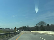
Between exits, I-76 crosses a CSX rail track in between its Akron and Kent yards. (4-9-2026)

Exit 31 sits within a wide lefthand curve. (4-9-2026)

The exit 31 gore sign. (4-9-2026)

I-76 crosses Tallmadge Road here. (4-9-2026)

Westbound I-76 collects traffic from Tallmadge Road at right. (4-9-2026)

Exit 29 intersects Ohio State Route 532, toward Tallmadge and Mogadore, in one mile. (4-9-2026)

Prior to exit 29, I-76 enters Summit County and the city of Tallmadge. (4-9-2026)

The Interstate goes on to cross Old Forge Road. (4-9-2026)

Exit 29 is ahead to the right. (4-9-2026)
