
The epzik8 Webpage
Interstate 76 west - Akron to Westfield Center

In Tallmadge, Ohio, just east of Akron, Interstate 76 heads west away from exit 29 (Ohio State Route 532). (4-9-2026)

Lodging at exit 27 is posted in front of the Newton Street overpass. (4-9-2026)

Exit 27 intersects Ohio State Route 91 (Gilchrist Road/Canton Road) in one mile. (4-9-2026)

One mile after exit 27, exit 26 intersects Ohio State Route 18 (East Market Street/Mogadore Road). (4-9-2026)

I-76 enters Akron city limits as it crosses OH 91. (4-9-2026)

At the onramp from OH 91, I-76 passes under Canton Street. (4-9-2026)

I-76 gains a third lane after exit 27. (4-9-2026)

At exit 26, there is one-mile advance signage for exit 25 at Ohio State Route 241 (Innovation Way/Kelly Avenue). (4-9-2026)

According to this variable message sign, the I-76/I-277 junction just west of downtown Akron is 8 minutes away via I-76 west and 10 minutes via Interstate 77 south. (4-9-2026)

The Akron-Fulton Airport and Goodyear Boulevard can both be reached from exit 25. (4-9-2026)

The onramp from East Market is to the right. (4-9-2026)

More I-76 reassurance is situated between exits 26 and 25. (4-9-2026)

East Market Street parallels I-76 to the north for a distance. (4-9-2026)

On approach to exit 25, exit 24 (Arlington Boulevard) is ¾ mile away, and exit 23B leads to southbound I-77 and Canton in 1½ miles. (4-9-2026)

Exit 25 is straight ahead on the right, ½ mile before exit 24. (4-9-2026)

Westbound I-76 then receives an onramp from OH 241. (4-9-2026)

At exit 24, I-76 is ¾ mile from both exit 23B and exit 23A, which leads to northbound Ohio State Route 8 and Cuyahoga Falls. OH 8 is concurrent with I-77 through downtown Akron. (4-9-2026)

The gore sign for exit 24B. (4-9-2026)

Interests to downtown Akron - including InfoCision Stadium, home of the Akron Zips football team - are directed to remain on I-76 west. (4-9-2026)

The University of Akron can be reached from exit 23A. (4-9-2026)

Approaching exit 23, together with I-77 north, I-76's westbound control cities are Barberton and Cleveland. (4-9-2026)

Across from exit 23A, exit 23B is a left exit to I-77 south. (4-9-2026)

A tiny gore sign for exit 23B is to the left. (4-9-2026)

The ramp from OH 8 south to I-76 west/I-77 north flies overhead here. (4-9-2026)

I-76 and I-77 reassurance shields sit side by side after exit 23. (4-9-2026)

Exit 22 intersects Main Street and Broadway Street, leading into downtown Akron, half a mile away. (4-9-2026)

Either of the right two lanes can be used to exit onto exit 22. (4-9-2026)

The following landmarks can be reached from exit 22: InfoCision Stadium, 7 17 Credit Union Park (home of AA minor league baseball's Akron RubberDucks), and the Akron Art Museum and Convention Center. (4-9-2026)

At the Grant Street overpass approaching exit 22, the I-76/I-77 split is 2 miles away, and the second lane from right (which is the rightmost through lane) ends in half a mile. (4-10-2026)

The offramp paralleling I-76 to Broadway and Main is seen at right. (4-10-2026)

Exit 21C intersects eastbound Ohio State Route 59 (Dart Avenue) in half a mile. (4-10-2026)

Exit 21C can be used to reach the Akron Zoo and Bowery Street. (4-10-2026)

At the Princeton Street overpass on approach to exit 21C, I-76 enters the Lake Erie Watershed. (4-10-2026)

Exit 21A intersects East Avenue one mile after exit 21C. (4-10-2026)

The exit 21C gore sign. (4-10-2026)

A ramp from I-76 east to OH 59 east flies overhead here. In downtown Akron, OH 59 is a freeway with Rhodes Avenue and Dart Avenue running along either side of it as surface streets. (4-10-2026)

The Interstate goes on to cross Lakeshore Boulevard. (4-10-2026)

A variable message sign then displays travel times to a nearby state route, which is obscured in this photo. (4-10-2026)
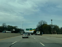
The highway then crosses Manchester Road immediately northwest of Summit Lake. (4-10-2026)

Approaching exit 21A, signage for Interstate 277 and Akron's western suburb of Barberton is added for the westbound I-76 through movement at the I-77 split. (4-10-2026)

A pedestrian overpass linking two disconnected sections of Hillcrest Street crosses I-76 prior to exit 21A. These sections of Hillcrest were severed as a result of I-76's construction through Akron. (4-10-2026)

The offramp from I-76 west to East Avenue is a sharp cloverleaf. There is no access to East Avenue from I-76 east. (4-10-2026)

Exit 21A also includes access to Russell Avenue. (4-10-2026)

I-76 exits I-77 by way of a sweeping righthand ramp. (4-10-2026)

The sign in the gore points the way for drivers to continue west on I-76. (4-10-2026)

The recommended speed along the upcoming curve is 40 MPH. (4-10-2026)

I-76 passes over I-77 as it shifts physical direction from west to south. (4-10-2026)

I-76 is now going due south, and receives a ramp from southbound I-77 on the right. (4-10-2026)

Exit 19 (Battles Avenue/Kenmore Boulevard) is half a mile away. (4-10-2026)

East Avenue crosses over before the exit at an oblique angle. (4-10-2026)

After exit 19, exit 18 leads to eastbound I-277, which shares U.S. Route 224 with a control city of Canton via I-77 south. US 224 west runs concurrent with I-76 west to Barberton and then to I-71 outside of Seville. (4-10-2026)

The exit 19 gore sign. (4-10-2026)

Once again, westbound I-76 through traffic is to get into the right 2 lanes. (4-10-2026)

I-76's crossing of Kenmore Boulevard. (4-10-2026)

I-76 begins its overlap with US 224 by maneuvering at a very sharp right angle. (4-10-2026)

Meanwhile, I-277 is one of only two auxiliary (3-digit) routes of I-77, alongside another I-277 in Charlotte, North Carolina. (4-10-2026)

Exit 18 is officially a straight movement even though it then loops around as a cloverleaf ramp to eastbound I-277. (4-10-2026)
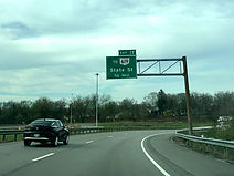
Exit 17, leading to Ohio State Route 619 (Wooster Road) by way of State Street, is ¾ of a mile away. (4-10-2026)
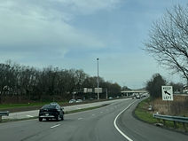
Through traffic is told by this sign to keep left as the far right lane will soon become exit 17. (4-10-2026)

The subsequent 27th Street overpass is dedicated to Marine Lance Corporal Michael C. Spaulding. (4-10-2026)

Aside from Wooster Road, Exit 17 can be used to reach East Avenue. (4-10-2026)

The far right lane is now marked for traffic getting off at exit 17. (4-10-2026)

I-76 crosses OH 619 at this point. (4-10-2026)

The Interstate enters Barberton city limits just before exit 17. (4-10-2026)

Signage for exit 17 is here, but the offramp already began well behind this photo. (4-10-2026)

State Street makes its crossing of I-76 along this overpass. (4-10-2026)

Just after exit 17, I-76 leaves Barberton for Norton. (4-10-2026)

Norton is served by I-76's next 3 exits. (4-10-2026)

I-76 and US 224 signage is situated between exits. (4-10-2026)

Exit 16, which intersects Barber Road, is ¾ mile from the Summit Road overpass seen ahead. (4-10-2026)

The Interstate crosses Wolf Creek before exit 16. (4-10-2026)

Due to the creek, exit 16 is a partial cloverleaf interchange with all 4 ramps located west of Barber Road. (4-10-2026)

The highway curves left as the westbound carriageway receives traffic from Barber Road. (4-10-2026)

I-76 is now leaving the greater Akron area behind and becoming rural in nature again. (4-10-2026)

In one mile, exit 14 intersects Cleve-Mass Road toward Norton. (4-10-2026)

Clark Mill Road passes overhead in the meantime. (4-10-2026)

Two gas stations (but apparently no food) are located at exit 14. (4-10-2026)

This exit can be used to reach the Ohio Veterans Memorial Park. (4-10-2026)

Exit 14 is straight ahead on the right. The name of the road intersected by it refers to the cities of Cleveland and Massilon, which are also the control cities of the forthcoming exit 13, at Ohio State Route 21. (4-10-2026)

Within exit 14, this corridor is marked as an alternate route for I-77. (4-10-2026)

The name of the city of Norton is engraved into the Cleve-Mass Road overpass. (4-10-2026)

Westbound I-76 receives an onramp from Cleve-Mass to the right. (4-10-2026)

The I-77 alternate route leaves I-76 at exit 13. (4-10-2026)

Westbound I-76/US 224's control city is now Lodi. Exit 13B to northbound OH 21 is straight ahead on the right. (4-10-2026)

At exit 13B, the Interstate's left lane ends a mile away. (4-10-2026)

Exit 13A to OH 21 south quickly follows. (4-10-2026)

Hametown Road crosses I-76 just west of exit 13. (4-10-2026)

I-76/US 224 reassurance follows exit 13. (4-10-2026)

A mile away, exit 11 intersects Ohio State Route 261, whose control cities are Norton and Wadsworth. (4-10-2026)

The left lane of the highway will end momentarily. (4-10-2026)

Gas stations at exit 11 include GetGo, operated by the Pittsburgh-based supermarket chain Giant Eagle. (4-10-2026)

Exit 11 is ahead on the right. (4-10-2026)

At exit 11, I-76 leaves Summit County and enters Medina County. (4-10-2026)

The exit 11 gore sign. (4-10-2026)

I-76 then makes its way over OH 261. (4-10-2026)

Now down to two lanes in each direction, I-76 curves left as it receives the onramp from OH 261. (4-10-2026)

More I-76/US 224 reassurance follows exit 11. (4-10-2026)

More I-76/US 224 reassurance follows exit 11. (4-10-2026)

Multiple gas and lodging options are at exit 9. (4-10-2026)

I-76 passes under Hartman Road on approach to exit 9. (4-10-2026)

I-76 enters Wadsworth city limits before the exit. (4-10-2026)

Exit 9 is just ahead on the right. (4-10-2026)

The exit 9 gore sign. (4-10-2026)

The city of Wadsworth has decorated the OH 94 overpass. (4-10-2026)

In one mile, I-76 will intersect Ohio State Route 57, which leads toward Rittman and Medina, at exit 7. (4-10-2026)

Exit 7 can be used to reach the Wadsworth Municipal Airport and the University of Akron Wayne College. (4-10-2026)

Exit 7 comes just after a slight curve to the left. (4-10-2026)

The exit 7 gore sign. (4-10-2026)
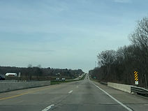
Just past exit 7, the Interstate crosses the River Styx. I-76 is beginning to make its way into the till plain flatlands characterizing much of the American Midwest in general. (4-10-2026)

A weigh station is located one mile away. (4-10-2026)

I-76 then crosses River Styx Road. (4-10-2026)

The weigh station entrance is near the top of a hill. (4-10-2026)

Soon afterward, I-76 flattens out and passes under Yoder Road. (4-10-2026)

Two hotels (but apparently no camping) are located off exit 2. (4-10-2026)

Exit 2 intersects Ohio State Route 3 toward Seville and Medina, and is a mile away. (4-10-2026)

Exit 1B, a sweeping ramp from I-76 west to northbound Interstate 71 toward Cleveland, is 1½ miles away. Exit 1A to I-71 south and Ohio state capital Columbus is 2¼ miles away. (4-10-2026)

Gas statins at exit 2 are displayed on the right. (4-10-2026)

Exit 2 is on the right at a hillcrest. (4-10-2026)

The exit 2 gore sign. (4-10-2026)

Exits 1B and A are now a respective 1 and 1¾ miles away. (4-10-2026)

The city of Seville has a water tower sitting beside exit 2. (4-10-2026)

A final pair of I-76/US 224 reassurance shields sit to the right. (4-10-2026)

Approaching I-71, I-76 crosses a freight railroad track. (4-10-2026)

Exit 1B lies just ahead, and exit 1A is in ¾ mile. (4-10-2026)

The exit 1B gore sign. (4-10-2026)

Exit 1A is now "next right". (4-10-2026)

I-71 passes overhead along these two overpasses. (4-10-2026)

This marks the end of the eastern iteration of I-76, which began 435 miles to the east in Camden, New Jersey. US 224 continues west from here toward Lodi and Findlay. (4-10-2026)
