
The epzik8 Webpage
Interstate 70 west - Hagerstown to Pennsylvania line

Westbound Interstate 70 pulls away from its interchange with Interstate 81 at exit 26 outside of Hagerstown, Maryland, with a gradual curve to the left up ahead. (4-9-2026)

In one mile, I-70 will intersect Maryland Route 63, which has control cities of Williamsport and Huyett, at exit 24. (4-9-2026)

The Cushwa Basin area of the Chesapeake and Ohio (C&O) Canal is off this exit. (4-9-2026)

Westbound I-70 is now marked as leading toward Interstate 68, about 24 miles to the west. (4-9-2026)

Food options at exit 24 are listed to the right. (4-9-2026)

Exit 24 is just ahead on the right. (4-9-2026)

MD 63 goes 17 miles southeast-to-north from the Fairplay area south of Hagerstown to the Pennsylvania line. (4-9-2026)

I-70 collects traffic from MD 63 at right and heads away from the Hagerstown hub. (4-9-2026)

Soon afterward, the Interstate passes under Walnut Point Road. (4-9-2026)

As it heads away from Hagerstown, I-70 crosses the Conococheague Creek. (4-9-2026)

The town of Clear Spring is 3 miles away, Hancock 18 miles, and the I-68 split just after that in 20 miles. (4-9-2026)

The next overpass is under Cedar Ridge Road. (4-9-2026)

The highway next goes past trees and rock formations lining either side of the carriageway. (4-9-2026)

There was a detour for westbound US 40 when these photos were taken. (4-9-2026)

There is then a crossing of St. Paul Road. (4-9-2026)

Local ski areas include Whitetail in Montgomery Township, Franklin County, Pennsylvania, accessible from exit 18, and Wisp in the Deep Creek Lake are of Garrett County, still more than 90 miles away via I-68 and U.S. Route 219. (4-9-2026)

The Four Locks and McCoys Ferry areas of the C&O Canal are off exit 18 up ahead. (4-9-2026)

There is subsequently a crossing of the Little Conococheague Creek. (4-9-2026)

One mile away, exit 18 intersects Maryland Route 68 and serves Clear Spring. (4-9-2026)

At the Ashton Road overpass, there is a sign stating that MD 68 is distinct from I-68, which is still 18 miles away. (4-9-2026)

Gas stations available at exit 18 are listed on the right. (4-9-2026)

Exit 68 lies straight ahead. (4-9-2026)

At exit 18, there is signage in the median reiterating that I-68 is a few exits past this one. (4-9-2026)

MD 68 is known as Clear Spring Road. (4-9-2026)

Traffic from MD 68 enters on the right. (4-9-2026)

Big Spring Road proceeds to pass overhead. (4-9-2026)

The next exit, at MD 56, is 5 miles away, Hancock 14, and Cumberland 54 miles via I-68. (4-9-2026)

Boyd Road soon crosses the highway. (4-9-2026)

The Interstate then passes Maryland mile marker 15. (4-9-2026)

The highway goes on straight and flat with pine trees in its median. (4-9-2026)

The Western Maryland Rail Trail can be reached from the forthcoming exit 12. (4-9-2026)

Exit 12, which intersects Maryland Route 56 toward Indian Springs and Big Pool, is one mile away. (4-9-2026)

Exit 12 is just ahead on the right. (4-9-2026)

The exit 12 gore sign. (4-9-2026)

MD 56 is known as Big Pool Road. (4-9-2026)

This next part of I-70 is part of Maryland's C&O Canal Byway. (4-9-2026)

Ernstville Road soon crosses the Interstate. (4-9-2026)

I-68, now billed as an alternate route to Ohio and points west, is 10 miles' drive away from this sign. (4-9-2026)

The highway crosses Licking Creek between exits. (4-9-2026)

I-68 is now just 9 miles away. (4-9-2026)

U.S. Route 40, which parted with I-70 about 44 miles earlier in Frederick, is about to rejoin the Interstate. This is an eastbound exit (exit 9) and westbound entrance. (4-9-2026)

Traffic coming from US 40 west merges onto I-70 west to the right. (4-9-2026)

An I-70/US 40 shield assembly follows the merge. (4-9-2026)

Truck services are located 5 miles away at exit 3. (4-9-2026)

An interchange with Maryland Route 615 is 2 miles away, Hancock 5, and Cumberland 45. (4-9-2026)

I-70 meets MD 615 a mile away at exit 5. (4-9-2026)

Exit 5 is just ahead on the right. (4-9-2026)

The exit 5 gore sign. (4-9-2026)

As the Interstate crosses MD 615, Sideling Hill, the deep cut in the mountain in the distance, starts to become visible. I-68 passes through that cut several miles to the west. (4-9-2026)
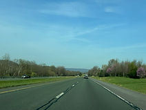
Having just navigated a wide curve to the left, I-70 straightens out momentarily. (4-9-2026)

Exit 3 up ahead can be used to reach the Little Tonoloway Visitors Center of the C&O canal along with the Western Maryland Rail Trail. (4-9-2026)

Another crossing of MD 615 is between exits. (4-9-2026)

Exit 3, a left exit westbound, intersects one of several disconnected segments of Maryland Route 144 which stretch from Cumberland to Baltimore. This segment is internally designated MD 144WB. (4-9-2026)

Through trucks over 13 tons are prohibited on MD 144, which goes straight through downtown Hancock. (4-9-2026)

Exit 3 also leads to the Hancock Museum and its Sideling Hill Exhibit. (4-9-2026)

There are C&O Canal Byway and Star-Spangled Banner Byway markers to the left in the median. (4-9-2026)

There is I-70/US 40 reassurance just before the exit. (4-9-2026)

At exit 3, there is two-mile advance notice for exit 1, which is I-70's junction with U.S. Route 522 and eastbound I-68. (4-9-2026)

The exit 3 gore sign. (4-9-2026)

The Interstate curves wide right after exit 3. (4-9-2026)

Beyond the curve, slower traffic is urged to stay in the right lane. (4-9-2026)

The Interstate then crosses the Great Tonoloway Creek. (4-9-2026)

Exit 1B, a left exit leading to southbound US 522 toward Hancock and Winchester, Virginia, is 1½ miles away. (4-9-2026)

Exit 1B can also be used to reach Berkeley Springs, West Virginia along US 522 south, while interests to Morgantown, West Virginia may diverge from I-70 onto I-68, a movement designated exit 1A. (4-9-2026)

The Super 8 in Hancock is accessible from exit 1B. (4-9-2026)

The highway's far right lane is about to end. (4-9-2026)

Just before exit 1B, there is a sign displaying an AM radio frequency to tune to for travel alerts. (4-9-2026)

At exit 1, US 522 north joins I-70 west for a concurrency into Pennsylvania. (4-9-2026)

With exit 1B coming into view, I-70 crosses Pennsylvania Avenue. (4-9-2026)

Exit 1B sits ahead on the left. US 522 spends less than two miles in Maryland, passing through the state at its narrowest point. (4-9-2026)

The exit 1B gore sign sits a few feet into the distance. (4-9-2026)

Approaching exit 1A, I-70's control city becomes Breezewood, Pennsylvania. Here, US 40 leaves I-70 to join I-68, with which it overlaps for about 66 miles west to Grantsville, in Garrett County. (4-9-2026)

A tiny sign on the left states exit 1A as being "next left". (4-9-2026)

Exit 1A has a 40 MPH speed limit as it is in the middle of a wye interchange complex and contains a sharp curve to the left. (4-9-2026)

The exit 1A gore sign. (4-9-2026)

I-70 now turns due north with an I-70/US 522 shield assembly to the right. (4-9-2026)

The speed limit drops to 55 MPH approaching the state line. (4-9-2026)

At this point the Interstate enters Bethel Township, Fulton County, Pennsylvania. (4-9-2026)

I-70 continues about 25 miles north to Breezewood and the Pennsylvania Turnpike. (4-9-2026)
