
The epzik8 Webpage
Interstate 70 west - Frederick to Hagerstown

Interstate 70 is on the western edge of Frederick, Maryland as it approaches exit 52, which provides a movement to U.S. Route 340 west and U.S. Route 15 south, which have control cities of Charles Town, West Virginia and Leesburg, Virginia respectively. (4-9-2026)

Exit 52 can also be used to reach Harpers Ferry, West Virginia via US 340. (4-9-2026)

Exit 52 is ahead on the right within a curve. (4-9-2026)

The exit 52 gore sign. (4-9-2026)

The northeastern terminus of US 340 is just north of here; its other end is in Greenville, Virginia, 155 miles away. (4-9-2026)

Within exit 52, I-70 is marked as proceeding straight ahead. (4-9-2026)

As it passes over the preceding westbound offramp, I-70 has narrowed from three to two lanes in each direction. (4-9-2026)

After receiving an onramp from southbound US 15, I-70 passes under Maryland Route 180 (Jefferson Pike). (4-9-2026)

There is I-70 reassurance after exit 52 as the Interstate leaves Frederick behind. (4-9-2026)

There is an Eisenhower Interstate System marker soon afterward. (4-9-2026)

The speed limit at this time increases to 70 MPH. (4-9-2026)
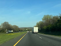
The Interstate eases downward before curving to the right. (4-9-2026)
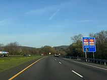
Signs for services at the forthcoming exit 49 now begin to appear. (4-9-2026)

Exit 49 intersects U.S. Route 40 Alternate (Old National Pike) which leads to Braddock Heights and Middletown. This is a westbound exit and eastbound entrance, and to return to I-70 west from this exit, drivers must take one of three left turns to get to mainline US 40, which they can then take west to a westbound I-70 onramp. (4-9-2026)

In the meantime, the Interstate passes under Mount Philip Road. (4-9-2026)

Exit 49 lies just ahead. This alternate route of US 40 parallels I-70 to downtown Hagerstown by way of Middletown and Boonsboro. (4-9-2026)

A third westbound lane has temporarily appeared for truckers in preparation for a steep ascent, the first of two drivers will have to deal with before reaching Hagerstown. (4-9-2026)

I-70's crossing of US 40 Alt. (4-9-2026)

I-70 then crosses an offramp from I-70 east to mainline US 40 east; this is the eastbound-only exit 48. (4-9-2026)

Westbound I-70 is now about to receive an onramp from westbound US 40 (Baltimore National Pike). (4-9-2026)

At the start of the uphill climb, there is I-70 reassurance. (4-9-2026)

The cities of Hagerstown, Hancock and Breezewood are 21, 49 and 75 miles away from here. (4-9-2026)

The highway's right lane will soon end. (4-9-2026)

Near the top of the ridge, Ridge Road passes overhead on this arch bridge. (4-9-2026)

I-70 reaches the top of the ridge at mile marker 47. (4-9-2026)

As it goes back downhill, the highway curves to the left. (4-9-2026)

Once at the bottom of the ridge, I-70 crosses Hollow Road. (4-9-2026)

The highway goes generally straight as it continues to make its way between exits. (4-9-2026)

Greenbrier State Park in Washington County can be reached from exit 35 about 10 miles ahead. (4-9-2026)

There is subsequently a bridge over Hollow Road. (4-9-2026)
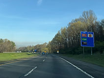
Food options for exit 42 are posted to the right. (4-9-2026)

A third lane again begins on the right and then ends almost as quickly. (4-9-2026)

Exit 42, at Maryland Route 17 (Middletown Road) toward Myersville, is a mile away. (4-9-2026)

Myersville's historic district can be reached from exit 42 as can the Musket Ridge Golf Club. (4-9-2026)

There is also a park and ride at the exit. (4-9-2026)

Before the exit, I-70 crosses Catoctin Creek, a tributary of the Potomac River. (4-9-2026)
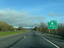
Exit 42 is now straight ahead. (4-9-2026)

MD 17 makes its passage over I-70 here. From here, MD 17 goes south to Burkittsville (of Blair Witch fame) and then Brunswick, before crossing the Potomac into Virginia. (4-9-2026)

An onramp comes in from MD 17 to the right. (4-9-2026)

A third westbound lane begins after exit 42, prohibiting trucks from the left lane. (4-9-2026)

The MD 66 interchange is 6 miles away, Hagerstown 13, and Hancock 40. (4-9-2026)

The Interstate goes on to cross Mt. Tabor Road. (4-9-2026)

There is a wide curve to the right as I-70 begins to climb another ridge. (4-9-2026)

The highway now begins to climb up the ridge, namely South Mountain. (4-9-2026)

A rest area, which acts as a Maryland welcome center, is a mile away. The next rest area on I-70 is the Pennsylvania welcome center in 41 miles, and on I-68, the Sideling Hill rest area in 46 miles. (4-9-2026)

An AM radio frequency for travel alerts is posted overhead. (4-9-2026)

The highway crosses Monument Road, named for the nearby Washington Monument, on its way up South Mountain. (4-9-2026)

The South Mountain Rest Area is at next right. This is where the D.C. snipers John Allen Muhammad and Lee Boyd Malvo were captured in October of 2002. (4-9-2026)

The rest area entrance. (4-9-2026)
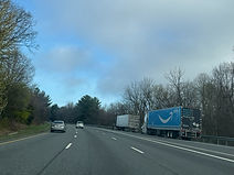
I-70 continues up the mountain after the rest area. (4-9-2026)

Soon, more I-70 reassurance appears. (4-9-2026)

Near the top of the mountain, I-70 leaves Frederick County for Washington County. (4-9-2026)

Just over the county line, I-70 passes under the famous Appalachian Trail just south of Annapolis Rock. (4-9-2026)

The summit of South Mountain is 1,200 feet above sea level. (4-9-2026)

US 40 (National Pike) subsequently passes overhead. (4-9-2026)

I-70 goes down South Mountain with a 9% downhill grade. (4-9-2026)

The highway curves left at the end of the truck lane. (4-9-2026)

After curving once more, the Interstate makes a beeline staight for the bottom of the mountain. (4-9-2026)

At the bottom, I-70 crosses Crystal Falls Drive. (4-9-2026)

The South Mountain Corridor, which includes state parks, Civil War sites (e.g. the Antietam battlefield) and the Crystal Grottoes Caverns, is served by exit 35. (4-9-2026)

Exit 35, intersecting Maryland Route 66 with control cities of Boonsboro and Smithsburg, is a mile away. (4-9-2026)

Crossed over before the exit is Black Rock Road. (4-9-2026)

A Sheetz at exit 35 counts as both gas and food for the exit. (4-9-2026)

This sign on the right points the way to exit 35. (4-9-2026)

The exit 35 gore sign. MD 66 is a 13-mile link between Boonsboro and Smithsburg. (4-9-2026)

MD 66 is known as Mapleville Road. (4-9-2026)

From exit 32B, drivers can reach some of Hagerstown's historic sites, like the City Park and Museum of the Fine Arts, along with the Hagerstown Greens golf course. (4-9-2026)

Hagerstown's notorious Maryland Correctional Training Center is 5 miles away via MD 65 south. (4-9-2026)

Some of the lodging available at exit 32B is displayed to the right. (4-9-2026)

The highway then goes over White Hall Road. (4-9-2026)

Exit 32 is the easternmost of the Hagerstown exits, and intersects US 40. (4-9-2026)

Food at exit 32B is displayed at right. (4-9-2026)

Also reachable from exit 32B are Meritus Park and the Hagerstown Community College. (4-9-2026)

At exit 32B, I-70's westbound control city becomes Hancock. (4-9-2026)

The exit 32B gore sign. (4-9-2026)

Exit 32A is on the other side of the US 40 overpass. (4-9-2026)

Soon after exit 32, I-70 passes under Beaver Creek Road. (4-9-2026)

That is followed by I-70 reassurance. (4-9-2026)

Hancock and Breezewood, PA are a respective 30 and 56 miles away via I-70. By way of I-68, Cumberland is 68 miles away. (4-9-2026)

At mile marker 31, I-70 crosses US 40 Alternate (Old National Pike) without an interchange. (4-9-2026)

Food and lodging at exit 29 up ahead are displayed to the right. (4-9-2026)

One mile away, exit 29 intersects Maryland Route 65 which has control cities of Sharpsburg and Hagerstown. (4-9-2026)

More food options at exit 29 are listed at right. (4-9-2026)

I-70 crosses Antietam Creek heading toward the exit. (4-9-2026)

This is the exit serving the Civil War-era Antietam Battlefield along with the Antietam Aqueduct and Ferry Hill along the Chesapeake and Ohio (C&O) Canal along the Potomac River. (4-9-2026)

Exit 29 can also be used to reach Premium Outlets Blvd., a park and ride, Motor Vehicle Administration facility, and the Maryland State Police's "O" barrack. (4-9-2026)

Including exit 29, the next four exits along I-70 fall along a span of 5½ miles. (4-9-2026)

There is a wide curve to the left prior to exit 29 at 60 MPH. (4-9-2026)

Exit 29 finally arrives. (4-9-2026)

Just before the cloverleaf offramp to the route, I-70 crosses a CSX freight railroad track which goes on to pass just east of the Hagerstown Yard. (4-9-2026)
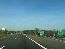
The exit 29 gore sign. (4-9-2026)

I-70 now passes over MD 65, a 12-mile highway between MD 34 in Sharpsburg and the south end of downtown Hagerstown. (4-9-2026)

Exit 28 up ahead is another with many hotels. (4-9-2026)
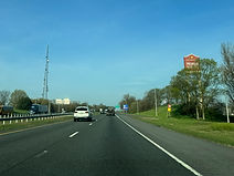
The sign of Hagerstown's Premium Outlets is at right. (4-9-2026)

Exit 28 intersects Maryland Route 632 (Downsville Pike) toward Downsville and Hagerstown in half a mile. (4-9-2026)

The Interstate crosses another CSX track before exit 28. (4-9-2026)

Exit 28 is ahead on the right. (4-9-2026)

The exit 28 gore sign. (4-9-2026)

This is a relatively new exit along I-70, not opening until 1999. (4-9-2026)

Truck services along the remainder of I-70 in Maryland are located at exit 24 in 4 miles and exit 3 in 25 miles. (4-9-2026)

In 1½ miles, I-70 meets Interstate 81, with control cities of Harrisburg, Pennsylvania and Roanoke, Virginia, at exit 26. (4-9-2026)

Meanwhile, there is I-70 reassurance to the right. (4-9-2026)

I-70's interchange with Interstate 68 just outside of Hancock is 26 miles from this variable message sign. (4-9-2026)

At exit 26, Chambersburg, Pennsylvania can be reached by way of I-81 north, and Williamsport, Maryland and Martinsburg, West Virginia from I-81 south. (4-9-2026)

Northbound I-81 also leads toward the Hagerstown Regional Airport. (4-9-2026)

I-70 makes its way into a construction zone before exit 26. (4-9-2026)

The offramps to both directions of I-81 from I-70 are from the right lane. (4-9-2026)

A gore sign and overhead sign assembly for exit 26 sit at right. (4-9-2026)

I-70 crosses I-81 along this overpass. (4-9-2026)

Exit 26A (I-81 south) presents a tipping hazard for large trucks. (4-9-2026)
