
The epzik8 Webpage
Interstate 70 west - Baltimore to Frederick

Interstate 70 begins a journey of 2,172 miles at this junction with Interstate 695 (Baltimore Beltway) in Woodlawn, Maryland, a western suburb of Baltimore. A short piece of the Interstate built inside the Beltway before its cancellation within Baltimore City is now under state maintenance. (4-9-2026)

The Interstate goes on to cross Rolling Road. (4-9-2026)

The highway curves left, then straightens out. (4-9-2026)

The famous sign at left displays the distances to four major cities along I-70's route: Columbus, Ohio; St. Louis, Missouri; Denver, Colorado; and I-70's western terminus in Cove Fort, Utah. (4-9-2026)

This overhead VMS states I-70's junction with Interstate 270 is 36 miles and 36 minutes away. (4-9-2026)

The highway next goes under Pickall Drive. (4-9-2026)

As I-70 descends into the Patapsco River valley, there is two-mile advance signage for exit 87 at U.S. Route 29, which has control cities of Columbia and Washington, DC. (4-9-2026)

I-70 subsequently begins crossing the Patapsco River. (4-9-2026)

The Patapsco bridge takes I-70 from Baltimore County into Howard County. (4-9-2026)

Services along U.S. Route 40 in Ellicott City can be reached by taking the upcoming left exit onto US 29 south. (4-9-2026)

Exit 87A leads to US 29 south, and exit 87B to US 29 north to its northern terminus at Maryland Route 99 (Rogers Avenue). At this time, I-70 has a westbound control city of Frederick. (4-9-2026)

Ellicott City's historic district can also be reached from exit 87A. (4-9-2026)

In the distance, Rogers Avenue passes over I-70 prior to exit 87. (4-9-2026)

Exit 87 lies straight ahead. (4-9-2026)

The exit 87A gore sign. At this interchange, I-70 loses a lane in each direction. (4-9-2026)

The exit 87B gore sign. (4-9-2026)

US 29 crosses I-70 with one span for each direction. (4-9-2026)

To the right, westbound I-70 collects traffic from southbound US 29. (4-9-2026)

Past exit 87, the speed limit goes up to 70 MPH. (4-9-2026)

St. Johns Lane subsequently passes overhead. (4-9-2026)

The Marriottsville Road interchange is 3 miles away, and Frederick 33 miles. (4-9-2026)

The next overpass is Bethany Lane. (4-9-2026)

Included at exit 83 up ahead is the Turf Valley golf resort. (4-9-2026)

Exit 83, a westbound exit/eastbound entrance, is at Marriottsville Road. (4-9-2026)

The McKeldin Area of Patapsco Valley State Park can be reached from exit 83. (4-9-2026)

Exit 83 is straight ahead. (4-9-2026)
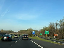
The gore sign for exit 83. (4-9-2026)

Marriottsville Road's bridge over I-70. (4-9-2026)

The Interstate crosses a Little Patuxent River tributary here. (4-9-2026)

The eastbound exit/westbound entrance component of exit 83 is exit 82 and is where US 40 joins I-70 for the first of many concurrencies across the U.S. (4-9-2026)

Traffic from westbound US 40 enters at right. (4-9-2026)

After exit 82, I-70 widens to 3 lanes in each direction, and services at the upcoming exit 80 are displayed to the right. (4-9-2026)

One-mile signage for exit 80, intersecting Maryland Route 32 toward Sykesville and Clarksville, is attached to the Sand Hill Road overpass. (4-9-2026)

The area of West Friendship and the Howard County Fairgrounds are off exit 80. (4-9-2026)

A park and ride is available at the next exit. (4-9-2026)

Meanwhile, a VMS lists the travel times to the I-270 and I-81 interchanges ahead. (4-9-2026)

Exit 80 is ahead on the right. (4-9-2026)

A distance south of here, MD 32 becomes the Patuxent Freeway, running through Clarksville, Columbia, Savage and near Fort Meade, before coming to an end at Interstate 97 in Millersville in Anne Arundel County. (4-9-2026)

A weigh station for trucks sits just over a mile away. (4-9-2026)

There is a hillcrest just after exit 80. (4-9-2026)

An AM radio frequency is then posted for drivers to receive travel information from. (4-9-2026)

The weigh station entrance. (4-9-2026)

Food options at exit 76 up ahead are displayed at right. (4-9-2026)

Exit 76 intersects Maryland Route 97, with control cities of Westminster and Olney, and is a mile away. (4-9-2026)

The historic district of Westminster, the seat of Carroll County, can be reached by taking exit 76 to a right turn onto MD 97 north. (4-9-2026)

Exit 76 is now just ahead. (4-9-2026)

I-70 goes on over MD 97, a 55-mile highway between Silver Spring just north of the D.C. line, and the Pennsylvania line near Gettysburg. (4-9-2026)

An interchange with MD 94 is 2 miles away. Frederick is 22 miles away. (4-9-2026)

Attractions at exit 73 are displayed to the right. (4-9-2026)

At Morgan Station Road, exit 73, intersecting Maryland Route 94 toward Woodbine and Lisbon, is a mile away. (4-9-2026)

A park and ride is at the next exit. (4-9-2026)

Exit 73 is "next right". (4-9-2026)

The exit 73 gore sign. (4-9-2026)

MD 94 passes over I-70 here. (4-9-2026)

The MD 27 interchange and Frederick are now 4 and 18 miles away. (4-9-2026)

The Interstate passes under Watersville Road and West Watersville Road in succession. (4-9-2026)

There is a slight curve to the right between exits. (4-9-2026)

The historic area of Mt. Airy can be reached from exit 68 up ahead. (4-9-2026)

I-70 makes a brief entry into Carroll County in the meantime. (4-9-2026)

Food and lodging at exit 68 is listed to the right. (4-9-2026)

Exit 68, one mile away, intersects Maryland Route 27 (Ridge Road) with control cities of Damascus and Mt. Airy. (4-9-2026)

The Interstate straightens out approaching the exit. (4-9-2026)

Westminster is off exit 68 along with a park and ride. (4-9-2026)

This sign points the way to exit 68. (4-9-2026)

The exit 68 gore sign. MD 27 runs nearly 40 miles southwest-northeast from I-270 in the Germantown area of Montgomery County to Maryland Route 30 in Manchester, Carroll County. (4-9-2026)

As it crosses MD 27, I-70 enters Frederick County. (4-9-2026)

A closer look at the MD 27 bridge. (4-9-2026)

As the Interstate leaves Mt. Airy behind and curves to the right, the Catoctin foothills of the Appalachian Mountains briefly become visible. (4-9-2026)

An I-70/US 40 shield assembly is located along the highway's subsequent descent. (4-9-2026)

The MD 75 interchange and Frederick are a respective 5 and 13 miles from this sign. (4-9-2026)

The highway momentarily straightens out after its curvaceous descent. An eastbound truck parking area is seen to the left. (4-9-2026)

I-70 then crosses Bill Moxley Road. (4-9-2026)

Another wide curve to the right sits ahead. (4-9-2026)

Afterward, Bartholows Road passes overhead along this tall bridge. (4-9-2026)

The historic district of New Market is off the upcoming exit 62 as is Adventure Park USA. (4-9-2026)

Gas stations available at exit 62 are posted on the right. (4-9-2026)

Exit 62, intersecting Maryland Route 75 toward Libertytown and Hyattstown, is one mile away. (4-9-2026)

The Monrovia area can also be reached from the next exit. (4-9-2026)

Exit 62 also contains a park and ride. (4-9-2026)

The exit 62 gore sign. (4-9-2026)

MD 75 proceeds to cross I-70. (4-9-2026)

The Interstate curves as it receives traffic from MD 75. (4-9-2026)

I-70/US 40 reassurance follows. (4-9-2026)

Frederick now sits just 8 miles away. (4-9-2026)

Truck services are available at exit 24, 38 miles away. (4-9-2026)

The highway dips, then starts back uphill. (4-9-2026)

The Interstate passes under Mussetter Road at the hillcrest. (4-9-2026)

Maryland Route 144 (here officially MD 144FA) is intersected at exit 59 in one mile. (4-9-2026)

The approaching mountains are starting to become more visible in the distance. (4-9-2026)

Next comes another sharp curve to the right. (4-9-2026)

MD 144 (Old National Pike) is crossed before exit 59. (4-9-2026)

The Interstate completes its curve at exit 59. (4-9-2026)

The exit 59 gore sign. (4-9-2026)

I-70's split from Interstate 68 (National Freeway), billed as an alternate route west, is 58 miles away. (4-9-2026)

I-70 then passes under Quinn Road. (4-9-2026)

Exits serving Frederick include 56 (MD 144/Patrick Street) and 54 (MD 85/East Street, serving downtown). (4-9-2026)

The next crossing is of Spring Ridge Parkway. (4-9-2026)

The Frederick fairgrounds, airport and a park and ride are located off exit 56. (4-9-2026)

Food options at exit 56 include a location of the Frederick-based Roy Rogers. (4-9-2026)

A State Police barrack and Frederick County Sheriff's Office are located off exit 56, while the Frederick Health Hospital can be reached from exit 53. (4-9-2026)

The highway's next two exits are respectively 1 and 2¼ miles away. (4-9-2026)

Nymeo Field at Harry Grove Stadium, home of minor league baseball's Frederick Keys, can be reached from exit 54, as can Maryland Route 355 (Market Street) and MARC's Frederick station. (4-9-2026)

I-70 now crosses the Monocacy River. (4-9-2026)

Exit 56 is half a mile away. (4-9-2026)

Up ahead, the speed limit drops to 65 miles per hour. (4-9-2026)

Historic sites in Frederick, including the National Civil War Medicine Museum, and the Monocacy National Battlefield, can be reached from exit 54. (4-9-2026)

Exit 56 is just ahead, and the next two exits come within a span of 2½ miles. (4-9-2026)

The exit 56 gore sign. (4-9-2026)

Exit 55 intersects Monocacy Boulevard and South Street in half a mile. In one mile, exit 54 meets Maryland Route 85 (East Street) with control cities of Buckeystown and downtown Frederick. A VEIP emissions testing station is also located at exit 55. (4-9-2026)

Patrick Street uses this overpass to cross I-70. (4-9-2026)

Exit 55 is straight ahead. The westbound offramp contains a hard-right turn. (4-9-2026)

The gore sign for exit 55. (4-9-2026)

I-70 proceeds over Monocacy Boulevard. (4-9-2026)

Gas, food and lodging are available at exit 54. (4-9-2026)

The next three exits after exit 54 are displayed on the left side of this overhead gantry. (4-9-2026)

The exit 54 gore sign. (4-9-2026)

East Street uses this elaborately-styled bridge to cross I-70. (4-9-2026)

I-70 next passes under MD 355 (Urbana Pike), which intersects MD 85 a few feet south of here. (4-9-2026)

Downtown Frederick is most directly accessible from the next exit. (4-9-2026)

Exit 53B is where westbound US 40 leaves I-70. U.S. Route 15, which leads north to Gettysburg, Pennsylvania, is also intersected here. Exit 53A leads to I-270 south (formerly I-70S) toward Washington, DC via Bethesda. I-70's westbound control city transitions to Hagerstown at this interchange. (4-9-2026)

New Design Road passes overhead just before exit 53B. (4-9-2026)

The exit 53B gore sign only acknowledges US 15 and not US 40. (4-9-2026)

Approaching exit 53A, signage appears for exit 52, U.S. Route 340 west/US 15 south toward Charles Town, West Virginia and Leesburg, Virginia. (4-9-2026)

I-70 goes on over I-270 south and US 40 west. (4-9-2026)

Exit 53A is straight ahead. (4-9-2026)

The exit 53A gore sign. (4-9-2026)
