
The epzik8 Webpage
Virginia State Route 207 east
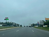
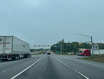
Proceeding from its interchange with Interstate 95 in Ruther Glen, Virginia, opposite Carmel Church in Caroline County, Virginia State Route 207 approaches junctions with state secondary routes 652 (Cool Water Drive) and 782 (Carmel Church Loop). Numerous truck stops are located at this interchange, exit 104 of I-95. Photo taken 10-06-2023.
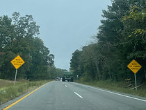
With four lanes in the eastbound direction at this point, VA 207 proceeds downhill toward a signal on the east side of the Loop. Photo taken 10-06-2023.
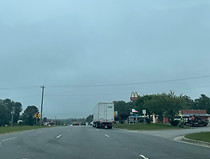
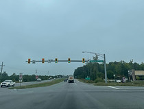
Additional access to several of the highway services is through a left turn at the signal. Photo taken 10-06-2023.
These services are listed individually on blue signs with their names in a variant of the Clearview font. Photo taken 10-06-2023.
From the signal, northbound SR 652 leads to northbound SR 782, and southbound SR 782 can be reached by turning right. Photo taken 10-06-2023.
A close-up of the Carmel Church Loop signal. Photo taken 10-06-2023.

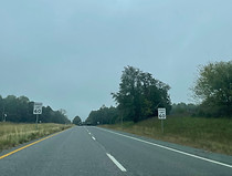
Known as Rogers Clark Boulevard, VA 207 leads 11 miles northeast to U.S. Route 301 outside of Bowling Green, the seat of Caroline County. On I-95 north, it is billed as the last access point to US 301 and the Nice/Middleton Bridge over the Potomac River into Maryland, a means of avoiding the frequent congestion on I-95 in Northern Virginia. Hence, Baltimore, Maryland is listed on this sign as being 118 miles away. Photo taken 10-06-2023.
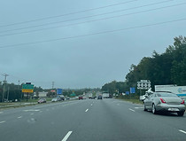
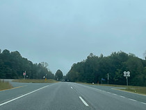
A traffic signal at Enterprise Parkway is forthcoming. Photo taken 10-06-2023.
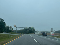
Enterprise Parkway (SR 799) leads into an extension of the Ruther Glen retail hub under construction. Photo taken 10-06-2023.

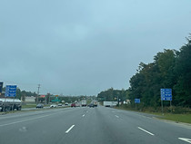
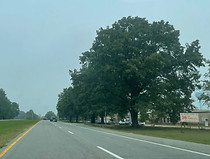
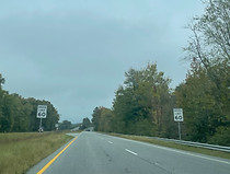
As the route heads into trees following Enterprise Parkway, the speed limit increases from 55 to 60 miles per hour. Photo taken 10-06-2023.

Guardrails line each side of the eastbound carriageway as a small break in the trees occurs in the median. Photo taken 10-06-2023.
Another pair of speed limit signs precedes the route's downward dip back into the trees. Photo taken 10-06-2023.
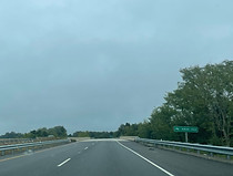
Secondary routes 716 (Moncure Drive) and 656 (Colemans Mill Road) intersect the highway next. Photo taken 10-06-2023.

Surrounded by trees again, VA 207 crosses over Polecat Creek, a Mattaponi River tributary. Photo taken 10-06-2023.

The trees on the left side of the highway clear out enough for it to intersect a median crossover leading to a residential driveway. Photo taken 10-06-2023.

Penola Road (SR 601) then intersects the highway. Photo taken 10-06-2023.

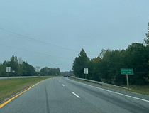
The speed limit remains 60. Photo taken 10-06-2023.

However, it then goes all the way down to 35 miles per hour as VA 207 nears a school zone. Meanwhile, SR 601 prepares to split off to the left as Golansville Road. Photo taken 10-06-2023.

The specific schools surrounded by the school zone are Caroline Middle and High Schools. Photo taken 10-06-2023.
As it passes the high school, VA 207 crosses the 38th parallel north of the Equator. This sign is modeled after a Korean War-era sign marking the line between North and South Korea, and highlights that connection to this area. The U.S. Capitol Building in Washington, DC sits slightly less than one degree of latitude north of here, just below the 39th parallel. Photo taken 10-06-2023.

The highway now leaves the school zone, and trees envelop it again. Photo taken 10-06-2023.
VA 207 next intersects SR 639 (Ladysmith Road), which goes west to I-95, meeting US 1 at the namesake community and then passes north of the Lake Caroline area. Photo taken 10-06-2023.
A warning to watch for turning vehicles follows. Photo taken 10-06-2023.

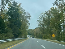
Slightly further ahead is an intersection with secondary route 722 (Nelson Hill Road). A former alignment of what is now the VA 207 corridor, SR 722 passes through the community and former railroad town of Milford. Photo taken 10-06-2023.

Past SR 722, drivers are provided with a reminder that they are bound for US 301, assuming they don't turn on one of the remaining handful of side streets beforehand. Photo taken 10-06-2023.

After that, the highway crosses over the Mattaponi River. Photo taken 10-06-2023.
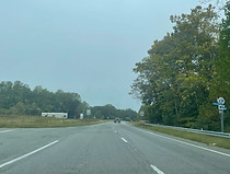
The speed limit remains 60 miles per hour, but that will soon change as VA 207 is nearing a more developed area, namely Bowling Green. Photo taken 10-06-2023.
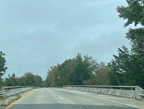
Another bridge just after the prior one carries VA 207 over the historic Richmond, Fredericksburg and Potomac railroad line that Milford was built along. This line now belongs to a subdivision of CSX. Photo taken 10-06-2023.
A forthcoming intersection at the other end of SR 722 warrants another warning sign at right. Photo taken 10-06-2023.

VA 207 Business leaves the highway ahead to go into downtown Bowling Green. Traffic bound for Virginia State Route 2 north toward the Fredericksburg area are advised to take it. US 301-bound traffic should remain on mainline VA 207. This intersection represents the west end of the Bowling Green Bypass, which runs south of the town proper. Photo taken 10-06-2023.

An Interstate-style blue service sign appears following that shield assembly, solely to bill a McDonald's at next left. Photo taken 10-06-2023.

Baltimore is straight ahead via the US 301 corridor, while Bowling Green and Fredericksburg as stated are accessible by bearing left. Photo taken 10-06-2023.

Another iteration of the same shield assembly is displayed at the business route split itself. Photo taken 10-06-2023.

As the bypass navigates a pair of wide curves, the speed limit is down to 55 miles per hour. Photo taken 10-06-2023.

The bypass goes on to curve back to the left, with the westbound carriageway at a slightly higher elevation than the eastbound. Photo taken 10-06-2023.

The junction with US 301 is approaching, and the R&D Family Campground is announced as being in the direction of US 301 south. Photo taken 10-06-2023.
The highway crosses over US 301, as a sign indicates another access point to downtown Bowling Green is at left. Photo taken 10-06-2023.

US 301 south is accessed by turning left at the connector road, then left again, requiring southbound traffic to pass back under VA 207. Photo taken 10-06-2023.

Port Royal and Baltimore as marked as control cities for US 301 north, and Richmond for US 301 south. Also marked northbound is the U.S. Army's Fort Walker, formerly Fort A.P. Hill. VA 207 now reaches its end and gives the reins to US 301. Photo taken 10-06-2023.