
The epzik8 Webpage
U.S. Route 50 west - Ocean City to Queenstown

U.S. Route 50 is shown here at its eastern terminus in Ocean City at the east end of a drawbridge, the Harry W. Kelley Memorial Bridge, over the Sinepuxent Bay which separates Ocean City from Maryland's mainland. US 50's western end in Sacramento, California is 3,073 miles away, acknowledged by a small overhead sign. (6-9-2026)

A traffic signal along the bridge turns yellow and then red whenever the drawbridge grates are opened. (6-9-2026)

As the bridge goes on, US 50 leaves Ocean City's corporate limits. (6-9-2026)

Just past the west end of the bridge, US 50 intersects Golf Course Road which leads southward to the West Ocean City Harbor. (6-9-2026)

Ocean City bids farewell to westbound drivers with a sign in the median. For the next 94 miles, US 50 runs along the lower half of Maryland's Eastern Shore as the Ocean Gateway. (6-9-2026)

After Golf Course Road, US 50 comes upon Maryland Route 611. (6-9-2026)

MD 611 (Stephen Decatur Highway) goes south toward the Ocean City Airport. (6-9-2026)

MD 611 also provides access from US 50 to the Assateague Island National Seashore, along with the Frontier Town amusement park and campground. (6-9-2026)

The MD 611 signal up close. (6-9-2026)

The next signal is at Keyser Point Road which leads into the Greenwood Place subdivision. (6-9-2026)

The cities of Salisbury and Cambridge are a respective 27 and 62 miles away from here. (6-9-2026)

A junction with Maryland Route 707 (Old Bridge Road, officially MD 707A) is up ahead. (6-9-2026)

Afterward, there is a notation that this portion of US 50 is a hurricane evacuation route. (6-9-2026)

Next up comes a traffic signal at Man O' War Lane. (6-9-2026)

The intersection after that is at Grays Corner Road (Maryland Route 707E), which is one of numerous historic alignments of US 50 paralleling its modern routing along the Eastern Shore. (6-9-2026)

To the left, across from the Glen Riddle Golf Club, the highway intersects an access road to Samuel Bowen Road. (6-9-2026)

From a signal up ahead, the Ocean Downs Casino and the community of Ocean Pines can be reached. (6-9-2026)

The signal intersects northbound Maryland Route 589 (Racetrack Road). (6-9-2026)

The highway goes on to intersect Maryland Route 452 (Seahawk Road south/Friendship Road north). (6-9-2026)
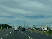
From here, MD 452 north leads to MD 707 east. (6-9-2026)

Maryland Route 346 (Old Ocean City Boulevard), another old alignment of US 50 leading into downtown Berlin, is intersected ahead on the left. (6-9-2026)

In half a mile, US 50 has an interchange with U.S. Route 113, which leads north to Dover, Delaware and south to Worcester County seat Snow Hill. (6-9-2026)

The offramp to US 113 north is ¼ mile prior to the cloverleaf ramp to US 113 south. Overall, US 113 runs 74 miles from Pocomoke City, Maryland to Milford, Delaware. Since 2004, it has only reached Dover by way of its parent U.S. Route 13. (6-9-2026)

The northbound US 113 ramp gore sign. (6-9-2026)

US 50 now leaves Worcester County's Coastal Bays Watershed, which covers the drainage basin surrounding the five bays that separate the county's mainland from Fenwick and Assateague islands and the Atlantic Ocean. (6-9-2026)

Just prior to US 50 passing under US 113, there is a sign in the median that downtown Berlin can be reached from the next left turn. Meanwhile, westbound US 50 receives its onramp from northbound US 113 to the right and the ramp from US 50 west to US 113 south is approaching. (6-9-2026)

Maryland Route 818 (North Main Street) is intersected at-grade immediately west of the US 113 interchange. (6-9-2026)

There is a freight railroad crossing before MD 818. (6-9-2026)

The onramp from US 113 south to US 50 west then comes in on the right. (6-9-2026)

A set of flashers is situated at the MD 818 junction. (6-9-2026)

A sign in the median then welcomes drivers to Berlin. (6-9-2026)

US 50's eastern junction with US 13 as well as downtown Salisbury are 22 miles away from the sign at right, and the Bay Bridge is 97 miles away. (6-9-2026)

US 50 then makes its way into the Chesapeake Bay Watershed. (6-9-2026)

There is subsequently US 50 reassurance on the right. (6-9-2026)

Ahead, a ramp from US 50 east to eastbound Maryland Route 90 (Ocean City Expressway) passes overhead. (6-9-2026)

US 50 west then receives traffic from MD 90 west. MD 90 goes from here to the intersection of 62nd Street and Coastal Highway in Ocean City via Ocean Pines and the Isle of Wight Nature Park. (6-9-2026)
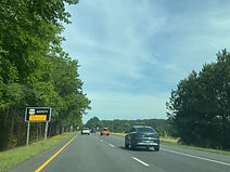
The next portion of US 50 is a mandatory headlight use area. (6-9-2026)

Hall Road is intersected next on the right. (6-9-2026)

Maryland Route 610 (Whaleyville Road) is intersected a short distance later, just west of US 50's crossing of Whaleysville Branch. (6-9-2026)

Opposite MD 610 up ahead is Dale Road. (6-9-2026)

The MD 610 intersection is another augmented by overhead flashers. (6-9-2026)

Salisbury is now 17 miles' drive to the west. (6-9-2026)

Bell Road is the next road intersected. (6-9-2026)

At this point, US 50 crosses the Pocomoke River from Worcester County into Wicomico County. (6-9-2026)

Bent Pine Road is the first intersection after the Pocomoke bridge. (6-9-2026)

Powellville Road (Maryland Route 354) is intersected at a crossroads ahead. (6-9-2026)

At the intersection, Powellville is accessible via a left turn, and Willards to the right. (6-9-2026)

The northern terminus of MD 354 is two-tenths of a mile north of here, at MD 346. (6-9-2026)

Salisbury, Cambridge and Easton are now 13, 46 and 62 miles away respectively. (6-9-2026)

The highway meets Woodyard Road up ahead. (6-9-2026)

Then, at mile marker 124, the route passes by trees on the left and a farm field at right. (6-9-2026)

White Richardson Road is intersected next, leading into Pittsville's Strawberry Village subdivision partly seen to the right. (6-9-2026)

At this moment, US 50's eastern junction with US 13 is 7 miles and 8 minutes away. (6-9-2026)

The next junction leads directly to Maryland Route 353. (6-9-2026)

MD 353 (Sixty Foot Road) is intersected at a fully-actuated traffic signal up ahead. (6-9-2026)

A right turn ahead leads drivers directly into downtown Pittsville. (6-9-2026)

The MD 353 junction is followed by US 50 reassurance. (6-9-2026)

The Main Street Extension up ahead also leads into Pittsville. (6-9-2026)

Next, the route intersects Parsonsburg Road. (6-9-2026)

Soon afterward, Forest Grove Road connects the US 50 corridor with Parsonsburg. (6-9-2026)

A traffic signal sits one mile from the yellow sign on the left. (6-9-2026)

Walston Switch Road is intersected at the signal, leading to the Lower Shore American Job Center (formerly the One Stop Job Market) and the facilities of Shore Transit, a bus service running across the lower Eastern Shore. (6-9-2026)

A left turn up ahead takes drivers toward the Salisbury Regional Airport and Wor-Wic Community College. (6-9-2026)

A pointer for the airport is located to the left. (6-9-2026)

The Walston Switch signal is seen here. (6-9-2026)

US 50 reassurance follows Walston Switch. (6-9-2026)

In 1½ miles, US 50 will join US 13 on the Salisbury Bypass. (6-9-2026)

Through traffic bypassing Salisbury, regardless of whether they are staying on US 50 or exiting onto US 13 at their split, is to keep right at the upcoming traffic signal. (6-9-2026)

A left turn at the signal takes one to the Arthur W. Perdue Stadium, home of minor league baseball's Delmarva Shorebirds. Interests to the WinterPlace Park and Equestrian Center off MD 346 are to turn right. (6-9-2026)

A lefthand ramp at the forthcoming interchange leads to US 13 south which has a control city of Norfolk, Virginia. (6-9-2026)
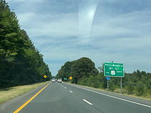
Northbound US 13 can be taken from the Salisbury area through Delaware to the areas of Philadelphia, Pennsylvania and, via Interstate 95, New York City and New Jersey. (6-9-2026)

The road intersected at the signal is Hobbs Road. (6-9-2026)

The Hobbs Road intersection is here. (6-9-2026)

Salisbury University can be reached by going straight through the interchange onto US 50 Business. (6-9-2026)

Westbound US 50 makes its diversion onto the bypass at this point. (6-9-2026)

A gore sign points the way to the Salisbury Bypass. (6-9-2026)

Upon entering the bypass, US 50 passes over MD 346 (Old Ocean City Road). (6-9-2026)

US 13 and US 50 shields sit side by side after US 50 joins the bypass. (6-9-2026)

US 13 and US 50 have their own mile markers posted separately along the bypass. Seen at right is US 50's Maryland mile marker 114.5. (6-9-2026)

Some of the food services available at the next exit are posted to the right. (6-9-2026)

This exit is where northbound US 13 departs the bypass toward the state of Delaware. This is also the northern terminus of Salisbury's iteration of U.S. Route 13 Business. (6-9-2026)

There is a second sign to the right billing US 13 as the way from here to the Philadelphia and NYC regions. (6-9-2026)

The US 13 split is now half a mile away, and this advance sign acknowledges that southbound US 13 Bus. can be used to backtrack into downtown Salisbury. (6-9-2026)

At the US 13 split, Cambridge assumes the role of US 50's westbound control city. (6-9-2026)

The gore sign for the US 13/13 Bus. interchange ramp. (6-9-2026)

US 50 crosses US 13 Bus. (Salisbury Boulevard) a few dozen feet south of where that designation ends. (6-9-2026)

Immediately afterward, it passes over the sweeping lefthand ramp that carries southbound US 13 onto the bypass, pairing it with US 50 east. (6-9-2026)

Up ahead, westbound US 50 receives its own onramp from US 13 south. (6-9-2026)

US 50 is now on its own again and is on the western extension of the Salisbury Bypass that opened in 2002, taking most beach-bound traffic out of Salisbury. (6-9-2026)

The highway then receives an onramp from Northwood Drive, which has an eastbound-only offramp to it. (6-9-2026)

Following that is a bridge over a Norfolk Southern freight railroad track. (6-9-2026)

Meanwhile, the speed limit on the bypass the whole time has been 65 MPH. (6-9-2026)

The highway goes on to cross the Wicomico River. (6-9-2026)

A mile away, US 50 has an interchange at Naylor Mill Road. (6-9-2026)

A precinct of the Wicomico County Sheriff's Office is off this exit. (6-9-2026)

The Naylor Mill exits is straight ahead. (6-9-2026)

As westbound US 50 Bus. flies overhead, there is an overhead sign with flashers along mainline US 50 stating the expressway will end at a traffic signal a mile away, and the speed limit drops to 55. (6-9-2026)

US 50 reassurance marks the end of the bypass. (6-9-2026)

US 50's business route merges in on the right, bringing the designation to an end. (6-9-2026)

These overhead flashers warn of an impending traffic signal ahead. (6-9-2026)

The road intersected at the signal is White Lowe Road. (6-9-2026)

Trucks over 10,000 GVW are instructed to bypass Maryland Route 670 ahead and instead stay on US 50 another mile to Maryland Route 347. (6-9-2026)

MD 670 (Lillian Street) leads west from here to Hebron and Quantico. (6-9-2026)

US 50 then comes upon its junction with MD 347 (Quantico Road). (6-9-2026)

MD 347 is a route that leads more directly to Hebron. (6-9-2026)

Cambridge and Easton are a respective 25 and 39 miles from the sign on the right. (6-9-2026)

A new traffic signal is then seen being put up at Old Railroad Road. (6-9-2026)

Afterward, the highway comes upon Rising Eagle Road. (6-9-2026)

The following intersection is at Barnes Creek Road. (6-9-2026)

US 50 then approaches an intersection at Main Street (left) and northbound Maryland Route 313 (Delmar Road) which leads to eastbound Maryland Route 54. (6-9-2026)

The highway crosses Baron Creek before the junction. (6-9-2026)

MD 313 leads north a few feet from here to the western end of the multi-state Route 54, which straddles the Maryland/Delaware line along its course from here to Fenwick Island. (6-9-2026)

Main Street goes south into Mardela Springs, while northbound MD 313 leads to Sharptown and, via MD 54, Delmar. (6-9-2026)

The highway subsequently intersects Branch Street. (6-9-2026)

The next segment of US 50 is part of the Chesapeake Country Scenic Byway. (6-9-2026)

Cambridge and Easton are now 21 and 37 miles away. (6-9-2026)

Spring Grove Road (left) and Riverton Road (right) are intersected soon afterward. (6-9-2026)

A rest area is situated 1,000 feet away on the left; there are no restrooms at it. (6-9-2026)

The rest area is straight ahead on the left. (6-9-2026)

Afterward, the highway meets Old Bradley Road at a crossroads. (6-9-2026)

A US 50 reassurance shield is seen soon afterward. (6-9-2026)

Elliott Island, Fishing Bay and the Blackwater National Wildlife Refuge - all part of a state-designated wildlife corridor - can be accessed by exiting at MD 331 up ahead. (6-9-2026)

The exit for Maryland Route 331 (Rhodesdale Vienna Road) is 1½ miles away. (6-9-2026)

First, US 50 crosses the Nanticoke River along the Nanticoke River Memorial Bridge, dedicated to combat veterans of the U.S. military. (6-9-2026)

US 50's current crossing of the Nanticoke replaced a two-lane bridge a few hundred feet upstream in the early 1990s. The completion of the new bridge eliminated US 50's last divided highway gap on the Eastern Shore. (6-9-2026)

At the west end of the bridge, US 50 has entered Dorchester County. (6-9-2026)

The MD 331 exit can be used to reach the towns of Hurlock and East New Market. (6-9-2026)

US 50 enters the town of Vienna as it approaches MD 331. (6-9-2026)

The Chesapeake Country byway leaves US 50 for MD 331 at the exit. (6-9-2026)

US 50 passes over MD 331 before the exit, which is a cloverleaf offramp. (6-9-2026)

An overhead sign point the way to the MD 331 exit ramp. (6-9-2026)

The MD 331 interchange is followed by US 50 reassurance. (6-9-2026)

The small town of Linkwood is 7 miles away, Cambridge 15, and the Bay Bridge 35. (6-9-2026)

Maiden Forest Road is intersected ahead on the left. (6-9-2026)

The highway soon crosses the Chicamacomico River. (6-9-2026)

Maiden Forest Road loops back around to US 50 and intersects it ahead on the right. (6-9-2026)

The Layton's Chance Vineyard and Winery is a left turn away from here. (6-9-2026)

The highway then begins a wide curve to the right. (6-9-2026)

Mill Road is intersected just past the end of the curve. (6-9-2026)

Percy May Road is intersected next. (6-9-2026)

A set of flashers to the right warns the Linkwood-Salem Volunteer Fire Company is approaching. (6-9-2026)

After an approaching railroad crossing, US 50 will intersect Linkwood Drive (left) and Linkwood Road (right). (6-9-2026)

US 50 now enters the community of Linkwood. (6-9-2026)

The railroad crossing is seen here. (6-9-2026)

A distance later, the highway intersects Hicksburg Road. (6-9-2026)

A light curve to the left then comes at mile marker 85. (6-9-2026)

A short time later, Maryland Route 16 joins US 50 for a concurrency. MD 16 goes east from this traffic signal as Mount Holly Road toward East New Market. (6-9-2026)

After that junction, US 50 and MD 16 shields sit beside each other on the right. (6-9-2026)

Backwoods Drive is next intersected on the right. (6-9-2026)

The highway is now coming upon a junction with Maryland Route 750. (6-9-2026)

MD 750 runs along a former alignment of US 50 just under a mile to Aireys Spur Road. To the left at the signal ahead is Bucktown Road which leads to the Cambridge-Dorchester Airport. (6-9-2026)

These signs warn of the MD 750/Bucktown signal. (6-9-2026)

US 50 has now expanded to 3 lanes as it is making its way into Cambridge, the seat of Dorchester County. (6-9-2026)

Just ahead, MD 16 will leave the US 50 corridor for the Harriet Tubman Underground Railroad museum, Church Creek, and Taylors and Hoopers islands. (6-9-2026)

Opposite MD 16, US 50 intersects Heron Boulevard which leads into the River Marsh Golf Club. (6-9-2026)

The highway then intersects Woods Road which goes northward to the Shoal Creek area. (6-9-2026)

Maryland Route 343 (Washington Street) can be accessed via the next left turn. (6-9-2026)

A traffic signal at Crusader Road follows. (6-9-2026)

The Crusader Road signal up close. (6-9-2026)

After a wide curve to the right, US 50 orients itself due north and intersects Meteor Avenue. (6-9-2026)

Maryland Avenue, intersected ahead, leads to the Chesapeake College. (6-9-2026)

Historic sites in Cambridge, like the visitors center, harbor, and historic house and museum, are located in either direction at the next intersection. (6-9-2026)

The Maryland Avenue signal is here. (6-9-2026)

As it leaves Cambridge, US 50 begins to cross the Choptank River on the Frederick C. Malkus, Jr. Bridge. (6-9-2026)

The part of the Choptank crossed by US 50 is lightly tidal. (6-9-2026)

Marina Drive (left) and Bolingbroke Point Drive (right) are intersected by US 50 at the north end of the bridge. (6-9-2026)

At the north end of the bridge, US 50 enters Talbot County. (6-9-2026)

The cities of Trappe and Easton are 4 and 12 miles away, and the Bay Bridge is 42 miles' drive away. (6-9-2026)

A gradual curve to the left follows. (6-9-2026)

Buck Bryan Road is intersected soon afterward. (6-9-2026)

Signs just further along warn drivers to watch for tractors along this stretch of the highway. (6-9-2026)

The next 3 miles of US 50 are a speed awareness zone. (6-9-2026)
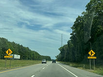
The highway's next intersection is at Beaver Dam Road. (6-9-2026)

A traffic signal is located a mile away from the sign on the right. (6-9-2026)

An access road intersected ahead at left leads to Howell Point Road. (6-9-2026)

The aforementioned traffic signal is located at Barber Road. (6-9-2026)

Beforehand, US 50 reassurance is posted as the highway nears Trappe. (6-9-2026)

Barber Road goes southeast from here to Schoolhouse Road at Belmont Landing beside the Choptank. (6-9-2026)

Greenfield Avenue is subsequently intersected on the left. (6-9-2026)

There is then a crossroads at Maple Avenue (left) and Piney Hill Road (right). (6-9-2026)

An intersection with Lakeside Boulevard follows. (6-9-2026)

Lakeside Boulevard is the main street of the Lakeside subdivision. (6-9-2026)

Sanderstown Road (left) and Tarbutton Mill Road (right) are intersected at a crossroads soon afterward. (6-9-2026)

The town of Oxford and the historic Oxford Bellevue Ferry can be accessed via the next left turn. (6-9-2026)
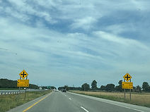
The highway's next intersection is situated at Almshouse Road (left) and Manander Road (right). (6-9-2026)

This is followed by another US 50 reassurance shield. (6-9-2026)

Barrack "I" of the Maryland State Police in Easton is located 2 miles from the blue sign on the right. (6-9-2026)

Yet another traffic signal is impending. (6-9-2026)

Meanwhile, in one mile, US 50 intersects the southern end of Maryland Route 322 (Easton Parkway), which can be used to reach St. Michaels and Oxford from the US 50 corridor. (6-9-2026)

The aforementioned signal is located at the north end of the main section of Maryland Route 565 (Old Trappe Road). (6-9-2026)

Opposite MD 565 at this signal is Landing Neck Road, which goes all the way back southeast to Bruceville Road, going through the crossroads of Manadier in the process. (6-9-2026)

A few dozen feet later, US 50 makes its way into Easton, which has the honor of being the seat of Talbot County. (6-9-2026)

MD 322 can be used to reach the following areas along Talbot County's bayside peninsulas: St. Michaels and Tilghman Island, the Chesapeake Bay Maritime Museum in St. Michaels, and Oxford. (6-9-2026)

Also reachable from MD 322 is Easton's historic district, including the Academy Art Museum and the Avalon Theater Historical Society. (6-9-2026)

Schwaninger Road is intersected prior to MD 322. (6-9-2026)

MD 322's split from US 50 is just ahead on the left. (6-9-2026)

MD 322 is a controlled-access western bypass of downtown Easton. (6-9-2026)
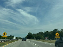
The intersection afterward is Woodridge Road. (6-9-2026)

US 50 soon makes its way into Easton's commercial hub, considered an urban area by a broad definition, and the speed limit drops to 45 MPH. (6-9-2026)

The highway now reaches a traffic signal at Dutchmans Lane. (6-9-2026)

Next comes a staggered intersection at Idlewid Avenue (left), which leads to Idlewild Park in downtown Easton, and Erickson Drive (right). (6-9-2026)

Bartlett Avenue is intersected on the right soon afterward. (6-9-2026)

US 50 then reconnects with MD 331, now known as Dover Road, at a traffic signal. Trucks are not allowed along MD 331 within Easton. (6-9-2026)

Easton's historic district is reachable by turning left at the signal. (6-9-2026)

This is the northern terminus of MD 331. Dover Road continues several blocks west to Easton Parkway. (6-9-2026)

Between intersections, US 50 passes by MDOT's Easton maintenance shop on the right. (6-9-2026)

The highway then meets the southern terminus of Maryland Route 328 (Matthewstown Road), which goes northeast to Denton, the seat of Caroline County across the Choptank. The road continues west into downtown Easton as Goldsborough Street. (6-9-2026)

The signal afterward is at Norris Taylor Drive, which leads into the subdivision of Calvert Village and is just ahead of US 50's crossing of the Tred Avon River. (6-9-2026)

The highway passes by a cornfield and light retail development before reaching its next signal, located at Chapel Road. (6-9-2026)

Chapel Road goes from Washington Street several miles northeastward to Coveys Landing Road in the Cordova area. (6-9-2026)

Intersected on the right soon afterward is Commons Drive, a connector to Sunflower Drive. (6-9-2026)

US 50 subsequently comes upon the northern terminus of MD 322. (6-9-2026)

A gore sign in the middle of the intersection points toward MD 322 south, and the movement to it from US 50 west is a sweeping lefthand turn ending at a traffic light where it crosses MD 322 north. (6-9-2026)

As US 50 makes its way out of Easton, a reassurance shield sits to its right. (6-9-2026)

The highway then nears a junction with Maryland Route 309. (6-9-2026)

Intersected opposite MD 309 at the forthcoming signal is Airport Road. (6-9-2026)

MD 309 goes north from here to Cordova and the community of Queen Anne. (6-9-2026)

MD 309 is known in this area as Black Dog Alley. (6-9-2026)

Soon afterward, US 50 nears the Talbot Agriculture Center which is ahead on the right, down Hiners Lane. (6-9-2026)

The highway then prepares to intersect Rabbit Hill Road. (6-9-2026)

US 50 will soon meet Maryland Route 662, its historic alignment between Easton and Wye Mills. (6-9-2026)
US 50 will soon meet Maryland Route 662, its historic alignment between Easton and Wye Mills. This segment of MD 662 is in fact internally designated MD 662C south of US 50 and MD 662B north of it, despite being the same physical roadway, Old Skipton Road. (6-9-2026)

A little bit further along, US 50 crosses Skipton Creek, a tributary of the Wye East River. (6-9-2026)

An intersection with Skipton Landing Road follows. (6-9-2026)

US 50 reaches the northern end of MD 662B ahead. (6-9-2026)

A MD 662 junction sign sits in the median. (6-9-2026)

Then, US 50 meets Maryland Route 404 at a major intersection half a mile away. (6-9-2026)

Chesapeake College and the town of Wye Mills can be reached from MD 404 west, and Denton from MD 404 east. (6-9-2026)

Two separate park and ride lots are located at this intersection, Lot B on the left and Lot A on the right. (6-9-2026)

Eastbound MD 404 is a right turn away. (6-9-2026)

Much of MD 404 is known as Queen Anne's Highway. (6-9-2026)

Beyond MD 404, US 50 enters Queen Anne's County, and the Bay Bridge is 17 miles' drive away. (6-9-2026)

A variable message sign ahead displays travel times to the Bay Bridge along with any important information regarding it. (6-9-2026)

The left turn up ahead is another way to get to Chesapeake College. (6-9-2026)

The route intersected ahead is Maryland Route 213 (Centreville Road), which heads north to the towns of Centreville and, in neighboring Kent County, Chestertown. (6-9-2026)

Northbound MD 213 can be taken from here to northbound U.S. Route 301, which runs along the upper Eastern Shore into Delaware. (6-9-2026)

There is US 50 reassurance after MD 213. (6-9-2026)

Grange Hall Road is intersected ahead on the right. (6-9-2026)

Queenstown, the Bay Bridge, and Maryland's capital city Annapolis are a respective 6, 15 and 28 miles away from here. (6-9-2026)

US 50 will intersect the north end of MD 662 in ¼ mile. (6-9-2026)

The highway then comes upon Scottown Road. (6-9-2026)

Queenstown and the Bay Bridge are now 5 and 14 miles away. (6-9-2026)

The highway slowly dips downhill, then goes back up. (6-9-2026)

A left turn ahead takes one to the Wye Mills Natural Resources Management Area. (6-9-2026)

An intersection with Carmichael Road soon afterward contains overhead flashers. (6-9-2026)

Carmichael Road is followed by an intersection with Bloomingdale Road. (6-9-2026)

A green sign on the right reiterates that one must remain on US 50 to reach the Bay Bridge. (6-9-2026)

Located ahead on the right is Maryland Route 456 (Del Rhodes Avenue) which can be taken into downtown Queenstown, crossing US 301 in the process. (6-9-2026)

The Shore Emergency Medical Center is located 2 miles from the blue sign on the right at exit 45B. (6-9-2026)

Sportsman's Neck Road, intersected at left, parallels the Wye River into the Hickory Ridge subdivision. (6-9-2026)

There is subsequently a full-fledged traffic signal at Outlet Center Drive, the entry into the Premium Outlets at Queenstown. (6-9-2026)

Intersected straight ahead, Maryland Route 18 (Main Street) leads west to Grasonville, paralleling the US 50 freeway along Kent Narrows and Kent Island, and east into Queenstown. This is the final intersection before US 301 joins US 50; the two routes travel across the Bay Bridge and through Annapolis before US 301 departs the corridor in Bowie in Prince George's County, a total distance of 33 miles. (6-9-2026)
