
The epzik8 Webpage
U.S. Route 17 north - Punta Gorda to Arcadia

Northbound U.S. Route 17 begins here at Olympia Avenue and the southbound Tamiami Trail (U.S. Route 41) in downtown Punta Gorda, Florida, a few blocks from the Peace River. Photo taken 10-02-2024.

A block to the north, it reaches Taylor Street. Photo taken 10-02-2024.

The route next approaches US 41 north beside the Charlotte County courthouse. Photo taken 10-02-2024.

Signage for US 41 and US 17 north is at the intersection. Photo taken 10-02-2024.

US 17 reassurance follows that signal. Photo taken 10-02-2024.

The next signal is at Nesbit Street. Photo taken 10-02-2024.

Meanwhile, Arcadia in DeSoto County and Winter Haven in Polk County are 25 and 85 miles away. Photo taken 10-02-2024.

Nesbit Street leads northwest to Laishley Park. Photo taken 10-02-2024.

The speed limit for now is 35 miles per hour. Photo taken 10-02-2024.

US 17 next intersects Cooper Street. Photo taken 10-02-2024.

The highway then leaves Punta Gorda, with reassurance shields. Photo taken 10-02-2024.

The next left (Marlympia Way) leads to Old US 17 and Solana. Photo taken 10-02-2024.

The speed limit increases to 55 approaching a crossing of the old Atlantic Coast railroad. Photo taken 10-02-2024.

The route curves sharp left at the north end of the bridge. Photo taken 10-02-2024.

US 17 now approaches its junction with Interstate 75. Photo taken 10-02-2024.

The ramp from US 17 north to I-75 south toward Naples sits ahead. Photo taken 10-02-2024.

Markers to the right point toward each direction of I-75. Photo taken 10-02-2024.

After I-75 passes overhead, a cloverleaf ramp leads from US 17 north to I-75 north toward Tampa (via 40 miles of I-275, two-thirds of that highway's total length). Photo taken 10-02-2024.

After the ramp to I-75 north, there is a traffic signal at the end of the ramp to both directions of US 17 from I-75 north. Photo taken 10-02-2024.

Leaving I-75 behind, US 17 approaches Regent Road and Piper Road at another signal. Photo taken 10-02-2024.

Intersected afterward is Bermont Road. Photo taken 10-02-2024.

Via a right turn at Bermont are the Sandlot Off-Road Adventure Park, Palmdale, and the Babcock/Webb Wildlife Management Area. Photo taken 10-02-2024.

The Bermont signal up-close. Photo taken 10-02-2024.

Arcadia, Bartow and Winter Haven are now 22, 72 and 82 miles away. Photo taken 10-02-2024.

US 17 is now departing the immediate Punta Gorda area as a four-lane divided highway. Photo taken 10-02-2024.

Soon, it reaches a signal at Disston Avenue. Photo taken 10-02-2024.

The speed remains 55 MPH. Photo taken 10-02-2024.

A curve to the left is visible ahead. Photo taken 10-02-2024.

A right turn away is the Shell Creek Airpark. Photo taken 10-02-2024.

US 17 reassurance comes before the curve. Photo taken 10-02-2024.

The highway then straightens out and forges due north. Photo taken 10-02-2024.

Then, it crosses Shell Creek, a Peace River tributary (the Peace in turn feeding into the Gulf of Mexico). Photo taken 10-02-2024.

The route goes on to have two bridges over swampland surrounding the creek. Photo taken 10-02-2024.

Back over proper land, US 17 intersects Taralane Drive. Photo taken 10-02-2024.

Then, to the right, it meets Red Pine Road. Photo taken 10-02-2024.

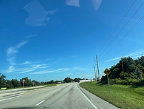
The speed limit now increases to 60 miles per hour. Photo taken 10-02-2024.

A fire station (Charlotte County station no. 16) is approaching on the left. Photo taken 10-02-2024.

US 17 then intersects Peace River Shores Boulevard which leads into the titular residential subdivision on the left. Photo taken 10-02-2024.

Soon afterward, US 17 departs Charlotte County for DeSoto County, one of the most inland portions of southwest Florida. Photo taken 10-02-2024.

After the county line, there are "trucks entering (the) highway" as can be seen in the distance of this photo. Photo taken 10-02-2024.

The highway then intersects a pair of long farm driveways. Photo taken 10-02-2024.

Next, it crosses Thornton Branch. Photo taken 10-02-2024.

The highway is nearing a meeting with DeSoto County Route 761. Photo taken 10-02-2024.

CR 761 leads northwest to Platt. Photo taken 10-02-2024.

US 17 reassurance follows. Photo taken 10-02-2024.

The highway now enters Fort Ogden. Photo taken 10-02-2024.
A crossroads is approaching at River Street where the left leg immediately encounters a railroad crossing. Photo taken 10-02-2024.

Now oriented northeast, a train is present parallel to the southbound carriageway. Photo taken 10-02-2024.

Another junction with railroad crossing (Collins Street) is ahead. Photo taken 10-02-2024.

The highway then goes by a farmstead. Photo taken 10-02-2024.

There is a picnic area in one mile. Photo taken 10-02-2024.

The speed limit is about to drop to 45. Photo taken 10-02-2024.

The highway prepares to meet DeSoto CR 760A. Photo taken 10-02-2024.

Then, it enters the community of Nocatee. Photo taken 10-02-2024.

More US 17 reassurance follows. Photo taken 10-02-2024.

The speed limit will soon further drop to 35. Photo taken 10-02-2024.

A school zone is nearing. Photo taken 10-02-2024.

US 17 subsequently intersects CR 760, which leads back west to CR 769. Photo taken 10-02-2024.

It then comes time for US 17 reassurance. Photo taken 10-02-2024.

The speed limit momentarily increases back to 45. Photo taken 10-02-2024.

Next, it crosses Joshua Creek. Photo taken 10-02-2024.

The speed limit then becomes 50. Photo taken 10-02-2024.

The highway straightens out, then curves left. Photo taken 10-02-2024.

One final US 17 marker precedes Arcadia town limits. Photo taken 10-02-2024.

The speed limit lowers to 40 as the route makes its way into Arcadia, the seat of DeSoto County. Photo taken 10-02-2024.

Drivers coming from this direction are met with a speed trap. Photo taken 10-02-2024.

The signal ahead intersects MLK Jr. Street and Palm Drive. Photo taken 10-02-2024.

US 17 now formally enters Arcadia. Photo taken 10-02-2024.

There is then a signalized crosswalk. Photo taken 10-02-2024.

The next signal is at Pine Street. Photo taken 10-02-2024.

The next three signals afterward are at Magnolia, Oak and Hickory streets. Photo taken 10-02-2024.

At the center of Arcadia, US 17 meets Florida State Road 70. Photo taken 10-02-2024.

SR 70 leads east to Okeechobee and Fort Pierce (and also west to Bradenton). Photo taken 10-02-2024.

Magnolia Street forms the eastbound component of SR 70's one-way pair through Arcadia. Photo taken 10-02-2024.