
The epzik8 Webpage
U.S. Route 101 north - Golden Gate Bridge to Novato

In Presidio Park in far-northern San Francisco, after emerging from the MacArthur Tunnel, California State Route 1 approaches its merge with U.S. Route 101. The two routes will cross the Golden Gate Bridge together onto the Marin Peninsula. Southbound US 101 goes into downtown San Francisco from here as Marina Boulevard. (5-4-2026)

The ramps to each direction of US 101 diverge here. (5-4-2026)

US 101's final San Francisco exit is up ahead, leading to a Golden Gate scenic view point, a Presidio Park entry point, and the Golden Gate Natural Resources Area. (5-4-2026)

This exit is numbered exit 439, and it is here that northbound drivers first get a view of the Golden Gate Bridge as the highway makes a righthand curve. (5-4-2026)


Just below the south end of the bridge sits a gift shop and coffee shop, which has a commemorative decal posted in 2017 celebrating the bridge's 80th anniversary. (5-4-2026)

The bridge begins alongside a pedestrian and bike pathway It crosses the namesake Golden Gate waterway, which is the San Francisco Bay's outlet to the Pacific Ocean. (5-4-2026)

Slower traffic is urged to keep in the far-right lane along the bridge. (5-4-2026)

Near the end of the bridge, US 101/CA 1 enter Marin County. (5-4-2026)

A vista point is at the north end of the bridge, accessed from the curb (right) lane. (5-4-2026)

The vista point entrance is ¼ mile prior to the Alexander Avenue exit. (5-4-2026)

The Alexander exit is at the end of a rightward curve. (5-4-2026)

Alexander Avenue is exit 442. (5-4-2026)

The next few miles of US 101 are a rock slide area. (5-4-2026)

The highway's next 3 exits, up to Sausalito, fall along a 2¾-mile span. (5-4-2026)

This portion of US 101 is designated the William T. Bagley Freeway, after the California State Assemblyman who once represented Marin and Sonoma counties. (5-4-2026)

US 101's interchange with Spencer Avenue and Monte Mar Drive is half a mile away. (5-4-2026)

In the meantime, the highway uses the Robin Williams Tunnel to pass under a sidehill along the Waldo Grade. Originally the Waldo Tunnel, it was renamed for the late Williams in April 2015. (5-4-2026)

The midpoint of the tunnel is around this point. (5-4-2026)
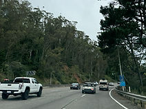
After exiting the tunnel, US 101 curves twice, the second time entering a grove of bamboo and pine trees. (5-4-2026)

The unnumbered Spencer/Monte Mar exit lies on the right at the end of this curve. (5-4-2026)

At the Wolfback Ridge Road overpass past the Monte Mar exit ramp, US 101's interchange with Rodeo Avenue is ¾ mile away, the highway's Sausalito exit 1¾ miles, and the CA 1 split 2¼ miles. (5-4-2026)

An onramp from Monte Mar approaches the northbound lanes to the right. (5-4-2026)

Traffic entering from Monte Mar is controlled by a ramp meter. (5-4-2026)

As the highway makes it way downhill, Rodeo Avenue is ¼ mile away. (5-4-2026)

Rodeo Avenue is exit 444. This street is distinct from Rodeo Drive in Los Angeles. (5-4-2026)

US 101 reassurance, with the directional banner below the shield, follows Rodeo Avenue. (5-4-2026)

The exit for Sausalito and Marin City is ¾ miles from this overhead sign. (5-4-2026)

Meanwhile, Seminary Drive is revealed to be the exit following the CA 1 split, coming a mile afterward. (5-4-2026)
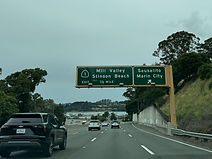
Half a mile after the Sausalito/Marin City exit, CA 1 diverges toward Mill Valley (via Almonte Boulevard/Miller Avenue) and Stinson Beach. (5-4-2026)

Sausalito/Marin City is exit 445, and specifically intersects Donahue Avenue. (5-4-2026)

Exit 445B, the number of the CA 1 split, also serves Muir Woods and Mt. Tamalpais. (5-4-2026)

Nearing exit 445B, US 101 and CA 1 shields sit alongside each other top-to-bottom. (5-4-2026)

A closer look at the exit 445B overhead sign assembly. US 101's northbound control cities are now San Rafael and Eureka. (5-4-2026)

For the next 154 miles, CA 1 will serve as the route most closely following the Pacific coastline. This situation ends at CA 1's northern terminus in Leggett, Medocino County, at which point US 101 assumes the role. (5-4-2026)

The Seminary Drive exit is now approaching. (5-4-2026)

Before Seminary, US 101 crosses Richardson Bay, and the highway's far-left lane becomes reserved for HOV traffic. (5-4-2026)

The offramp to Seminary lies straight ahead. (5-4-2026)

The Seminary ramp is exit 446, and it leads into the De Silva Island residential subdivision. (5-4-2026)

Next, in ¾ mile, US 101 has an interchange with California State Route 131 (Tiburon Boulevard/East Blithedale). (5-4-2026)

The CA 131 exit (447) is up ahead, and is the exit most directly serving Mill Valley to the west. (5-4-2026)

In 1½ miles, US 101 meets Paradise Drive and Tamalpais Drive. (5-4-2026)

There is US 101 reassurance between exits. (5-4-2026)

The highway goes on into the city of Corte Madera. (5-4-2026)

The Paradise/Tamalpais exit is ahead on the right. (5-4-2026)

An exit intersecting Lucky Drive is ¾ mile away, and and interchange serving San Anselmo and the Richmond Bridge is a mile away. (5-4-2026)
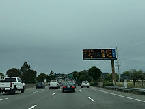
This overhead VMS displays the drivetimes to Novato, Petaluma and Sears Point to the north and east. (5-4-2026)

The second of the forthcoming exits (450B) can be taken to the Larkspur ferry terminal, Marin College, and the area of Fairfax. (5-4-2026)

US 101 enters Larkspur municipal limits as it comes upon exit 450A, with overhead signage for exit 450B. (5-4-2026)

Exit 450B can additionally be used to reach the city of San Quentin, Sir Francis Drake Boulevard, and the MarinHealth Medical Center. (5-4-2026)

Exit 450A, a right-in/right-out with Lucky Drive, is ahead to the right. (5-4-2026)

The exit 450A gore sign. The intersecting street southbound at this spot is Fifer Avenue. There is no direct connection between the two streets. (5-4-2026)

A pedestrian walkway extending from the western end of Industrial Way is situated between the two Exit 450's. (5-4-2026)

Exit 450B sits to the right. (5-4-2026)
Afterward, the highway crosses Corte Madera Creek. (5-4-2026)

Just ahead, US 101 intersects the northern terminus of Interstate 580 at exit 451. I-580 is the highway carried by the Richmond Bridge and provides access to northbound Francisco Boulevard from US 101. (5-4-2026)

Meanwhile, US 101 climbs up a hill, in the process entering San Rafael. (5-4-2026)

San Rafael is served by the next 5 exits. (5-4-2026)

On approach to exit 451, US 101 crosses Andersen Drive. (5-4-2026)

The overhead sign at right points the way to exit 451 and I-580 south. (5-4-2026)

I-580 runs a total of 76 miles northwest-to-southeast from here to Tracy in the Central Valley in San Joaquin County, passing through Berkeley and Oakland on the east side of the bay in the process. (5-4-2026)

The next exit, 452, can be used to reach Dominican University. (5-4-2026)
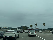
At right, traffic leaving I-580 north defaults onto US 101 north. (5-4-2026)

The next 3 exits, beginning with Central San Rafael, are placed along the next three miles. (5-4-2026)

Approaching exit 452, Santa Rosa has replaced San Rafael as one of US 101's northbound control cities. (5-4-2026)
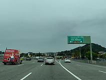
Exit 452 lies just ahead, leading to one-way-eastbound 2nd Street. (5-4-2026)

In a matter of a few feet, US 101 goes over the San Rafael Creek, then crosses 2nd Street and its westbound counterpart, 3rd Street. (5-4-2026)

After leaving downtown San Rafael, US 101 passes under a pedestrian walkway linking Paloma Avenue with Rafael Drive. (5-4-2026)

North San Pedro Drive is intersected at an interchange a mile away. (5-4-2026)

This exit leads to the Marin County Civic Center and China Camp State Park. (5-4-2026)
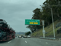
North San Pedro is designated as exit 454. (5-4-2026)

The exit 454 gore sign. (5-4-2026)

One mile away, US 101 intersects Freitas Parkway, which leads toward Terra Linda, at exit 455. (5-4-2026)

A cutout US 101 shield is situated between exits. (5-4-2026)

Overhead signage for exit 455 is mounted to the Merrydale Drive overpass, located beside the Mount Olivet Cemetery. (5-4-2026)

In ¾ mile, at exit 456, US 101 meets Lucas Valley Road. (5-4-2026)

In the meantime, truck scales sit along the right side of the highway. (5-4-2026)
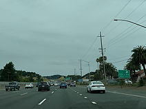
There is a park and ride at exit 456. (5-4-2026)

Those hauling trailers and campers are urged to use caution over the next 2 miles, which are a gusty wind area. (5-4-2026)

Exit 456, located just ahead, also intersects Smith Ranch Road. (5-4-2026)

The exit 456 gore sign. (5-4-2026)

The distances to the next 3 exits, up to Ignacio Boulevard, are displayed to the right. (5-4-2026)

This segment of US 101 is designated the Marin County Veterans Memorial Freeway. (5-4-2026)

Exit 457, leading to St. Vincent Drive and Miller Creek Road, is located just ahead. (5-4-2026)

One mile after exit 457, US 101 intersects Nave Drive at exit 458. (5-4-2026)

On the next exit distance sign, exit 458 is marked as for Hamilton Field. (5-4-2026)

Exit 458 can be used to reach Alameda del Prado, a loop road leading into a subdivision surrounded by the Pacheco Valley Preserve. (5-4-2026)

US 101 enters Novato as it approaches exit 458. (5-4-2026)

Exit 459, intersecting Ignacio Boulevard and Bel Marin Keys Boulevard, follows exit 458 by 1¼ miles. (5-4-2026)

The exit 458 gore sign. (5-4-2026)

Nave Drive crosses US 101 here and then spends the next mile paralleling it to its east. (5-4-2026)

From here, US 101's interchange with California State Route 37 to Vallejo is 1½ miles away, and South Novato Boulevard is 1¾ miles away. (5-4-2026)

The one-mile advance sign for the CA 37 exit (460A) adds a second control city of Napa. (5-4-2026)

The exit 459 gore sign. (5-4-2026)

CA 37 also serves interests to Sonoma and Sacramento, with connections made from it by other routes. (5-4-2026)

Exit 460A is straight ahead on the right, ¼ mile before exit 460B. (5-4-2026)