
The epzik8 Webpage
U.S. Route 1 north - Baltimore to Pennsylvania line

U.S. Route 1, as North Avenue, passes under Interstate 83 (Jones Falls Expressway) at its exit 6 in the city of Baltimore, just north of the central business district, headed due east. (1-15-2025)

Passing over the Baltimore Light RailLink as well as freight trackage, US 1 nears an intersection with Howard Street. (1-15-2025)

US 1 reassurance is posted along the bridge. (1-15-2025)

Just to the south, Howard Street has a low passage under Mount Royal Avenue with a 13-foot vertical clearance. (1-15-2025)

Then, the route reaches Charles Street, the dividing line between west and east Baltimore. This point is also the northern terminus of Maryland Route 2, Maryland's longest state route at 80 miles in length, which goes to the Calvert County town of Solomons by way of Glen Burnie and state capital Annapolis. (1-15-2025)

North and Howard intersect just north of the Light Rail's Mount Royal/MICA station on the opposite side of I-83. The Light Rail itself runs over top of Howard Street to the area of Camden Yards. (1-15-2025)

The next light is at southbound-only Maryland Avenue which runs from Wyman Park to Madison Street near Baltimore's iteration of the Washington Monument. (1-15-2025)

St. Paul Street, again southbound-only, is intersected next. (1-15-2025)

Calvert Street, seen here, is the northbound complement to St. Paul. (1-15-2025)

The route goes on past penthouse rowhomes to the right. (1-15-2025)

The subsequent Greenmount Avenue intersection is the southern terminus of Maryland Route 45, formerly U.S. Route 111. (1-15-2025)

The route reaches Homewood Avenue at the Greenmount Cemetery. (1-15-2025)

Aisquith Street leads northeast from here to 25th Street and due south to Biddle Street. (1-15-2025)

At the Eastside District Court, US 1 reaches Maryland Route 147, Harford Road. MD 147 goes through northeast Baltimore and Parkville and ends up back at US 1 in Benson, southwest of Bel Air in Harford County. MD 147 is the only Maryland state route to be present in both jurisdictions. (1-15-2025)

The route meets Bond Street at the next light. (1-15-2025)

Broadway links this part of the city to Fells Point. (1-15-2025)

Wolfe Street, which becomes 25th to the north, leads south to the Johns Hopkins hospital. (1-15-2025)

A block to the east is Washington Street, which turns into the Alameda to the north. (1-15-2025)

The route then meets Chester Street. (1-15-2025)

A shield to the right states US 1 is about to divert to the left. (1-15-2025)

The final signal before the turnoff is Patterson Park Avenue. (1-15-2025)

North Avenue now comes across an intersection with Belair Road and Gay and Port streets. Gay Street heads southwest toward Old Town Mall. Due to the east is the Baltimore Cemetery. (1-15-2025)

The route meets Sinclair Lane at a traffic signal before passing under the Baltimore Terminal Subdivision. (6-15-2024)

US 1 is now running northeast along Belair Road, and will maintain this orientation to well outside of Baltimore city limits. (6-15-2024)

A 30 MPH speed limit and US 1 shield are affixed to a light pole just past Ravenwood Avenue. (6-15-2024)

Seen at left is Clifton Park, while rowhomes line the right side of the street. (6-15-2024)

Past Elmley Avenue, the route eases downhill. (6-15-2024)

US 1 now encounters Erdman Avenue. At left, it runs along the northeast side of Clifton Park to Harford Road. At right, it becomes Maryland Route 151 and makes its way through Dundalk and Edgemere in southeast Baltimore County, coming to an end at Sparrows Point. There is also a truck route of U.S. Route 40 that turns right from Belair Road onto Erdman here. (6-15-2024)

The next signal is at Lake Avenue. (6-15-2024)

While going downhill toward Herring Run Park, US 1 meets Chesterfield Avenue. (6-15-2024)

The route reaches the bottom of the hill and crosses a pedestrian trail and Herring Run, a tributary of the Back River. (6-15-2024)

US 1 then climbs back uphill, cresting at Seidel Avenue. (6-15-2024)

Now in the Frankford neighborhood, US 1 intersects Moravia Road. At left, it leads to Harford Road where it becomes Cold Spring Lane. At right, Moravia runs southeast to interstates 895 and 95 and also has access to US 40. (6-15-2024)

Another 30 MPH sign is posted at Southern Avenue. (6-15-2024)

The route then intersects Woodlea Avenue at the renowned Woodlea Bakery. (6-15-2024)

Frankford Avenue, intersected here, is the main drag through Frankford. (6-15-2024)
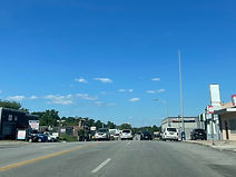
At Berger Avenue there is another hillcrest. (6-15-2024)

US 1 then meets another northeast Baltimore arterial, Hamilton Avenue. (6-15-2024)

A US 1 shield without directional banner is situated after Hamilton. (6-15-2024)

Making its way into the Cedmont neighborhood, the route intersects Parkmont Avenue. (6-15-2024)

The next signal is at Kenwood Avenue, which goes east into Baltimore County, to the Linhigh area of Overlea. (6-15-2024)

Fleetwood Avenue is US 1's final signal in Baltimore city. (6-15-2024)

At Maple Avenue (right) and Northern Parkway (left), US 1 leaves the city and enters Baltimore County. Northern Parkway is a well-known local arterial running east-west across the width of the city; its west end is at Liberty Heights Avenue in northwest Baltimore. (6-15-2024)

Entering Overlea, the route intersects the namesake Overlea Avenue. (6-15-2024)

After the Willow Avenue intersection, the route goes steeply downhill. (6-15-2024)

The next two signals are respectively at Taylor and Fullerton avenues. Taylor Avenue acts as a link between Overlea and the south side of Towson, via Parkville. (6-15-2024)

The Taylor Avenue light is seen here. (6-15-2024)

This is followed by US 1 reassurance. Now out of Baltimore city limits, the State Highway Administration is responsible for maintaining US 1 at this point. (6-15-2024)

Thorncliff Lane, at right, leads to a section of Linhigh Avenue. (6-15-2024)

US 1 intersects Fowler Avenue as it approaches its interchange with Interstate 695. (6-15-2024)

The final intersection prior to I-695 is Overton Avenue. (6-15-2024)

I-695 (Baltimore Beltway) has control cities of Towson and Essex at this interchange. In the absence of a Patapsco River crossing, it has termini at Sparrows Point, clockwise from here, and Hawkins Point counterclockwise. (6-15-2024)

US 1 crosses over the Beltway here. (6-15-2024)

The cloverleaf ramp to the outer loop toward Towson then branches off. (6-15-2024)

The first intersection after I-695 is Lincoln Avenue. (6-15-2024)

Traffic from the outer loop of 695 comes in at right along with US 1 reassurance. (6-15-2024)

Now in Fullerton, US 1 approaches Rossville Boulevard. There is a notation indicating its access to Franklin Square Hospital. (6-15-2024)

Going uphill, the route then nears Putty Hill Avenue (left) and Ridge Road (right). (6-15-2024)

Intersected here is a disjoint section of Putty Hill that stops at Walther Boulevard just to the west. It then picks up where Rossville Boulevard leaves off and runs through Parkville and Towson. (6-15-2024)
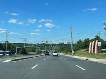
The route then goes downhill at 40 miles per hour. (6-15-2024)

Then, it crosses over Maryland Route 43 (White Marsh Boulevard) before meeting Wholesale Club Drive at a traffic signal. (6-15-2024)

A ramp to westbound MD 43 leading to the outer loop of I-695 sits ahead. (6-15-2024)

Opposite the MD 43 ramp, US 1 intersects Dunfield Road, a connector to Walther Boulevard. (6-15-2024)

After that, the highway intersects Klosterman Avenue. (6-15-2024)

US 1 goes downhill again and nears Olde Forge Lane. (6-15-2024)

Approaching Necker Avenue, US 1 enters Perry Hall. (6-15-2024)

As it starts to go back uphill, the route has a signal at Slater Avenue. (6-15-2024)

Silver Spring Road is intersected at the subsequent signal. (6-15-2024)

Beginning just to the northwest at Joppa Road, Silver Spring Road is a residential arterial that has access to the White Marsh Mall via Perry Hall and Honeygo boulevards. It dead-ends just west of I-95, then resumes east of the Interstate and runs to Maryland Route 7 (Philadelphia Road). (6-15-2024)

There is US 1 reassurance following Silver Spring. (6-15-2024)
There is US 1 reassurance following Silver Spring. (5-18-2026)

Easing downward, the route intersects Raab Avenue. (5-18-2026)
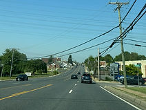
The following intersection is Blakely Avenue. (5-18-2026)

At a hillcrest soon afterward sits a traffic signal at the entrance to the Perry Hall Centre. (5-18-2026)

The next light is at Ebenezer Road (right) and the western segment of Joppa Road (left), which leads to Parkville and Towson. (5-18-2026)

Intersected opposite the eastern leg of Joppa Road is India Avenue. From here, Joppa Road goes through far-eastern Perry Hall, skirts White Marsh to the north and ends at MD 7. (5-18-2026)

Continuing northeast through Perry Hall (technically a part of Nottingham at this point), US 1 intersects the residential streets Farmside Drive (left, leading into Cedarside Farm) and Soth Avenue (right). (5-18-2026)

This overhead signal warns of the approaching Perry Hall fire station, officially Baltimore County's Station 55. Unlike surrounding counties like Carroll and Harford, Baltimore County has a paid countywide system of fire departments rather than volunteers. (5-18-2026)

The next street intersected is Halbert Avenue. (5-18-2026)
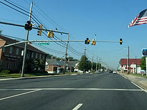
Subsequently, a traffic signal appears at Klausmier Road near the auto shop of the Klausmeier family, members of whom include Baltimore County Executive Kathy Klausmeier, and former NASCAR crew chief Johnny. (5-18-2026)
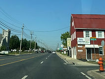
Horn Avenue is intersected next on the right. (5-18-2026)

Baker Lane (left) and Chapel Road (right) are met at the next traffic signal. (5-18-2026)
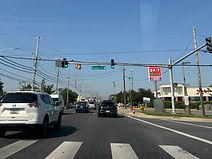
Chapel Road leads from here southeast back to Joppa Road. (5-18-2026)

More US 1 reassurance sits at a traffic signal at the Perry Hall Marketplace. (5-18-2026)

A disjoint western section of Forge Road is intersected soon afterward. (5-18-2026)

US 1 then makes its way downhill toward the northern end of Honeygo Boulevard. (5-18-2026)

Honeygo Boulevard is one of the main roads in the area of the White Marsh Mall and Avenue to the south, forming the south and east legs of a loop around the mall from Perry Hall Boulevard to a signal at MD 43. It was extended northward from Ebenezer Road in phases and reached US 1 in 2010, allowing mall-bound traffic to bypass US 1 and Silver Spring Road through Perry Hall. (5-18-2026)

At its intersection with Perry Hall Road beside the entrance to the Gunpowder Overlook development, US 1 departs Perry Hall into a heavily wooded area. (5-18-2026)

Now devoid of commercial and residential development, US 1 approaches Miller Road. (5-18-2026)

A few dozen feet ahead, the route becomes a full-fledged divided highway with a grassy median lined with curbs. (5-18-2026)

The bridge ahead is dedicated to Harry Dorsey Gough, founder of Perry Hall. (5-18-2026)

The highway is making its way into the Central Area of Gunpowder Falls State Park, and will cross the Big Gunpowder Trail. (5-18-2026)

US 1 now crosses the Big Gunpowder Falls. (5-18-2026)

Now back to an undivided highway, US 1 prepares to intersect Sheradale Drive. (5-18-2026)

The route goes slightly uphill as it approaches a traffic signal at Mount Vista Road. (5-18-2026)

Mt. Vista goes north to a roundabout at Harford Road (MD 147) where it becomes Glen Arm Road, and south to Raphel Road. (5-18-2026)

US 1 reassurance follows Mt. Vista. (5-18-2026)

Cheryl Avenue is intersected ahead on the left. (5-18-2026)

To the left, Longfield Drive leads into the subdivision of Longfield Estates. (5-18-2026)

Making its way into the center of Kingsville, US 1 will curve slight left and intersects Jerusalem Road on the right. (5-18-2026)

Jerusalem Road is the way to get to Sunshine Avenue or Bradshaw Road from US 1 north. (5-18-2026)

Jerusalem Road itself goes eastward past some of Kingsville's residential subdivisions and over the Little Gunpowder Falls into Harford County, where it crosses a Gunpowder Falls State Park trail and passes the historic Jerusalem Mill and through its surrounding village. (5-18-2026)

US 1 directly intersects Sunshine and Bradshaw, but only southbound traffic has direct access to either. Sunshine Avenue goes northwest from here to the community of Fork, where it becomes Fork Road at MD 147. (5-18-2026)

Leaving Kingsville, the route has a short hillcrest, dips downhill, then back up. (5-18-2026)

The speed limit goes from 40 back up to 50 at this point. (5-18-2026)

Overhead flashers precede US 1's intersection with New Cut Road. (5-18-2026)

The highway starts descending into the Gunpowder valley as it passes by New Cut. (5-18-2026)

There is a wide curve to the right as the route continues downhill. (5-18-2026)

Up ahead, US 1 meets the Little Gunpowder Trail. (5-18-2026)

At the bottom of the hill, US 1 crosses the Little Gunpowder Falls into Harford County. (5-18-2026)

A closer look at the Little Gunpowder bridge. (5-18-2026)

Making its way uphill, US 1 prepares to meet Reckord Road at a crossroads. (5-18-2026)

The Reckord Road signal is in the process of being upgraded from flashers to a full signal with full red light phases along both roadways. (5-18-2026)
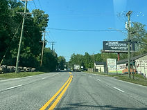
The next turn is Wilgis Road on the right. (5-18-2026)

As it goes uphill, US 1 nears a junction with Maryland Route 152. (5-18-2026)

MD 152 leads north toward the Ladew Topiary Gardens in Monkton, and south toward the Jerusalem area of Gunpowder Falls State Park. (7-15-2026)

MD 152, known at this particular spot as Mountain Road, stretches 17 miles southeast-to-northwest from Aberdeen Proving Ground's Edgewood Arsenal just south of Magnolia and Joppa to MD 146 near the Madonna area west of Jarrettsville. The route passes through the center of Fallston in the process. (7-15-2026)

After MD 152 comes time for US 1 reassurance. (5-18-2026)

At Milton Avenue, an intersection augmented by flashers, a sign bearing "Hospital" has a straight-pointing arrow reflecting the direction in which Bel Air's Upper Chesapeake Medical Center is located. A previous sign here had the arrow pointing left in the direction of the Fallston General Hospital, which Upper Chesapeake replaced. (5-18-2026)

Fallston Boulevard on the right leads to a Walmart and residential development. (5-18-2026)

The next signal is located at Connolly Road (left) which backtracks to downtown Fallston, and Whitaker Mill Road (right) which makes its way eastward to a bridge over Winters Run, where it becomes Ring Factory Road headed toward the south side of Bel Air. (5-18-2026)

Now in an area known as Benson, overhead flashers warn of a major junction ahead. (5-18-2026)

Said junction represent the northern terminus of MD 147 and the southern terminus of Bel Air's iteration of U.S. Route 1 Business, the only business route of US 1 in Maryland. (7-15-2026)

A shield on the right points in the direction of US 1 Business. (7-15-2026)
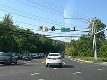
US 1 Business takes the name of Belair Road with it into downtown Bel Air, the seat of Harford County, and mainline US 1 becomes the Bel Air Bypass. (5-18-2026)

US 1 reassurance is at the south end of the bypass, which was built in the mid-1960s and re-routed mainline US 1 away from downtown Bel Air. (5-18-2026)
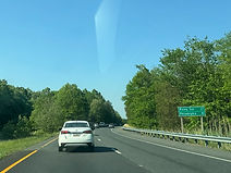
Rising Sun and Philadelphia are a respective 27 and 81 miles away. (5-18-2026)

Though US 1 is now a divided highway, this is soon to end as the right lane will end in half a mile. (5-18-2026)

All of the Bel Air Bypass is a mandatory headlight use area. (5-18-2026)

Along the Bypass are mile markers reflecting US 1's mileage within Harford County. (5-18-2026)

The highway's right lane will end momentarily. (5-18-2026)

In ¾ mile, there is an offramp to southbound Maryland Route 24, which leads to Interstate 95 as well as Bel Air and Edgewood. (5-18-2026)

The northbound carriageway curves left before the bypass consolidates into a two-way trafficway. (5-18-2026)

Afterward, the highway crosses Winters Run, one of the main tributaries of the Bush River to the south. (5-18-2026)

Interests to Rocks State Park and, via MD 924, the historic downtown of Bel Air are to continue straight past the forthcoming exit ramp. (5-18-2026)

The bypass goes uphill and crosses Tollgate Road just before the exit. (5-18-2026)

The ramp to southbound MD 24 is on the right and includes a notation for the Upper Chesapeake hospital. (7-15-2026)

The MD 24 exit gore sign. (5-18-2026)

The highway divides as it nears a traffic signal at one leg of MD 24. (5-18-2026)

This is where southbound MD 24 leaves southbound US 1 and where drivers coming from MD 24 north can get onto US 1 south, in a setup known as a seagull intersection. Right turns onto MD 24 south and from MD 24 north directly along US 1 north are technically not permitted here, though there is no signage explicity stating so. (5-18-2026)

The right northbound lane ends, a guardrail begins in the median, and a one-mile advance sign appears for the exit at which MD 24 north departs the bypass bound for Forest Hill. At the same interchange, one ramp beforehand, is an exit to southbound Maryland Route 924, the original alignment of MD 24 through downtown Bel Air. (5-18-2026)

The cross street at the next interchange is Rock Spring Road, becoming Rock Spring Avenue and subsequently Main Street to the south, and Rocks Road to the north. (7-15-2026)
_edited.jpg)
Traffic coming onto the bypass from MD 24 north enters by way of a long ramp seen to the right. (7-15-2026)
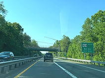
The ramp to MD 924 south is "next right". (5-18-2026)

In the meantime, the highway passes under Vale Road. (5-18-2026)
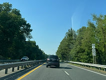
US 1 and MD 24 markers sit together at the next point of reassurance. (5-18-2026)

Rocks State Park in northern Harford County is 8 miles' drive to the north along MD 24 up ahead. (5-18-2026)

This overhead sign points toward the MD 924 offramp. (5-18-2026)

The MD 924 exit gore sign. To the left, southbound US 1 receives traffic from MD 24 south. (5-18-2026)

Northbound US 1 dwindles to one lane up ahead as it will become the exit ramp to northbound MD 24 and the Forest Hill area. (5-18-2026)

US 1's concrete bridge over Rock Spring Road was paved over with asphalt in 2022. Prior to 1987, when the current alignment of MD 24 west of Bel Air and Abingdon opened, MD 24 went straight through under US 1 at this interchange. (7-15-2026)

MD 24 exits US 1 along a cloverleaf ramp. (5-18-2026)

Now traveling solo again, US 1 is back down to one lane in each direction. On the left sits southbound US 1's offramp to MD 24 north and MD 924 south. (5-18-2026)

The route curves downhill and eases its way rightward before picking up an onramp from MD 24 south and MD 924 north. (5-18-2026)

A left turn movement ¼ mile away provides access from US 1 north to Maryland Route 23 (East-West Highway). (5-18-2026)

The connector to MD 23 is known as Water Tower Way. (5-18-2026)

Water Tower Way leads toward a Vehicle Emissions Inspection Program (VEIP) station. North of Granary Road, Water Tower Way was once part of MD 23 itself. (5-18-2026)

Mainline US 1 is now about to cross paths with its business route, now known as Conowingo Road. Before 2000, the Bel Air Bypass curved right at this spot before coming to an end at Conowingo Road. (7-15-2026)

Mainline US 1 goes north from here to Rising Sun, US 1 Bus. north to Hickory and south back into downtown Bel Air. (5-18-2026)

A shield to the left points toward northbound US 1 Bus. (5-18-2026)

It is here that mainline US 1 becomes the Hickory Bypass, an extension of the Bel Air Bypass that opened in 2000 and was built to relieve traffic congestion along Conowingo Road in Hickory. (5-18-2026)

A US 1 reassurance marker follows Conowingo Road. (5-18-2026)

US 1 will next intersect the eastern end of MD 23. (5-18-2026)

From here, westbound MD 23 goes about 8 miles to Jarrettsville. An MTA commuter lot is also located along it just to the west of this junction. (5-18-2026)

Before construction of the Hickory Bypass, MD 23 ran along Granary Road to an end at Conowingo Road to the west. (5-18-2026)

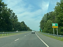
The next portion of the highway is a deer watch area as it runs through a heavily wooded area. (5-18-2026)
_edited.jpg)
The highway goes uphill as it nears its junction with Maryland Route 543 (Fountain Green Road). (5-18-2026)

MD 543 goes north to Ady in northern Harford County, and south to I-95 and the Fountain Green area east of Bel Air. (5-18-2026)

Route markers to the right point the way to each direction of MD 543. (5-18-2026)

A close-up of the MD 543 signal. (5-18-2026)

Following MD 543, US 1 goes uphill and prepares to consolidate back into a two-way trafficway. (5-18-2026)

The northbound right lane ends straight ahead. (5-18-2026)

The highway curves left approaching the end of the bypass. (5-18-2026)

Ahead, the northern terminus of US 1 Bus. is intersected. (5-18-2026)

Mainline US 1 inherits the Conowingo Road name at this point. (5-18-2026)
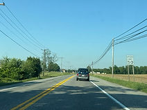
US 1 continues northeastward as a two-lane road with speed limit of 50 MPH. (5-18-2026)

Ruffs Mill Road is intersected ahead on the right. (5-18-2026)

Ruffs Mill links the US 1 corridor with Thomas Run Road to the southeast. (5-18-2026)

The next intersection is Waverly Drive. (5-18-2026)

Gibson Road, intersected ahead on the left, makes its way to MD 543 with a couple of tight curves in the process. (5-18-2026)

Subsequently, Robertson Road to the right leads into the subdivision of Gibson Manor. (5-18-2026)

After going slightly uphill, the route meets White House Road. (5-18-2026)

The highway continues straight ahead past houses and farm fields. (5-18-2026)

Forge Hill Road, a historic alignment of US 1 passing through Palmer State Park, is then intersected at a 45-degree angle, forming a fork in the road. (5-18-2026)

The highway plunges downhill into trees, preparing to intersect Kalmia Road. (5-18-2026)
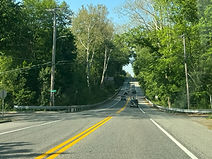
Kalmia Road heads west to Sandy Hook Road, where it becomes Walters Mill Road and begins to parallel Deer Creek, and east to Thomas Run Road. (5-18-2026)

US 1 then heads back uphill and encounters a very small break in the trees. (5-18-2026)

Next is a crossroads at Allibone Road, which backtracks to Kalmia Road (left) or Forge Hill (right). (5-18-2026)

Going back downhill, US 1 curves widely to the right. (5-18-2026)

The route goes on over Deer Creek, a tributary of the Susquehanna River that forms an agricultural watershed within Harford County. (5-18-2026)

As it goes back uphill, US 1 comes upon Sandy Hook Road (left) and Trappe Road (right). (5-18-2026)

Sandy Hook Road loops back southward along Deer Creek toward Gibson Road, while Trappe Road is a shortcut to MD 136 to the east. (5-18-2026)
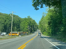
Yet again, US 1 dips downward after the previous intersection. (5-18-2026)

Finally emerging from the trees, US 1 meets the other end of Forge Hill. (5-18-2026)

Just past the top of the hill, US 1 intersects Queens Castle Court. (5-18-2026)

Next up is a junction with Maryland Route 136 (Priestford Road). (5-18-2026)

From this intersection, MD 136 goes north to Dublin and Whiteford, and south to Churchville and Creswell. (5-18-2026)

The route curves slightly after MD 136, then prepares to intersect Arena Road. (8-14-2023)

As the route then dips downward into some trees, the speed limit is still 50. (8-14-2023)

US 1 now approaches a crossroads with Poole Road, one of the residential roads in the Dublin area. (8-14-2023)

Poole Road goes northwest back to MD 136, and southeast to Trappe Church Road. (8-14-2023)

The route then reaches the other end of Arena Road. (8-14-2023)

US 1's next intersection is with Hughes Road. (8-14-2023)

A wide curve to the right follows. (8-14-2023)

The highway then passes the Emma Rockey Park at left, and the Darlington Meadows mobile home park to the right. (8-14-2023)

US 1 now approaches the eastern terminus of Maryland Route 440 (Dublin Road). (8-14-2023)

Drivers have to deal with another curve prior to reaching MD 440. (8-14-2023)

From here, MD 440 backtracks west to Dublin proper, where it meets MD 136, and out to MD 543 in the Ady area. (8-14-2023)

The intersection is located near the end of the curve. (8-14-2023)
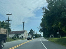
Subsequently, US 1 straightens out and passes a defunct State Highway Administration building at left. (8-14-2023)

The highway curves slightly again, then prepares to intersects Cedar Church Road. (8-14-2023)

It then comes up on Smith Road, which leads northward to the Glen Cove Marina. (8-14-2023)
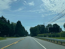
A ground-level variable message sign is then located at right. (8-14-2023)

The next road intersected is Berkley Road, which follows the same path as Smith Road to Glen Cove. (8-14-2023)

This is followed by another curve to the right, this one wider than the previous. (8-14-2023)

The highway eases downward as a green sign to the right announces an approaching weigh station, which was closed when these photos were taken. (8-14-2023)

US 1 now approaches a junction with Maryland Route 161 (Darlington Road). (8-14-2023)

As US 1 curves to the left, there is a "TO MD 161" marker, although MD 161 officially begins here. It runs southward through Darlington and out to Maryland Route 155 in the Level area northwest of Havre de Grace, in the process crossing Deer Creek and running just west of Susquehanna State Park. (8-14-2023)

Contradicting the previous sign, the next sign for the weigh station states it is open. (8-14-2023)

US 1 is now approaching a traffic signal at Maryland Route 623 (Castleton Road). (8-14-2023)

As they were at MD 161, Susquehanna State Park and Havre de Grace's historic district are both at right up ahead. (8-14-2023)

Despite mostly running north-south in its 7 miles and change, MD 623 is signed east-west. At right, it goes a short distance to an end at MD 161, while in the other direction, it runs parallel to the Susquehanna into Peach Bottom Township, York County in Pennsylvania as Flintville Road. (8-14-2023)

A US 1 reassurance shield follows the MD 623 signal, which is the final one in Harford County. (8-14-2023)
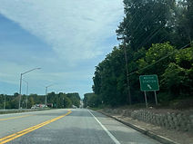
The weigh station is ahead at left. (8-14-2023)
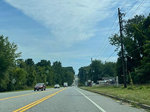
US 1 will now dip sharply downward, then back uphill as it makes its approach to the Conowingo Dam. (8-14-2023)

The hillcrest can be seen feet ahead. (8-14-2023)
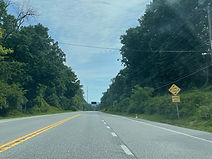
The right lane that formed for slow traffic along the hill ends ahead. However, the highway will have to navigate another hill before it reaches the dam. (8-14-2023)

An overhead VMS sits above the highway prior to its next descent. (8-14-2023)
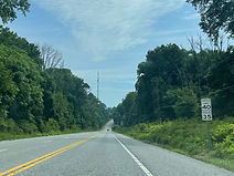
The speed limit through the area is 40 miles per hour, with a 35 MPH limits for trucks. (8-14-2023)

As US 1 goes downhill again, interests to historic areas of Port Deposit in Cecil County are instructed to turn right (south) onto Maryland Route 222 on the other side of the dam. (8-14-2023)

Shuresville Road is the final road intersected in Harford County. It goes back around to Darlington, while also accessing via Shures Landing Road the Conowingo Fisherman's Park, a popular regional sighting spot for bald eagles. (8-14-2023)

Because large trucks are prohibited through Port Deposit, a truck route involving Maryland Route 276 (as well as Maryland Route 275) to the east exists for such traffic bound for the corridors of Interstate 95 or U.S. Route 40. Previously marked as MD 222 Truck, it no longer bears a formal state highway designation and there are instead simple "TO 95/40" shields. (8-14-2023)

At the second hillcrest, there is a sign with flashers warning of the potential for ice on the roadway, especially in the winter months. (8-14-2023)

There is a pedestrian crossing and a sharp curve to the left right before the dam begins. (8-14-2023)

The curve and river valley are seen here. (8-14-2023)

The Conowingo Dam runs across the Susquehanna River between Harford and Cecil counties, and US 1 uses it to cross between them. The dam also incorporates a hydroelectric power plant on the Harford side (seen here), offices for which are accessed from the Fisherman's Park down below. It is the Susquehanna's third-southernmost road crossing and fifth-southernmost overall, when accounting for two train bridges between Havre de Grace and Perryville downstream. (8-14-2023)

The highway gets past the power plant, and there is now a view of the river looking south (right). The I-95 (Tydings) bridge can be seen from here on good-weather days. (8-14-2023)

Nearing the northeast (Cecil) end of the dam, there is another 30 MPH curve to the left. (8-14-2023)

At the end of the dam, US 1 intersects MD 222. For a number of years up until 1995, much of MD 222 was a southern extension of U.S. Route 222 from Conowingo; it was downgraded due to the tight path of the corridor through Port Deposit and a steep hill exiting the town southbound. (8-14-2023)

After MD 222, the route crosses over a Norfolk Southern right of-way that runs along the east bank of the Susquehanna. (8-14-2023)

US 1 now climbs uphill once more as it pulls away from the dam and river. (8-14-2023)

Along the hill sits a Cecil County welcome sign. This is the final county in Maryland going north on US 1 before it reaches Pennsylvania. (8-14-2023)

The right lane will end momentarily. (8-14-2023)

For now, the speed limit remains 40 miles per hour. (8-14-2023)

The right lane ends at the crest of the hill, near the Susquehanna Inn, and US 1 becomes a proper two-lane road again. (8-14-2023)

Entering Conowingo, the route intersects Barrett Road. (8-14-2023)

US 1 is preparing to meet US 222 at the center of Conowingo, and the sign at right points interests to Rising Sun straight, and to Lancaster, Pennsylvania left (north) on US 222. (8-14-2023)

This route marker points the way to US 222 north. It runs 95 miles from here to Allentown, Pennsylvania at Interstate 78, where it becomes Pennsylvania Route 222. Meanwhile, at right is county-maintained Rowlandsville Road. (8-14-2023)

Just past US 222, there is a US 1 reassurance shield as well as the first of the above-mentioned "TO 95/40" markers for trucks. (8-14-2023)

The speed limit now goes up to 50 miles per hour. (8-14-2023)
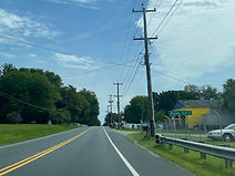
From here, Rising Sun is 5 miles to the east. (8-14-2023)

The route proceeds slightly downward, surrounded by a cluster of trees. (8-14-2023)

The highway then levels out and approaches Merry Knoll Lane. (8-14-2023)

Weight restrictions for a bridge on Merry Knoll are posted here. (8-14-2023)

The highway goes uphill again and nears an intersection with Connelly Road. (8-14-2023)

Connelly Road, at left, leads to New Bridge Road, which reconnects with US 222, then becomes Old Mill Road and ends up in Fulton Township, Lancaster County, Pennsylvania. At right, proceeding parallel to US 1, is a disjoint segment of Colora Road, which is marked as a section of Maryland Route 591, severed in two by the removal of its bridge over the Octoraro Creek; the two combined segments of MD 591 plus the bridge were an old alignment of US 1 beforehand. (8-14-2023)

Another "TO 95/40" shield assembly follows. (8-14-2023)

Reaching the top of another hill and briefly poking out of the trees, US 1 then goes downward again. (8-14-2023)

US 1 now crosses the Octoraro Creek. (8-14-2023)

Again, the route climbs upward out of the creek valley, curving gradually to the right in the process. (8-14-2023)

Nearing the top of the hill, the speed limit prepares to drop back down to 40. (8-14-2023)

At a pair of forks in the road, as it prepares to straighten out northbound, US 1 intersects Porters Bridge Road, the eastern segment of MD 591, followed by Love Run Road, seen at right here. (8-14-2023)

US 1 is now running due east, although its posted cardinal directions are still north-south. (8-14-2023)

The Plumpton Park Zoo just outside of Rising Sun is eastbound on Maryland Route 273 up ahead. (8-14-2023)

The highway then approaches Horse Shoe Road, which indirectly leads to the presumed namesake Horseshoe Scout Reservation straddling the line between Cecil County and Chester County, Pennsylvania; the state line runs straight through one of its campsites. (8-14-2023)

Nearing a gradual curve to the left, US 1 passes a row of lookalike houses at right. (8-14-2023)

US 1 is nearing the MD 273 split, where 95/40-bound truck traffic is directed to remain on US 1 for a little longer. (8-14-2023)

"US 1" is marked here on a directional sign bearing left along with Oxford, Pennsylvania. (8-14-2023)

Shields for US 1 north, TO I-95, and MD 273 east sit in the fork between the two routes. Known first as Rising Sun Road, then Main Street and finally Telegraph Road, MD 273 runs 16 and a half miles through Rising Sun and the Fair Hill area before crossing into Delaware and becoming Delaware Route 273 just west of Newark. (8-14-2023)

Traffic coming from MD 273 west enters US 1 at this separate intersection just further ahead. (8-14-2023)

Now with controlled access, US 1 assumes the name of the Rising Sun Bypass. (8-14-2023)

The speed limit is back to 50 miles per hour. (8-14-2023)
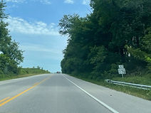
Passing north of Rising Sun, US 1 nears Maryland Route 276. (8-14-2023)

"Pennsylvania" is marked continuing straight on US 1, while Rising Sun is marked for MD 276 south. At left, continuing from where MD 276 ends, is Slicers Mill Road. (8-14-2023)

The MD 276 junction has a set of flashers hanging above it. Named the Jacob Tome Memorial Highway, MD 276 meets MD 273 at a roundabout just south of here, then goes through a section of Colora, before turning west and descending into Port Deposit to its other end at MD 222. This is also where the Port Deposit truck bypass parts ways with US 1. (8-14-2023)

A US 1 reassurance shield follows MD 276. (8-14-2023)

The Pennsylvania line is 4 miles away, Nottingham 5, and Philadelphia 56. (8-14-2023)
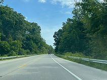
The route goes on through a grove of trees. (8-14-2023)

A traffic signal up ahead is situated at Red Pump Road (left) and Mount Street (right). (8-14-2023)

Mount Street goes south from here a short distance into downtown Rising Sun. (8-14-2023)

The signal is followed by the last northbound US 1 reassurance shield in Maryland. (8-14-2023)

The highway dips downward into more trees. (8-14-2023)

Up ahead, the route intersects Stevens Road. (8-14-2023)

The next intersection is at Little New York Road. (8-14-2023)

Finally, as it curves to the left, the highway comes up on Greenmount Road. (8-14-2023)

Greenmount Road leads to a couple of local businesses in each direction. (8-14-2023)

The state line is visible in the distance. (8-14-2023)

US 1 now bids farewell to Maryland and crosses the Mason-Dixon Line into West Nottingham Township, Chester County, Pennsylvania. Just ahead, it becomes a four-lane divided highway named the Kennett Oxford Bypass, with nine freeway interchanges over 21 miles. (8-14-2023)