
The epzik8 Webpage
U.S. Route 1 Business (Bel Air) north

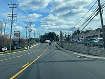
In the Benson area of Harford County, southwest of Bel Air, Maryland, the mainline of U.S. Route 1 intersects the north end of Maryland Route 147 (Harford Road) and the south end of Bel Air's iteration of U.S. Route 1 Business. The latter assumes the name of Belair Road from mainline US 1, while mainline US 1 becomes the limited-access, 1960s-built Bel Air Bypass, passing west of Bel Air proper. Photo taken 03-18-2024.

Per Maryland protocol, most US 1 Business reassurance shields are varying combinations of green and white. Photo taken 03-18-2024.

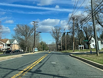
The current speed limit is 45 miles per hour; meanwhile, the right travel lane ends ahead. Photo taken 03-18-2024.

The route is now three lanes wide including a center left-turn lane. Photo taken 03-18-2024.
Going moderately uphill, US 1 Bus. nears a traffic light (formerly a three-way flasher) at Old Joppa Road. Photo taken 03-18-2024.

Old Joppa Road, at right, runs several miles southward to Maryland Route 7 (Philadelphia Road) at the namesake community of Joppa. At left, Old Joppa Court leads into the Park at Winters Run apartment complex; this leg of the intersection was added in 2016, when construction of the apartments began. Photo taken 03-18-2024.

Past Old Joppa Road, the route curves left, then wide right. Photo taken 03-18-2024.

At right is Country Life Farm, a thoroughbred horse breeding ground representative of Maryland's role in the horse industry. Farm founder Adolphe Pons oversaw the 1918 sale of the famed Man o' War, grandsire of Seabiscuit, from August Belmont Jr. to Samuel Riddle. Among those foaled at Country Life itself were two-time American Horse of the Year Cigar, as well as Malibu Moon, sire of 2013 Kentucky Derby winner Orb. Photo taken 03-18-2024.

At the end of the curve, the route dips downward, its speed limit still 45. Photo taken 03-18-2024.

The highway now crosses Winters Run. It has sources in the form of separate east and west branches in the Jarrettsville area. Several miles south of here, to the east of Edgewood, it becomes Otter Point Creek, which turns tidal and empties into the Bush River. In the interim, it temporarily becomes the Atkisson Reservoir on the western fringes of Abingdon. At this crossing, Winters Run is not marked northbound, but is southbound. Photo taken 03-18-2024.

Going sharply uphill as it emerges from the Winters Run valley, US 1 Bus. prepares to separately intersect Hillendale Road (left) and Lake Fanny Road (right). Photo taken 03-18-2024.

Located along Lake Fanny Road is what was mainline US 1's original crossing of Winters Run, which was later bypassed by the crossing shown above. US 1's current mainline crossing, its third, is half a mile upstream. Photo taken 03-18-2024.

Intersected next are Broadview Avenue (left) and Locust Lane (right). Both Hillendale and Broadview lead into the Bel Air Acres development. Photo taken 03-18-2024.

Still going uphill, the route is about to curve to the left. Photo taken 03-18-2024.

At right near the top of the hill sits US 1 Business reassurance. Photo taken 03-18-2024.

Auction Way, ahead at right, accesses the original site of the Bel Air Auto Auction, now located in the Belcamp-Riverside area to the south. Photo taken 03-18-2024.

The crest of the hill is now in plain sight. Photo taken 03-18-2024.

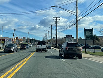
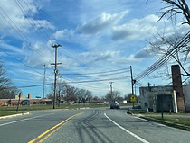
Going slightly downward, the route enters a commercial strip of increasing density. Photo taken 03-18-2024.

The speed limit decreases to 35, a second lane begins at right, and a traffic signal at Tollgate Road is approaching. Photo taken 03-18-2024.
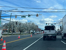
Tollgate Road is a westbound local arterial connecting several neighborhoods on the west sides of Bel Air and Abingdon, running parallel to MD 24. This status was made possible in 2016, when the segment between Plumtree Road and Bel Air South Parkway opened. In this picture, part of the Harford Mall is seen to the left. Photo taken 03-18-2024.

Now known as Baltimore Pike, US 1 Bus. continues alongside the mall and also passes the Tollgate Marketplace seen at right. Photo taken 03-18-2024.

The route is coming up on Maryland Route 24. Photo taken 03-18-2024.

At the signal ahead, MD 24 north (left) leads to US 1, and MD 24 south (right) to Interstate 95 and the Upper Chesapeake Medical Center ("Hospital"). Photo taken 03-18-2024.

Beyond MD 24, US 1 Bus. goes straight into downtown Bel Air. Photo taken 03-18-2024.

This segment of MD 24 (Vietnam Veterans Memorial Highway) opened in 1987, linking US 1 with I-95 and superseding that running through Bel Air proper that is now designated as MD 924. Shopping centers (including the mall and Marketplace) dot all four corners of this intersection (said to be the busiest light in Harford County), although the Bel Air Town Center at left was only made possible by the death of the original property owner, who used it to graze the locally famous Betsy the cow. Photo taken 03-18-2024.

A reassurance shield follows the MD 24 light. Photo taken 03-18-2024.

There is then a light at the entrances to the Bel Air Town Center and Plaza. A second Bel Air Plaza light sits ahead. Photo taken 03-18-2024.

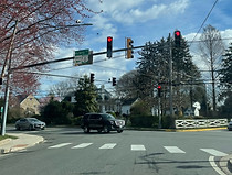
The next signal is at Atwood Road. At left, Atwood goes into the 1950s Howard Park subdivision, while at right it goes out to West MacPhail Road. Photo taken 03-18-2024.
Going into downtown Bel Air, there is a sign at right listing and pointing toward some of the town's historic landmarks. Photo taken 03-18-2024.

The speed limit now lowers to 30 miles per hour. Photo taken 03-18-2024.

At left, Hays Street - here one-way southbound and a continuation of one-way westbound Churchville Road - merges into Baltimore Pike. The latter will remain two-way for just over a block. Photo taken 03-18-2024.

The route now reaches one-way southbound Kenmore Avenue - a continuation of Bond Street, serving as part of southbound Maryland Route 924. Here, northbound US 1 Bus. becomes known as Fulford Avenue and becomes one-way northbound. Also located here is the first of two black-and-white shields of this iteration of US 1 Bus. Photo taken 03-18-2024.

Then, an overhead sign points toward northbound MD 924 (and US 1 Bus.), as well as eastbound Maryland Route 22 A grounded sign at left, meanwhile, displays pointers to various Bel Air town landmarks and Harford County government offices. Photo taken 03-18-2024.

A shield at right points to MD 924 north and one-way northbound Main Street. Photo taken 03-18-2024.

At the Main Street light itself sits a northbound US 1 Bus. marker. On the other side of the signal, eastbound MD 22 begins, continuing east as Fulford Avenue for several more blocks; then, both directions of MD 22 leave Bel Air together as Churchville Road, passing through the same-name community of Churchville, then reaching Aberdeen, where the route intersects I-95 and eventually ends at an Aberdeen Proving Ground gate. MD 22 lasts just over 12 miles in total. Photo taken 03-18-2024.

Now headed north on Main Street, there is immediate access back the other way onto southbound US 1 Bus. via a left turn. At right is the endpoint of the westbound lanes of MD 22. Photo taken 03-18-2024.

As both Churchville and Main are one-way at this signal, there are no right turns permitted in this direction, nor any left turns going west. Photo taken 03-18-2024.

Past that light, following the US 1 Bus. shields, there is reassurance for MD 924 north. This segment of Main Street represents the northbound component of the original US 1/MD 24 duplex, which is now on the Bel Air Bypass to the west. Photo taken 03-18-2024.

Main Street now reaches Courtland Street and the Harford County Sheriff's Department. Courtland Street continues to the right, becoming Courtland Place and passing through a subdivision east of downtown. Photo taken 03-18-2024.

As its two lanes briefly split apart, Main Street intersects Office Street at left. Off-picture to the right is the Bel Air parking garage. Photo taken 03-18-2024.

At Pennsylvania Avenue, Main Street's address numbers reach 0 and start counting back up. Here, Pennsylvania Avenue is honorifically marked Kimmie Way in reference to town figure skater Kimmie Meissner. Photo taken 03-18-2024.

The street proceeds downhill, passes the Bel Air Armory at right, and prepares to curve to the left. Photo taken 03-18-2024.

Lee Street, intersected here, goes eastward past the St. Margaret's Catholic church to Hickory Avenue, then becomes Lee Way and reconnects with MD 22 in the area of Rockfield Park. Photo taken 03-18-2024.

Now going back uphill, the Historical Society of Harford County is at right, while up ahead, the second of two left turns leads to the Liriodendron mansion and a Ma and Pa Trail access point. Photo taken 03-18-2024.

The first left turn allows drivers to make an effective U-turn onto Bond Street, taking them back onto US 1 Bus./MD 924 south, while the second left accesses Gordon Street. Photo taken 03-18-2024.

Gordon Street is seen here along with a pedestrian crosswalk. Photo taken 03-18-2024.

Northbound US 1 Bus. now turns right onto Broadway, leaving MD 924 to travel north out of Bel Air by itself as Rock Spring Avenue. MD 924 goes on to its north end at an interchange with the US 1 bypass, where it becomes the northern segment of MD 24. Meanwhile, Broadway in the opposite direction leads straight into the Liriodendron. Photo taken 03-18-2024.

Still marked north-south, US 1 Bus. is now situated east-west along Broadway. Photo taken 03-18-2024.

The route reaches Franklin Street which, at right, leads back to Gordon Street. Photo taken 03-18-2024.

The speed limit along here is just 25 miles per hour. Photo taken 03-18-2024.

At left sits an intersection with Choice Street. Photo taken 03-18-2024.

Broadway is nearing a traffic signal at Hickory Avenue, onto which US 1 Bus. will make a left turn. Photo taken 03-18-2024.
From Hickory Avenue, Broadway continues east through some of Bel Air's northern residential areas, eventually reaching Moores Mill Road adjacent to Southampton Middle School. Photo taken 03-18-2024.

The ensuing reassurance shield is white-on-green. Photo taken 03-18-2024.

The speed limit is now 30 miles per hour. Photo taken 03-18-2024.
The route now intersects Crocker Drive (left) and Crocker Street (right). Photo taken 03-18-2024.

Easing downward, the route meets Kings Crossing Drive. Photo taken 03-18-2024.

A signal at Moores Mill Road is forthcoming. Photo taken 03-18-2024.

Moores Mill Road runs along the northern boundary of Bel Air's corporate limits, from MD 924 (picking up where Vale Road leaves off) to MD 22 at the Greenbrier Shopping Center. Numerous residential subdivisions are located along its path. Photo taken 03-18-2024.

Now out of Bel Air proper, US 1 Bus. becomes known as Conowingo Road and has an unmarked crossing of Bynum Run. Photo taken 03-18-2024.

The speed limit has increased to 40. Photo taken 03-18-2024.

Irwin Road is intersected at right as the highway goes uphill. Photo taken 03-18-2024.

Intersected shortly thereafter at a crossroads, Henderson Road goes east (right) to Maryland Route 543 at C. Milton Wright High School, and west (left) through multiple newer area subdivisions. An extension of North Avenue gives Henderson Road direct access to MD 924. Photo taken 03-18-2024.

When the hill crests, the route begins curving to the right. Photo taken 03-18-2024.

A pair of sharper curves sits ahead, after the route intersects Irwin Way at left. Photo taken 03-18-2024.

Intersected amid these curves are Spalding Drive (left) and Loring Avenue (right). Photo taken 03-18-2024.

Spalding Drive, at the top of another hill, leads into a condominium complex, Village Green, which has a pedestrian connection to Deer Run off Henderson Road. Photo taken 03-18-2024.

Loring Avenue, intersected mid-hill, serves the Pelhamwood development. Photo taken 03-18-2024.

Hartley Way, intersected ahead at left at a dip in the route, serves the Kelly Glen development and connects with the latest extension of Henderson Road. Photo taken 03-18-2024.

As it starts back uphill, the highway's 40 MPH speed limit is unchanged. Photo taken 03-18-2024.

The route's center left-turn lane ends with the ascent in progress. Photo taken 03-18-2024.

Near the top of the hill, the Bel Air-area branch of the Motor Vehicle Administration's Vehicle Emissions Inspection Program (VEIP) is marked as being straight ahead. Photo taken 03-18-2024.

The highway levels out at the top of the hill and intersects Hickory Overlook Drive, an access road into the eponymous housing development. Photo taken 03-18-2024.

Overlook Way, intersected next, serves Hickory Overlook's northern phase. Photo taken 03-18-2024.

US 1 Bus. now comes up on a junction with mainline US 1, by now dubbed the Hickory Bypass. Photo taken 03-18-2024.

Around this point is where US 1 Bus. had its original northern terminus, from 1965 to 2000, as the US 1 bypass went no further than here. Meanwhile, at right just off-picture is the former site of the Bel Air Roller Rink, a beloved area landmark from the 1950s to the early 2000s that had a particular reputation as a teen hangout spot in its early decades. After the rink closed in 2006, the building remained up and was redeveloped as a strip shopping center. Photo taken 03-18-2024.

US 1 Bus. intersects its mainline at a perpendicular angle at the latter's Harford County mile marker 7. The other of the business route's two black-and-white shields is at this intersection. Cut off from the picture to the left, Bynum Road, which used to reach Conowingo Road, leads into a McDonald's parking lot, part of the Hickory Station retail area. Photo taken 03-18-2024.

To the left beyond the bypass signal is the Conowingo Road entrance of Hickory Station, which also has a side entrance from Granary Road ahead. Photo taken 03-18-2024.

Granary Road itself leads to the VEIP via a roundabout at Water Tower Way and a right turn onto Robin Circle. Photo taken 03-18-2024.

Another white-on-green US 1 Bus. shield sits at right. Additionally, there is no direct access from Granary Road to the Wawa at right, whose Conowingo Road entrance is a right-in/right-out. Photo taken 03-18-2024.

The next signal is at Maryland Route 23 (East-West Highway). Photo taken 03-18-2024.

From here, MD 23 goes west to Jarrettsville, about eight miles' drive away, and east to a park-and-ride at which MTA commuter buses to Baltimore stop. Photo taken 03-18-2024.

Shields for each direction of MD 23 are at right. This segment of MD 23 is an eastward realignment and extension of the route that was constructed in tandem with the Hickory Bypass in 2000. Portions of Water Tower Way and Granary Road represent MD 23's original path in the area. Photo taken 03-18-2024.

MD 23's current eastern terminus at mainline US 1 is two-tenths of a mile east of this signal. Overall, MD 23 covers just over 20 miles through portions of Forest Hill and Jarrettsville, shifting from west to north, and ending at the Pennsylvania state line northwest of Norrisville where it transitions into Pennsylvania Route 24. Photo taken 03-18-2024.

US 1 Bus. next intersects Jarrettsville Road, the original Hickory-to-Jarrettsville alignment of MD 23. Photo taken 03-18-2024.

Jarrettsville Road, officially East Jarrettsville Road here for mailing address purposes, passes by several housing developments and the Forest Hill Industrial Airpark, then meets MD 24 at the center of Forest Hill, where it becomes West Jarrettsville Road and continues to parallel modern MD 23 to Jarrettsville proper. Photo taken 03-18-2024.

US 1 Bus. then curves to the right and passes by several older-styled houses. Photo taken 03-18-2024.

The route intersects Evergreen Drive as it nears another rightward curve. Photo taken 03-18-2024.
Mid-curve, the route intersects Johnson Mill Road, which runs northwest through lighter residential development to Chestnut Hill Road on the north side of Forest Hill. Photo taken 03-18-2024.

Going almost due east, US 1 Bus. approaches the historic center of Hickory and passes Hickory Elementary School on the left. Photo taken 03-18-2024.

As the highway approaches its final major junction at Maryland Route 543, there is a set of flashers ahead over the entrance to the Hickory Village Center. Photo taken 03-18-2024.

MD 543 (Ady Road north/Fountain Green Road south) runs 20 miles from U.S. Route 40 in Belcamp to Maryland Route 165 in Pylesville in the North Harford region, running east of Bel Air in the process. Photo taken 03-18-2024.

The final northbound US 1 Bus. reassurance shield is just after the signal. Photo taken 03-18-2024.

Dipping downward and with fresh pavement, the highway's speed limit remains at 40, and an old sign displays mileages to Rising Sun in Cecil County, as well as Philadelphia. A newer sign just to the north on mainline US 1 previously displayed identical information, but it has been removed. Photo taken 03-18-2024.

Climbing back uphill, US 1 Bus. nears its northern terminus at mainline US 1. Photo taken 03-18-2024.

A sharp right turn precedes the route's end. Photo taken 03-18-2024.

Rising Sun and Baltimore are respectively marked as to the north and south on US 1. Photo taken 03-18-2024.

US 1 Bus. ends here, and US 1 north takes the Conowingo Road name with it, crossing the Susquehanna River along the Conowingo Dam, passing through the community of Conowingo itself in Cecil County, and eventually exiting Maryland into Pennsylvania en route to Philadelphia and northward. Photo taken 03-18-2024.