
The epzik8 Webpage
Pennsylvania Route 100 north - Pottstown to Trexlertown

South of downtown Pottstown, Pennsylvania, in North Coventry Township, Chester County, Pennsylvania Route 100 approaches its northbound split with South Hanover Street. Photo taken 08-14-2023.

South Hanover Street splits off at right, and northbound PA 100 momentarily becomes one lane. Photo taken 08-14-2023.

The highway's two carriageways now come together to form a single roadway. Photo taken 08-14-2023.

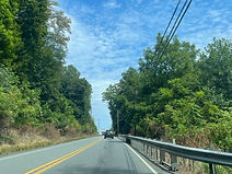
PA 100 proceeds to cross Neiman Road. Photo taken 08-14-2023.

The route prepares to become a semi-freeway with three interchanges all serving Pottstown. Photo taken 08-14-2023.

Shortly afterward, there is a traffic signal at Lenape Crossing, which leads to South Hanover with access to the Town Square Plaza. Photo taken 08-14-2023.

The first of the aforementioned interchanges, intersecting Pennsylvania Route 724 and serving Birdsboro and Kenilworth, is half a mile to the north. Photo taken 08-14-2023.

As the exit nears, PA 100 divides again. Photo taken 08-14-2023.

The next exit is at U.S. Route 422, with control cities King of Prussia, its eastern terminus, and Reading. The interchange is listed by this sign as being three-eighths of a mile away, Pennsylvania having a penchant for distance measurements usually considered archaic nowadays. Photo taken 08-14-2023.

PA 100 crosses over PA 724 here, and receives an onramp from it shortly. Photo taken 08-14-2023.

The ramp to US 422 east is up ahead. Photo taken 08-14-2023.

The eastbound US 422 ramp gore. Behind it sits the onramp from US 422 east to PA 100 north. Photo taken 08-14-2023.

The ramp to US 422 west is then located on the other side of US 422's crossing of PA 100. US 422 forms a southern expressway bypass of Pottstown parallel to the Schuylkill River, ultimately remaining as such to King of Prussia. Photo taken 08-14-2023.

Following US 422, there is a PA 100 reassurance shield; then, it begins crossing the Schuylkill, entering Montgomery County and the borough of Pottstown. Photo taken 08-14-2023.

The route's crossing of the Schuylkill lasts just shy of 1,000 feet, and is flat and straight. Photo taken 08-14-2023.

Forthcoming is an exit ramp to westbound High Street, followed by an at-grade intersection with the south end of Pennsylvania Route 663 (King Street), in a quarter of a mile. Photo taken 08-14-2023.

A junction sign for PA 663 sits prior to PA 100's bridge over High Street. Photo taken 08-14-2023.

The traffic signal at King Street sits just feet past the ramp to High Street. Photo taken 08-14-2023.

Afterward, there is PA 100 reassurance, and the median is slightly wider with yellow steel posts. Photo taken 08-14-2023.

The route next intersects Shoemaker Road, which leads through a retail area to Glasgow Street beside the Pottstown Municipal Airport. Photo taken 08-14-2023.

Past Shoemaker, the highway crosses the Colebrookdale Railroad, and its median then narrows again, returning to a concrete barrier. Photo taken 08-14-2023.

After the route crosses Manatawny Creek, the speed limit is back up to 55 miles per hour. Photo taken 08-14-2023.

The next traffic signal is at Upland Square Drive (left) and State Road (right), and sits beside the Upland Square shopping center. Photo taken 08-14-2023.

The highway curves to the left as it eases upward past Upland Square. Photo taken 08-14-2023.

The route now nears its next signal at North State Road. Photo taken 08-14-2023.

Another PA 100 marker follows State Street. The route is now pulling away from the immediate Pottstown area. Photo taken 08-14-2023.

There is now a diamond interchange with Farmington Avenue, which parallels PA 100 to the east through the north side of Pottstown. Photo taken 08-14-2023.

The Farmington Avenue offramp, at right. From here, Farmington goes northward to Pennsylvania Route 562 outside of Boyertown. Photo taken 08-14-2023.

PA 100 curves to the right, then passes under Farmington. Photo taken 08-14-2023.

Beyond the interchange, PA 100 goes uphill once more. Photo taken 08-14-2023.

Still in the midst of its ascent, the highway meets Moyer Road at a traffic signal. Photo taken 08-14-2023.

There has been no change to the 55 MPH speed limit at this point. Photo taken 08-14-2023.

The route reaches the crest of the hill, then starts going back downward. Photo taken 08-14-2023.

The highway's next intersection is at Rick Road. To the left, it becomes Swinehart Road and begins paralleling PA 100 to the west. Photo taken 08-14-2023.

The intersection is followed by still more PA 100 reassurance. Photo taken 08-14-2023.

A traffic signal at Grosser Road is approaching. Photo taken 08-14-2023.

Grosser Road goes left a few feet to Swinehart and right to Gilbertsville Road, passing two residential subdivisions in the process. Photo taken 08-14-2023.

Still with 55 MPH speed limit, PA 100 passes the construction site of the Gilbertsville branch of Lehigh Valley Hospital. Photo taken 08-14-2023.

The next signal is at Jackson Road, and northbound signage for it includes a diagram displaying which lane one must be in to make their required movement. Photo taken 08-14-2023.

Also not going past Swinehart to the left, Jackson Road at right curves northward to Pennsylvania Route 73. Photo taken 08-14-2023.

PA 100 itself intersects PA 73 (Philadelphia Avenue) at an interchange with control cities Boyertown and Gilbertsville half a mile to the north. Photo taken 08-14-2023.

The exit is just ahead. PA 73 passes through the center of Boyertown just to the west. Photo taken 08-14-2023.

The PA 73 exit gore. Here, PA 100 effectively serves as the line between Boyertown and Gilbertsville. Photo taken 08-14-2023.

PA 73's overpass over PA 100. Photo taken 08-14-2023.

A PA 100 reassurance shield follows PA 73, and the highway eases downward and curves to the left. At the end of this curve, it crosses from Montgomery into Berks County. Photo taken 08-14-2023.

This expressway segment of PA 100 ends in one mile. Meanwhile, the highway's median has changed to a simple guardrail. Photo taken 08-14-2023.

An interchange marked as toward New Berlinville is half a mile ahead. Photo taken 08-14-2023.

The New Berlinville ramp is straight ahead. It is a cloverleaf ramp surrounded by three diamond-style ramps, thus making it a type of partial cloverleaf or "parclo" interchange. Turning right at the end of this ramp leads southwest to PA 562 in Boyertown. Photo taken 08-14-2023.

The exit ramp is here, with a sign warning of its sharp curve. The streets intersected at this interchange are Montgomery Avenue (right at the end of both offramps from PA 100) and Spring Garden Drive (left). Photo taken 08-14-2023.

At the proper end of the onramp from Spring Garden sits a stop sign. This sudden ending of the ramp is to facilitate any necessary movements by incoming traffic to commercial properties just a few feet ahead at left. There is also an acceleration lane that acts as a sort of extension of the onramp that ends further ahead with a yield sign. Photo taken 08-14-2023.

The two carriageways condense into one, and the route curves gradually to the right, then reaches a traffic signal at Rowell Road, which goes through more retail development to Reading Avenue. Photo taken 08-14-2023.

Crossing Swamp Creek, and with a 45 MPH speed limit, PA 100 is now a two-lane, undivided, and fairly more rural highway. Photo taken 08-14-2023.

Bally and Allentown are a respective 4 and 21 miles ahead. Photo taken 08-14-2023.

A crossroads (Mill Street/Washington Road) is approaching. Photo taken 08-14-2023.

There is then a curve to the right before the route intersects Chestnut Street, which goes into the center of Bechtelsville. Photo taken 08-14-2023.

Opposite Chestnut Street at that intersection, at right, is Ehst Street. Photo taken 08-14-2023.

PA 100 reaches another hillcrest as it passes right of Bechtelsville, and there is a reassurance shield. Photo taken 08-14-2023.

Limekiln Road (left) and Passmore Road (right) meet at the next intersection. Limekiln Road leads to an old alignment of PA 100 between Bechtelsville and Bally, to the northeast. Photo taken 08-14-2023.

Stauffer Road, ahead at left, passes through the Spring Valley Village subdivision and also ends up at old route 100. Photo taken 08-14-2023.

The route then passes an open field at left and a scattering of trees and buildings at right. Photo taken 08-14-2023.

The highway intersects Niantic Road at a traffic signal, then enters the borough of Bally. Photo taken 08-14-2023.

It goes on to pass the Bally Mennonite Church at left and a subdivision at right. Photo taken 08-14-2023.

The route then curves to the left as it meets its old alignment. Photo taken 08-14-2023.

Further ahead, at 7th Street, sits the Bally Ribbon Mills. Photo taken 08-14-2023.

The speed limit through Bally is 35 miles per hour. Photo taken 08-14-2023.

The speed then increases to 55 as it leaves the borough. Photo taken 08-14-2023.

Out of Bally, PA 100 passes along a row of houses to the left and farmland on the right. Photo taken 08-14-2023.

A row of trees appears in front of the houses at left, providing a contrast to the crop fields across the street. Photo taken 08-14-2023.

The route dips slightly downward, then crosses Perkiomen Creek. Photo taken 08-14-2023.

The highway then goes on to meet Church Hill Road and Kutztown Road at a crossroads. Photo taken 08-14-2023.

This intersection marks the hamlet of Clayton. Photo taken 08-14-2023.

PA 100 then curves to the left past another farm field. Photo taken 08-14-2023.

The route prepares to intersect Huffs Church Road, leading west 3 miles to Huffs Church and 7 to Fredericksville. It eventually reaches the borough of Fleetwood as Dryville Road. Photo taken 08-14-2023.

After Huffs Church Road, the route intersects Creamery Road and crosses a tributary of Valley Run to the east. Photo taken 08-14-2023.

The highway next intersects Tollgate Road, which leads east 2 miles to "Chapel" (presumably that of the Palm Schwenkfelder Church). Photo taken 08-14-2023.

These crossings are followed by a PA 100 reassurance shield. Photo taken 08-14-2023.

A "NEXT 1 MILE" warning sign just up the road has been vandalized or dismantled, making it unknown what the specific hazard is for that distance. Photo taken 08-14-2023.

Then, for a short stretch, both sides of the highway are lined by picturesque farmland. Photo taken 08-14-2023.

Another cluster of development is approaching, and the speed limit accordingly drops to 40 miles per hour. Photo taken 08-14-2023.

There is an impending junction with Pennsylvania Route 29 (Gravel Pike). This crossroads is known as Hereford. Photo taken 08-14-2023.

It is here that PA 29 begins a concurrency with PA 100 that lasts just over four miles. At right, PA 29 goes southward back toward Montgomery County. Photo taken 08-14-2023.

Another PA 29 shield here is covered up by a sign pointing the way to Hereford Township landmarks from this intersection. Photo taken 08-14-2023.

Meanwhile, at left, the roadway departed by PA 29 becomes township-maintained Seisholtzville Road. Photo taken 08-14-2023.

A joint PA 29/100 reassurance shield sits just past the intersection. Photo taken 08-14-2023.

Shimerville, Emmaus and Allentown are 4, 7 and 13 miles away. Shimerville is where PA 100 and 29 diverge, while Emmaus and Allentown are both via PA 29. Photo taken 08-14-2023.

Leaving the center of Hereford, the highway eases downward and curves slightly to the right. Photo taken 08-14-2023.

Going back uphill, it intersects Strunk Road, and the speed limit is shown as 45 miles per hour. Photo taken 08-14-2023.

Then at Spring Hill Road, the routes enter Upper Milford Township, Lehigh County. Photo taken 08-14-2023.

Subsequently, after emerging from the woods and as it curves to the right, the highway approaches Yeakels Mill Road. Photo taken 08-14-2023.

The highway pulls away from Yeakels Mill and prepares to cross a stream. Photo taken 08-14-2023.
Once more, the routes climb uphill surrounded by trees. Photo taken 08-14-2023.

Then, a cornfield is seen to the left of the highway as it goes downhill again. Photo taken 08-14-2023.

At the bottom of the hill, the road enters the village of Old Zionsville. Photo taken 08-14-2023.

Still a distance from the village center, PA 100/29 crosses Indian Creek. Photo taken 08-14-2023.

45 miles per hour is still the speed limit. Photo taken 08-14-2023.

The community of Powder Valley is at right, a mile away on Powder Valley Road. Photo taken 08-14-2023.

At the center of Old Zionsville, PA 29 and 100 bear left. Photo taken 08-14-2023.

As the highway curves to the left, the speed limit is still 40. Photo taken 08-14-2023.

Leaving Old Zionsville, it meets Kings Highway south at a Y-intersection. In this direction, the Y is upside-down. Photo taken 08-14-2023.

Following the curve, there is a notice that trailers over 45 feet are prohibited on PA 100 following its split with PA 29. Photo taken 08-14-2023.

The highway approaches a traffic signal as it proceeds into Shimerville. Photo taken 08-14-2023.

Intersected at the light is St. Peters Road, which goes west 5 miles to Seisholtzville and east 3 to Vera Cruz. Photo taken 08-14-2023.

PA 100 splits from PA 29 just ahead, turning off to the left while PA 29 continues straight as Chestnut Street. Photo taken 08-14-2023.

PA 100 becomes another segment of Kings Highway at the split. Photo taken 08-14-2023.

Emmaus is 3 miles away and Allentown 9 by way of PA 29. Fogelsville is the same distance away as Allentown on PA 100. Photo taken 08-14-2023.

PA 100 splits from PA 29 here with a speed limit of only 30 miles per hour. Photo taken 08-14-2023.

The low speed limit is explained by a series of steep hills and curves along this segment of the route. In just over a mile, there is a descent with a 9 percent grade. Photo taken 08-14-2023.

The route curves 90 degrees to the left up ahead. Photo taken 08-14-2023.

Then, while going downhill, it turns sharp right. Photo taken 08-14-2023.

The land levels out, but there is then one more hard-left turn. Photo taken 08-14-2023.

With those curves and descents out of the way, PA 100 enters the borough of Macungie, with the 30 MPH speed limit remaining in place. Photo taken 08-14-2023.

A left-turn lane is forming in the middle of the road. Photo taken 08-14-2023.

Just before Sycamore Street, the speed limit increases to 35. Photo taken 08-14-2023.

The route reaches Chestnut Street, which goes northeast 3 miles to Emmaus, reconnecting with PA 29. Photo taken 08-14-2023.

A PA 100 marker follows the light at Chestnut. Photo taken 08-14-2023.

The next signal is at Church Street. Photo taken 08-14-2023.

Leaving Macungie proper, PA 100 crosses a Norfolk Southern track, followed by Swabia Creek. Photo taken 08-14-2023.

PA 100 leaves Macungie, and the facilities of Mack trucks are at left. Photo taken 08-14-2023.

Soon afterward, the center left-turn lane ends. Photo taken 08-14-2023.

The speed limit now increases to 45 miles per hour. Photo taken 08-14-2023.

The route proceeds to a signal at Schoeneck Road, which leads into a complex of distribution centers. Photo taken 08-14-2023.

Next, it intersects Sauerkraut Lane, which goes east through several subdivisions, including Ancient Oaks, and out to Indian Creek Road on the west side of Emmaus. Photo taken 08-14-2023.

Heading into Trexlertown, PA 100 crosses the Little Lehigh Creek. Photo taken 08-14-2023.

There is another Norfolk Southern railroad crossing, and then the route expands into a four-lane divided highway. Photo taken 08-14-2023.

The highway nears a signal at Spring Creek Road, which goes southwest 2 miles to Alburtis and east 3 miles to East Texas. Trexlertown is officially a mile to the north; before the Trexlertown Bypass, its current alignment through the area, was built, PA 100 used Trexlertown Road just to the east of this signal. Photo taken 08-14-2023.

This PA 100 reassurance shield follows the Spring Creek intersection. This current alignment of PA 100 opened in 2005, in conjunction with a separate bypass segment of U.S. Route 222 just to the north. Photo taken 08-14-2023.

Soon afterward, the highway loses one lane in each direction. Photo taken 08-14-2023.

The speed limit now drops to 45 miles per hour. Photo taken 08-14-2023.

A light at Schaefer Run Road and Weilers Road is forthcoming. Photo taken 08-14-2023.

Weilers Road, at right, serves as access to southbound U.S. Route 222 via a township-maintained segment of Hamilton Boulevard, part of US 222's old alignment between Breinigsville and just west of Allentown. US 222 north is straight ahead, traffic from PA 100 north defaulting onto it ahead. Photo taken 08-14-2023.

Fogelsville is 4 miles northward by way of PA 100, while the center of Trexlertown is a mile to the east. Photo taken 08-14-2023.

The route enters Upper Macungie Township at the intersection, subsequently reaching US 222 and then Interstate 78 in Fogelsville. Photo taken 08-14-2023.