
The epzik8 Webpage
Maryland Route 22 west

Maryland Route 22 (Aberdeen Thruway) heads west from its eastern terminus at an Aberdeen Proving Ground gate into the city of Aberdeen. Just a few feet after it begins, it intersects East Bel Air Avenue (left) and Richard Lane (right), the former being MD 22's old alignment through downtown Aberdeen. (5-28-2026)

At the moment, westbound MD 22's speed limit is 50 MPH. Going east, the speed limit is 40 as drivers going in that direction are about to reach the proving ground gate. (5-28-2026)

MD 22 will intersect U.S. Route 40 and Interstate 95 at interchanges that are respectively 1 and 3 miles away. (5-28-2026)

Making its way into the east side of Aberdeen, MD 22 is getting ready to intersect Post Road (left) and Old Post Road (right) at a traffic signal. (5-28-2026)

Post and Old Post roads form part of a historic alignment of what is now US 40. Though not marked here, Old Post Road is a segment of Maryland Route 132, officially designated MD 132B by the State Highway Administration. (5-28-2026)

MD 22 gains a third westbound lane as it comes upon US 40 (Pulaski Highway). (5-28-2026)

While MD 22 goes toward Harford County seat Bel Air, eastbound US 40 can be taken from here to Havre de Grace via Maryland Route 7A. (5-28-2026)

Access to westbound US 40 from either direction of MD 22 is by way of Rogers Street, which MD 22 intersects at the forthcoming signal. (5-28-2026)

First, MD 22 crosses over the right-of-way of Amtrak's Northeast Corridor, which facilitates multiple Amtrak routes and MARC's Penn Line. (5-28-2026)

Each direction of MD 22 has its own exit ramp to US 40 east. (5-28-2026)

MD 22 subsequently makes its way over US 40. (5-28-2026)

The Rogers Street signal is seen here. (5-28-2026)

After it receives traffic from US 40 west, westbound MD 22 approaches a traffic signal at Mount Royal Avenue. (5-28-2026)

Mount Royal goes south from here to West Bel Air Avenue, which it meets beside a CSX railroad crossing. (5-28-2026)

MD 22 then goes uphill and nears an intersection with Maryland Route 462 (Paradise Road). (5-28-2026)

As it approaches MD 462, MD 22 gains a third lane in each direction, and a turn lane for MD 462 north appears along MD 22 west. (5-28-2026)

From this intersection, MD 462 goes south half a mile or so to West Bel Air Avenue, which represents the mainline of MD 132, and north to Maryland Route 155 a distance west of Havre de Grace. (5-28-2026)

The highway's speed limit has now dropped down to 40. (5-28-2026)

Middleton Road is intersected at the next traffic light. (5-28-2026)

A left turn at the light leads toward Upper Chesapeake Aberdeen which opened in 2024, having been built to replace the 112-year-old Harford Memorial Hospital in Havre de Grace. (5-28-2026)

Middleton Road goes south to West Bel Air Avenue and north to Beards Hill Road. It took until 2019 for the portion of the road north of here to be built and opened. (5-28-2026)

MD 22 will have its interchange with Interstate 95 (John F. Kennedy Memorial Highway), which has control cities of New York City and Baltimore, in half a mile. (5-28-2026)

Before I-95, MD 22 meets Beards Hill Road. South of here (at left), to mainline MD 132, Beards Hill is in the state highway system as MD 132A. While unmarked northbound, it is signed southbound as simply MD 132. There is also an exit ramp from MD 22 east to mainline MD 132 that is designated MD 132C. (5-28-2026)

A marker at left announces MD 22's junction with I-95. (5-28-2026)

MD 22's westbound right lane is about to become the onramp to I-95 north. (5-28-2026)

I-95's northbound control city here of New York, 160 miles' drive north of here, is a vestige of the decades-long span of I-95's gap within the state of New Jersey. It has remained even though, since 2018, drivers can now go through the closer cities of Wilmington, DE and Philadelphia, PA, then onto the New Jersey Turnpike, entirely along I-95-designated roadways. (5-28-2026)

MD 22's cloverleaf onramp to I-95 south toward Baltimore is ¼ mile away. (5-28-2026)
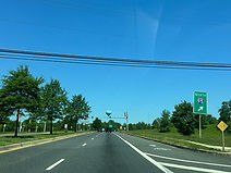
The northbound I-95 ramp gore sign. (5-28-2026)

Between onramps sits a traffic signal at the end of the offramp from I-95 north to MD 22, designated exit 85 of I-95. (5-28-2026)

MD 22 makes its passage over I-95 at this point. This bridge was built as part of a reconfiguration of this interchange during 2003 and 2004 which also added the two cloverleaf onramps to the Interstate from each direction of MD 22; the interchange was originally a simple four-ramp diamond. (5-28-2026)

The ramp to I-95 south is ahead on the right. This ramp empties onto a collector/distributor lane which then merges in with I-95 proper. (5-28-2026)

There is then a traffic signal at the end of the offramp from I-95 south. (5-28-2026)

The next signal is located at the entry to Blackstone Plaza. (5-28-2026)

The signal after that intersects Technology Drive (left), leading into the Higher Education and Applied Technology (HEAT) Center, and Long Drive (right), leading to minor league baseball's Ripken Stadium and surrounding residential development. Long Drive is MD 22's access point to Gilbert Road, which used to reach MD 22 before construction of the stadium. (5-28-2026)

As it leaves Aberdeen, MD 22 condenses to one lane in each direction. (5-28-2026)

The next MD 22 reassurance marker is located soon afterward. (5-28-2026)

The route soon meets Aldino Stepney Road at a crossroads. (5-28-2026)

The intersection after that is at Lynn Lee Drive and is located within a lefthand curve. (5-28-2026)

After going downhill, MD 22 meets Carsins Run Road, a long local arterial stretching from Creswell Road in the Belcamp/Riverside area in the southwest to Aldino Road in the northeast. (5-28-2026)

The route goes uphill, curves right, then back left. (5-28-2026)

The highway subsequently intersects Oakwood Road. (5-28-2026)

Stepney Road, another lengthy county road running southward to just beyond Maryland Route 7 (Old Philadelphia Road) beside the Beechtree Estates subdivision to Aberdeen's southwest, is intersected next between two more curves. (5-28-2026)

After Stepney, MD 22's speed limit finally goes back up to 50 MPH. (5-28-2026)

Intersected soon afterward in quick succession are Snake Lane and Graftons Lane. (5-28-2026)

The highway then continues straight and flat for a short distance through modest tree cover. (5-28-2026)

Another curve to the left is in the distance. (5-28-2026)

Intersected on the right within another curve is Aldino Road (Maryland Route 156). (5-28-2026)

MD 156 leads east to MD 155 and the Harford County Airport. (5-28-2026)

MD 156 intersects MD 22 at an angle. (5-28-2026)
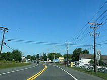
MD 22 reassurance follows MD 156. (5-28-2026)

Now making its way into Churchville, MD 22 will soon intersect Glenville Road which provides access to the Churchville Recreation Center. (5-28-2026)

MD 22 now prepares to intersect MD 155 and MD 136 in rapid succession. (5-28-2026)

MD 155 leads back east toward Havre de Grace. (5-28-2026)

MD 155 is intersected at a signal a few feet east of MD 136. (5-28-2026)

From Churchville, MD 136 heads north as Priestford Road to Dublin and Whiteford, and south as Calvary Road to Creswell and an end at Maryland Route 7. (5-28-2026)

There is MD 22 reassurance as the route makes its way out of Churchville. (5-28-2026)

The highway promptly intersects Toy Drive on the left. (5-28-2026)

Intersected soon afterward is Rockdale Avenue. (5-28-2026)

Subsequently, Bramble Lane leads into the Bramblewood subdivision. (5-28-2026)

After curving slightly to the right, MD 22 comes upon Asbury Road (left) and Rhineforte Drive (right). (5-28-2026)

A little further along, the route reaches a traffic signal at the Campus Hills Shopping Center entrance. (5-28-2026)

Intersected on the west side of Campus Hills are Meadow Spring Drive (left) and Campus Hills Drive (right). The latter facilitates an additional entry into the shopping center and leads into the subdivision of Campus Lakes. (5-28-2026)

Campus Hills Drive is seen to the right. (5-28-2026)

The highway goes on to a signal at one of the main entrances to the Harford Community College campus. (5-28-2026)

The route dips slightly downhill and then back up as it runs along the south side of the college. (5-28-2026)

MD 22 now comes upon a signal at Schucks Road (left) and Thomas Run Road (right). (5-28-2026)

Thomas Run Road leads to 3 additional college entrances and the HCC sports complex, which includes the Aberdeen Proving Ground Federal Credit Union (APGFCU) Arena. (5-28-2026)

From here, Thomas Run runs a few miles northward, then does a 180 and heads back southwest, ending up at MD 543 near Bel Air's Southampton development. (5-28-2026)

The signal afterward is located at Prospect Mill Road. (5-28-2026)

Prospect Mill can be used as a shortcut to get between MD 22 and MD 543. (5-28-2026)

Following Prospect Mill, MD 22's westbound right lane again prepares to end. (5-28-2026)

The highway curves right before intersecting Moonlight Drive. (5-28-2026)

At right, Tudor Lane leads to the historic Tudor Hall, birthplace of John Wilkes Booth. (5-28-2026)

The route then approaches the entrance to the St. Mary Magdalen Mission of Bel Air's St. Margaret's Catholic church. (5-28-2026)

On the right, Andreas Drive leads into the Amyclae East subdivision. (5-28-2026)

Maryland Route 543, which MD 22 intersects up ahead, goes south to its own interchange with I-95 and north to Hickory, an area situated north of Bel Air proper. (5-28-2026)

MD 543 is known along here as Fountain Green Road, and its intersection with MD 22 forms the center of the namesake community. MD 22 itself expands into a four-lane divided highway once again at this spot. (5-28-2026)

It is at this junction where MD 543 changes names from North Fountain Green to South Fountain Green Road, with address numbers going up from 0 from here regardless of which direction of MD 543 that one turns onto from MD 22. (5-28-2026)

The next MD 22 reassurance shield directly follows MD 543. (5-28-2026)

An intersection with Hillside Drive (left) and Econ Drive (right), which runs through Amyclae Estates, is ahead. (5-28-2026)

The highway's speed limit is down to 45 MPH. (5-28-2026)

Tredmore Road, another residential street, is intersected on the left. (5-28-2026)

A traffic signal at Moores Mill Road now approaches. (5-28-2026)

Moores Mill goes south a short distance from here to a roundabout at the main entrance to the Greenbrier Shopping Center and Brushing Lane, and northwest past the Majors Choice development and along the northern reaches of Bel Air town limits to Rock Spring Avenue (MD 924). (5-28-2026)

Brierhill Drive is intersected at the next signal. (5-28-2026)

Brierhill Drive goes south from here to MacPhail Road, where it becomes Ring Factory Road. To the right, sharing the same signal, is the entrance to St. Matthew's Lutheran Church. (5-28-2026)

At a crossing of Bynum Run, one of the two main tributaries of the tidal Bush River to the south, MD 22's speed limit goes down to 40. (5-28-2026)

East Bel Air's Bynum Run Park is located ahead to the left. (5-28-2026)

Thurlow Court is intersected to the right across from the park entrance. (5-28-2026)

The following traffic signal sits at the entrance to John Carroll High School, a Catholic school. (5-28-2026)

Lee Way, at right, works its way westward toward Bel Air's Shamrock Park. (5-28-2026)

MD 22 reassurance sits just prior to Bel Air town limits. (5-28-2026)

The highway encounters South Shamrock Road on the right. (5-28-2026)

At the town line, the two directions of MD 22 split into a one-way pair. While MD 22 west remains Churchville Road, MD 22 east becomes Fulford Avenue. (5-28-2026)

At Giles Street, the highway curves slightly to the left. (5-28-2026)

The route subsequently intersects Maitland Street (left) and Hickory Avenue (right) beside the main station of the Bel Air Volunteer Fire Company. (5-28-2026)

It then pulls up to a traffic signal at Main Street. (5-28-2026)

Main Street carries northbound Maryland Route 924 and U.S. Route 1 Business through downtown Bel Air. (5-28-2026)

Westbound MD 22 then reaches its end at Bond Street, transitioning into southbound US 1 Bus. which then becomes Baltimore Pike. (5-28-2026)