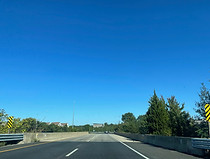
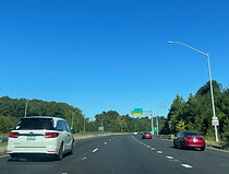
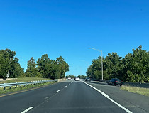
Maryland Route 100 west

Maryland Route 100 is heading west away from a ramp it receives from southbound Maryland Route 10 (Arundel Expressway) via a signal at Maryland Route 177 (Mountain Road), near Pasadena in Anne Arundel County. Just behind, MD 100 and MD 10 overlap for a short period before MD 10 properly ends at MD 2 to the southeast. Photo taken 09-08-2024.

At left, westbound MD 100 receives traffic from northbound Maryland Route 2 (Ritchie Highway). Photo taken 09-08-2024.

MD 100 proceeds over MD 10 here. Photo taken 09-08-2024.

Exit 16A, a cloverleaf leading to MD 2 south toward Pasadena and state capital Annapolis, sits ahead. Photo taken 09-08-2024.

The westbound left lane ends just before an onramp from MD 2 south comes in. Photo taken 09-08-2024.

At the onramp from MD 2, the Baltimore-Annapolis Trail, part of the East Coast Greenway, passes overhead. Photo taken 09-08-2024.

It then comes time for MD 100 reassurance. Photo taken 09-08-2024.

Exit 15, Oakwood Road leading to the Anne Arundel Medical Center, is half a mile away. Photo taken 09-08-2024.

Before the exit, MD 100 crosses Marley Creek on a paved-over bridge. Photo taken 09-08-2024.

Exit 15 lies ahead. Oakwood Road links 5th Avenue in downtown Glen Burnie with Old Mill Road. Photo taken 09-08-2024.

The exit 15 gore, unnumbered. Photo taken 09-08-2024.

MD 100 then crosses Oakwood Road. Photo taken 09-08-2024.

After exit 15, MD 100 curves slight right. Photo taken 09-08-2024.

Next comes MD 100 reassurance. Photo taken 09-08-2024.

Maryland Route 174 (Quarterfield Road) is met by MD 100 at a partial interchange in ¾ mile. Photo taken 09-08-2024.

¼ mile away, small signage is placed for exits 14 and 13 (I-97) on each post of a dismantled overhead gantry. Photo taken 09-08-2024.

At the bridge over Crain Highway (MD 3 Business), a sign in the median directs BWI-bound traffic to I-97 north. Photo taken 09-08-2024.

After rounding another curve, MD 100 reaches exit 14, a westbound exit and eastbound entrance at MD 174. Exit 13 at Interstate 97, with control cities Baltimore (via I-695 and MD 295) and Annapolis (via US 50) is half a mile away. MD 174 has its own interchange with I-97 one exit to the south. Photo taken 09-08-2024.

At the Quarterfield Road bridge, on approach to exit 13B (I-97 north), MD 100's westbound control city becomes Ellicott City, in Howard County. Photo taken 09-08-2024.

Prior to the exit, a third westbound lane commences exclusively for traffic exiting onto I-97 north. Photo taken 09-08-2024.

Exit 13B is ahead. Photo taken 09-08-2024.

The exit 13B gore sign. Photo taken 09-08-2024.

The highway goes on over a ramp from I-97 north to MD 100 west. Photo taken 09-08-2024.

The next crossing is over I-97 itself. Photo taken 09-08-2024.

MD 100 now reaches exit 13A, a cloverleaf ramp to I-97 south. Photo taken 09-08-2024.

The exit 13A gore sign. Photo taken 09-08-2024.

Next, there is a crossing of the ramp from I-97 south to MD 100 east. Photo taken 09-08-2024.

At right, traffic from both directions of I-97 enters MD 100 west. Photo taken 09-08-2024.

The highway curves left as a BWI-bound plane flies overhead. Photo taken 09-08-2024.

MD 100 is now three lanes in each direction. Photo taken 09-08-2024.

Exit 11, intersecting Maryland Route 170 (Telegraph Road) toward Odenton and Linthicum, is a mile away. The right lane ends at this exit, becoming the offramp to MD 170. Photo taken 09-08-2024.

Three different districts of the BWI Region can be reached from the next two exits. Photo taken 09-08-2024.

WB&A Road, running from the parallel Dorsey Road to just north of Odenton, passes over MD 100 in the meantime. It approximates the path of the old Washington, Baltimore and Annapolis Electric Railroad. Photo taken 09-08-2024.

Another airport landmark off exit 11 is the rental car facility off Stoney Run. Photo taken 09-08-2024.

MD 100 passes under Queenstown Road before the exit. Photo taken 09-08-2024.

Exit 11 prepares to depart MD 100, leaving it two lanes in each direction. Photo taken 09-08-2024.

The exit 11 gore sign contains a full-fledged state highway shield with the state's name included. Photo taken 09-08-2024.

MD 100 crosses over MD 170 here. Its interchange with MD 100 is a diverging diamond. Photo taken 09-08-2024.

The onramp from MD 170 to MD 100 west is at right. Photo taken 09-08-2024.

At the highway's crossing of Amtrak's Northeast Corridor, the Maryland Live! Casino (the state's second to open) is announced to be at exit 10. Photo taken 09-08-2024.

Exit 10 intersects Arundel Mills Boulevard (here part of Maryland Route 713) and, aside from the namesake mall, serves Hanover (although since the mall's opening in 2000, "Hanover" has more or less been synonymous with it). Photo taken 09-08-2024.

The highway curves right in the meantime, and crosses Stony Run. Photo taken 09-08-2024.

At the half-mile advance sign for Arundel Mills, Harmans Road passes over the highway. Photo taken 09-08-2024.

Numerous food establishments are at Arundel Mills; these are some. Photo taken 09-08-2024.

One mile past exit 10, MD 100 meets the Baltimore-Washington Parkway (MD 295) at exit 9. Photo taken 09-08-2024.

The exit 10 gore sign. The Arundel Mills complex has expanded over the years to include a 24-cinema theater, Bass Pro Shops, Costco, and a separate strip shopping center along with residential developments, hotels, and the Joe Cannon Stadium of college baseball. Photo taken 09-08-2024.

MD 100 then makes its passage over Arundel Mills Boulevard. MD 713 splits from it just to the south onto Ridge Road, which takes it to MD 175 on the west side of Severn. Photo taken 09-08-2024.

Traffic ostensibly leaving Arundel Mills enters westbound MD 100 at right. Photo taken 09-08-2024.

The ramps to each direction of the B-W Parkway are half a mile apart. Photo taken 09-08-2024.

As exit 9 nears, there is advance notice that exit 8 up ahead can be used to the western segment of Dorsey Road (MD 103) and Park Circle Drive. Photo taken 09-08-2024.

Just beyond Wright Road's crossing of MD 100, exit 9B departs to northbound MD 295 toward Baltimore. ¾ mile away, exit 8 intersects Coca Cola Drive, named for the soda giant's Hanover bottling plant located there. Photo taken 09-08-2024.

A closer look at the Wright Road overpass. Wright Road also crosses the Parkway nearby. Photo taken 09-08-2024.

The exit 9B gore is missing signage for the time being. Prior to MD 100's construction through the area, Dorsey Road was the intersecting road at this interchange. Photo taken 09-08-2024.

Exit 9A is a cloverleaf ramp to MD 295 south and Washington, DC. Each carriageway of the B-W Parkway passes over MD 100 far apart from one another. Photo taken 09-08-2024.

The exit 9A gore sign. Photo taken 09-08-2024.

The following MD 100 reassurance shield is mounted to a light pole. Photo taken 09-08-2024.

Coca-Cola Drive (hyphenated here) is approaching. Photo taken 09-08-2024.

There is more MD 103 signage at right along with notations for food and lodging. Photo taken 09-08-2024.

Exit 8 is ahead, exit 7 for the Dorsey MARC station in half a mile, and exit 6 at U.S. Route 1 (Washington Boulevard) in a mile. Photo taken 09-08-2024.

U.S. Route 29, where MD 100 has its west end, is 7 miles and 8 minutes away. Photo taken 09-08-2024.

MD 100 receives traffic from Coca-Cola Drive, then crosses Deep Run. Photo taken 09-08-2024.

That bridge takes MD 100 into Howard County. Photo taken 09-08-2024.

The highway crosses MARC's Camden Line, where the Dorsey station is situated, prior to exit 7. Photo taken 09-08-2024.

Exit 7 is half a mile from exit 6, and one mile from exit 5 at I-95. Photo taken 09-08-2024.

The highway crosses the MARC access road here. Photo taken 09-08-2024.

Exit 7 is followed by exit 6. US 1's control cities at this exit are Elkridge and Laurel; this is also the case at Maryland Route 32 a few miles to the southwest in Savage. Photo taken 09-08-2024.

The exit 6 gore sign. Photo taken 09-08-2024.

MD 100 will reach Interstate 95 at exit 5 in half a mile. Photo taken 09-08-2024.

The next three exits after I-95 are posted at left, and represent points of access along the east side of Columbia. Photo taken 09-08-2024.

Exit 5 sits ahead, subsequently splitting into ramps to each direction of I-95. Photo taken 09-08-2024.

The exit 5 gore sign. Unlike in this direction where access to I-95 south is via a flyover ramp, going east there is a cloverleaf ramp. Photo taken 09-08-2024.

MD 100 proceeds over I-95 here. Photo taken 09-08-2024.

Then, it goes over the ramp to I-95 south. Photo taken 09-08-2024.

At right, traffic enters MD 100 west from I-95 south. Photo taken 09-08-2024.

Exit 4 at MD 103, now named Meadowridge Road, is half a mile away. Photo taken 02-24-2024.

Exit 4 is up ahead. North of this interchange, Meadowridge Road becomes Montgomery Road and follows MD 100 to the south side of Ellicott City. Photo taken 02-24-2024.

MD 103 has roundabouts at each entrance and exit ramp at MD 100. Photo taken 02-24-2024.

MD 103's crossing of MD 100 is dedicated to Charles Ecker, Howard County executive from 1990 to 1998. Photo taken 02-24-2024.

Exit 3 meets the Snowden River Parkway, a controlled-access road running through Columbia's east. Photo taken 02-24-2024.

A very small MD 100 reassurance shield sits between exits. Photo taken 02-24-2024.

The Snowden can be taken to the Columbia villages of Long Reach and Owen Brown. Photo taken 02-24-2024.

This overhead sign points the way to exit 3. Photo taken 02-24-2024.

Before the exit, MD 100 crosses over Old Montgomery Road. Photo taken 02-24-2024.

Like exit 4, exit 3 is roundabouted, but only at its east end. Photo taken 02-24-2024.

The route then passes over the Snowden. Photo taken 02-24-2024.

The next three exits are displayed overhead, leading up to Ellicott City's far-south. Photo taken 02-24-2024.

Exit 2, leading to Maryland routes 104 and 108 with no control cities, is half a mile away. Photo taken 02-24-2024.

MD 100 curves sharp left before the exit. Photo taken 02-24-2024.

Exit 2 lies ahead. MD 104 is known as Waterloo Road. There is more access to MD 108 via US 29 south. Photo taken 02-24-2024.

The exit 2 gore sign. Again, there is a roundabout at this interchange. Photo taken 02-24-2024.

Incoming traffic enters at right. Photo taken 02-24-2024.

The next three exits, including the US 29 junction, come in the span of a mile and a half. Photo taken 02-24-2024.

Exits 1B and C, situated on the left, lead to Executive Park Drive and Centre Park Drive in ¼ mile. Photo taken 02-24-2024.

Meanwhile, the speed limit is still 55 miles per hour. Photo taken 02-24-2024.

Exits 1B and C are up ahead. Centre Park Drive is accessible by itself from eastbound MD 100 just to the south at a right-in/right-out. Photo taken 02-24-2024.

The Executive Park/Centre Park exit gore. Photo taken 02-24-2024.

Exit 1A, MD 100's final exit, leads to Long Gate Parkway in half a mile. Photo taken 02-24-2024.

Exit 1A contains a park and ride lot. Photo taken 02-24-2024.

Just before Long Gate is advance signage for US 29, which goes south to Washington, DC and north to its national northern terminus at Interstate 70. Photo taken 02-24-2024.

The Long Gate exit sits after a wide curve. A shopping center of the same name is situated beside the exit. Photo taken 02-24-2024.

The exit 1A gore sign. Photo taken 02-24-2024.

As US 29 approaches, the left lane is set aside for southbound traffic, and the right two lanes for northbound traffic. Photo taken 02-24-2024.

The Columbia Town Center is southbound on US 29, and Ellicott City proper, including its historic district, is northbound. Photo taken 02-24-2024.

MD 100 reaches its end, and the westbound carriageway splits into ramps to each direction of US 29. Northbound, US 29 represents a slight continuation of the never-finished Baltimore Outer Beltway to its north end at Old Frederick Road and Rogers Avenue. At I-70 just prior, drivers can either head west toward Frederick or east back toward Baltimore. Photo taken 02-24-2024.
