
The epzik8 Webpage
Interstate 95 south - Fredericksburg to Richmond

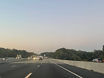
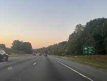
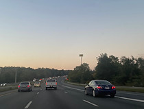
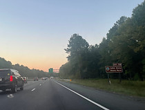
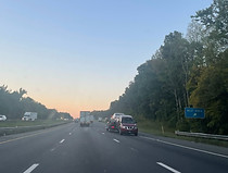
Just north of Fredericksburg, Virginia, in southern Stafford County, Interstate 95 approaches exits 133 (U.S. Route 17/17 Bus.) and 130 (Virginia State Route 3), along with a welcome center, around the spot where its lengthy median HOV express lanes end. Access to all three of these features is via a separate access road on the right. Photo taken 10-02-2023.

A full overhead sign gantry is then placed as exit 133A, with control city Falmouth, nears. Photo taken 10-02-2023.

Leaving exit 133 behind, on the local carriageway, the Virginia welcome center is a mile ahead. Photo taken 10-02-2023.
I-95 now crosses the Rappahannock River from Stafford County into the independent city of Fredericksburg. This crossing has been doubled from two spans to four with the construction of the extra lanes. Photo taken 10-02-2023.
The entrance to the welcome center sits in the distance. Meanwhile, on the other side of the trees at right is the Virginia Credit Union Stadium, home of minor league baseball's Fredericksburg Nationals. Photo taken 10-02-2023.

Just behind the one-mile advance sign for exit 130, Fall Hill Avenue (state secondary route 639) crosses over I-95. Photo taken 10-02-2023.

Exit 130B, VA 3 west to Culpeper, comes nearly half a mile before exit 130A. In the distance sits Cowan Boulevard's overpass over the highway. Photo taken 10-02-2023.

I-95 passes Fredericksburg's Central Park retail complex just prior to the exit. Photo taken 10-02-2023.

Exit 130A, a cloverleaf ramp leading to VA 3 east into downtown Fredericksburg, then leaves the local carriageway at far-right. Photo taken 10-02-2023.
Beyond exit 130, the local carriageway reaches its end, and incoming traffic from the previous two exits is received by I-95 proper. I-95 will be three lanes in each direction until downtown Petersburg, 79 miles to the south. Photo taken 10-02-2023.

One of the extra lanes lingers for a few feet longer, but is preparing to end. Photo taken 10-02-2023.
As the far-right lane disappears, the cities of Ashland and Richmond, Virginia's capital, are a respective 38 and 52 miles away. Photo taken 10-02-2023.

I-95 then departs Fredericksburg for Spotsylvania County. Photo taken 10-02-2023.

An I-95 and US 17 shield assembly follows. The directional banner of the US 17 shield is Interstate blue, in non-compliance with MUTCD guidelines. Photo taken 10-02-2023.

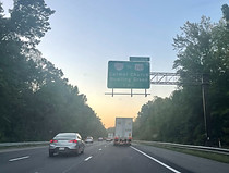
Further ahead, an overhead variable message sign announces Ladysmith (exit 110) as being 18 miles and 16 minutes ahead. Photo taken 10-02-2023.

State secondary route 620, Harrison Road, now crosses over the highway. Photo taken 10-02-2023.
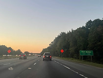
The Spotsylvania station of Virginia Railway Express, which opened in 2015 as a southward extension of the Fredericksburg Line shared with four Amtrak services, is off the next exit, 126. Photo taken 10-02-2023.

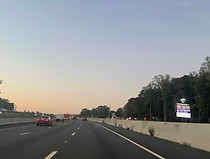
Lodging options at the exit are displayed at right. Photo taken 10-02-2023.

Exit 126 is where US 17 parts ways with I-95. U.S. Route 1, I-95's parallel pre-Interstate route through the area, also intersects I-95 there as the surface through route at that spot. Photo taken 10-02-2023.
Also accessible from exit 126 is Fort Walker, known as Fort A.P. Hill from its 1941 founding until August 2023. Photo taken 10-02-2023.

There is also a Spotsylvania County tourist information center here. Photo taken 10-02-2023.

Exit 126 is impending. Spotsylvania Courthouse, the exit's control city by way of Virginia State Route 208, is billed as simply Spotsylvania on all I-95 guide signs. US 17 follows southbound US 1 for a few tenths of a mile before turning eastward on its own alignment toward Fort Walker and Virginia's Middle Peninsula. Photo taken 10-02-2023.
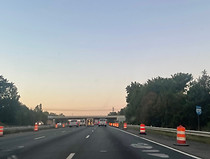
The exit 126 gore. There was paving work being done at this interchange. Photo taken 10-02-2023.
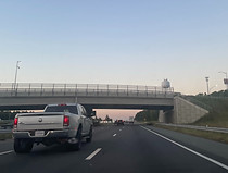
I-95 now crosses over US 1/17 with a great view of south Fredericksburg. Photo taken 10-02-2023.
The highway curves to the right as it receives traffic from US 1/17 north. Photo taken 10-02-2023.
Up ahead, as southbound traffic is provided with I-95 reassurance, US 17, now known as Mills Drive and later as the Tidewater Trail, crosses over the highway. Photo taken 10-02-2023.
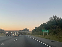
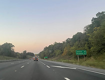
As the Spotsylvania County Parkway crosses over I-95, Ashland and Richmond are 34 and 49 miles away. Photo taken 10-02-2023.

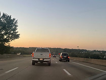
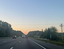
I-95 then goes on to encounter a swath of heavy forest, a common sight along the segment of the highway from Dumfries, in Prince William County, to Hanover County north of Richmond. Photo taken 10-02-2023.

Massaponax Church Road crosses the highway at mile marker 123. Photo taken 10-02-2023.
The highway then crosses the Ni River, one of three component rivers that combine to the east in forming the Mattaponi River, a tributary of the York River. Photo taken 10-02-2023.

Gas stations and attractions at the next exit (118) are shown at right. Photo taken 10-02-2023.
Lake Anna State Park can be reached from this exit. Photo taken 10-02-2023.

The exit, intersecting state secondary route 606 and serving the community of Thornburg at US 1, is a mile ahead. Photo taken 10-02-2023.

Before the exit, I-95 crosses the Po River, the middle source of the Mattaponi. Photo taken 10-02-2023.

Exit 118 is just ahead, although the southbound offramp is much closer to mile marker 119. Photo taken 10-02-2023.
A new SR 606 overpass was constructed during 2019-20 in tandem with the Fredericksburg HOV extension. Photo taken 10-02-2023.

An I-95 reassurance shield follows exit 118. Photo taken 10-02-2023.

The highway then encounters the final source of the Mattaponi, the Matta River. Photo taken 10-02-2023.

At right, a mobile VMS states Ashland (exit 92) as being 24 miles and 20 minutes away. Photo taken 10-02-2023.
I-95 proceeds to reach mile marker 114 as it passes under a large power line. By now, the highway has crossed from Spotsylvania into Caroline County. Photo taken 10-02-2023.

Eventually, the food options at the next exit are listed by a blue sign. Photo taken 10-02-2023.

Intersecting state secondary route 639 and leading to Ladysmith, exit 110 is one mile away. Photo taken 10-02-2023.

I-95 now reaches exit 110. Photo taken 10-02-2023.

The exit 110 gore. Photo taken 10-02-2023.

SR 639's bridge over I-95 is dedicated to late Virginia state trooper Robin Lee Farmer. Photo taken 10-02-2023.

A newer I-95 reassurance shield is located just past the exit, right at mile marker 110. Photo taken 10-02-2023.

The highway's speed limit is now 70 miles per hour. Photo taken 10-02-2023.
There is another rest area a mile away. Photo taken 10-02-2023.

Beforehand, Golansville Road (SR 601) crosses over the highway. Photo taken 10-02-2023.
The rest area entrance is just ahead. This is the final southbound rest area on I-95 prior to the North Carolina line, about 108 miles away; northbound I-95, however, has one near mile marker 36 in the Carson area of Prince George County, south of Richmond and Petersburg. This is imaginably a measure of consistency taken to compensate for the lack of a northbound rest area in Fredericksburg. Photo taken 10-02-2023.

Traffic leaving the rest area proceeds to rejoin the southbound lanes. Photo taken 10-02-2023.

Just afterward, I-95 passes under secondary route 652, Cool Water Drive. Photo taken 10-02-2023.

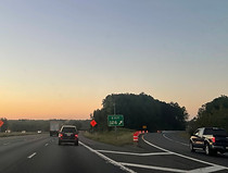
The next exit, 104, is approaching, meaning time for another blue sign to list available services. Photo taken 10-02-2023.
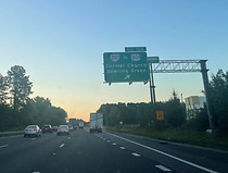
Exit 104 intersects Virginia State Route 207 (Rogers Clark Boulevard) and directly serves the retail areas of Carmel Church and Ruther Glen. In the northeast direction, it furthermore leads to Caroline County seat Bowling Green. where U.S. Route 301 takes over the corridor, leading over the Potomac River through southern Maryland toward Annapolis and Baltimore. As such, US 301 is a well-known alternative to I-95 and its proneness to congestion between Baltimore and Richmond. Photo taken 10-02-2023.

Exit 104 is another Fort Walker access point. Photo taken 10-02-2023.
Exit 104 is imminent. From this interchange, VA 207 leads a short distance to US 1, where it continues west as secondary route 658, Jericho Road. Photo taken 10-02-2023.

The exit 104 gore, with VA 207 crossing in the background. Photo taken 10-02-2023.

Traffic from VA 207 west, and presumably US 301 south, comes in at right. Photo taken 10-02-2023.

Southbound I-95 then receives traffic from VA 207 east. Photo taken 10-02-2023.

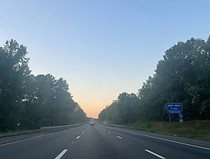
The speed limit remains 70 miles per hour. Photo taken 10-02-2023.

Between exits, I-95 crosses the North Anna River. Photo taken 10-02-2023.

This marks I-95's entry into Hanover County, inching it closer to the core of Greater Richmond. Photo taken 10-02-2023.

Off the approaching exit 98 are the Kings Dominion amusement park and Meadow Event Park. Photo taken 10-02-2023.

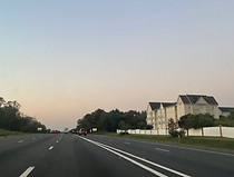
No less than four hotels are also situated at the next exit. Photo taken 10-02-2023.

Exit 98 itself intersects Virginia State Route 30, leading west to Doswell at US 1 and southeast to the colonial town of West Point in King William County, on Virginia's Middle Peninsula. Photo taken 10-02-2023.

I-95 crosses over secondary route 688, Doswell Road, before the exit. Photo taken 10-02-2023.

Exit 98 is just ahead. This exit sign still has the browned-out "Paramount's" above "Kings Dominion" from the withdrawal of the park's original ownership. Photo taken 10-02-2023.

The close-up exit 98 gore. Photo taken 10-02-2023.

A Kings Dominion sign towers over the trees as VA 30 crosses over I-95, for highway visibility. Each direction of VA 30 has its own onramp to I-95 south, and the ramp from VA 30 west comes in at right. Photo taken 10-02-2023.

After the exit comes I-95 reassurance. Photo taken 10-02-2023.

Ashland and Richmond are 6 and 21 miles southward. Photo taken 10-02-2023.

Old Ridge Road (SR 738) then crosses the Interstate. Photo taken 10-02-2023.

Next is a crossing of the Little River, a North Anna River tributary. Photo taken 10-02-2023.

A sign soon afterward displays travel times to what is declared south of Richmond for each of the two north-south Interstates in the area - I-95 and I-295, about 11 miles to the south. Both trips lasted 44 minutes at this particular moment in time. Photo taken 10-02-2023.

There is a variable message sign after that, at mile marker 94.4. Photo taken 10-02-2023.

Some of the services at the approaching exit 92 are listed here. Photo taken 10-02-2023.

An Ashland/Hanover tourist information center is at this exit. Photo taken 10-02-2023.

I-95 enters Ashland here. Photo taken 10-02-2023.

Intersecting Virginia State Route 54, exit 92 is a mile ahead. Photo taken 10-02-2023.

The historic Scotchtown and Hanover Tavern are off this exit. Photo taken 10-02-2023.

Exit 92 is announced by this overhead sign. This exit also accesses a train station in downtown Ashland with Amtrak service. Photo taken 10-02-2023.

VA 54 crosses over I-95 on this bridge, reconstructed in the mid-2010s. Photo taken 10-02-2023.

Traffic coming from VA 54 merges in at right. Photo taken 10-02-2023.

Richmond and Petersburg are a respective 15 and 40 miles away. Photo taken 10-02-2023.

Exit 89, SR 802/Lewistown Road, is in one mile. Meanwhile, I-95 reaches its northern junction with Interstate 295, a northern and eastern bypass of Richmond-Petersburg also leading to both directions of the area's Interstate 64, five miles from these signs. Photo taken 10-02-2023.

The speed limit is now down to 65 miles per hour. Photo taken 10-02-2023.

Exit 89 is the location of the Hanover County Airport. Photo taken 10-02-2023.

Exit 89 is just in the distance. The northbound offramp of this diamond interchange was reconstructed in 2017, the new ramp going slightly further away from the highway. Photo taken 10-02-2023.

The southbound onramp from SR 802 then enters. Photo taken 10-02-2023.

Points of interest at the forthcoming exit 86B include two alcohol-centric attractions. Photo taken 10-02-2023.

Exit 86 intersects secondary route 656, serves the Atlee section of Mechanicsville and Elmont, and is in one and a half miles. Photo taken 10-02-2023.

Meanwhile, exit 84A (I-295 south), three miles away, is for interests to Williamsburg, Norfolk and Virginia Beach, in Virginia's southeastern Historic Triangle and Hampton Roads. Photo taken 10-02-2023.

Exit 86 contains plenty of gas options, including a competing Sheetz and Wawa albeit on opposite sides of the interchange, and at least one hotel. Photo taken 10-02-2023.

To reach Interstate 85 south toward e.g. Durham, North Carolina or Atlanta, Georgia, drivers are to remain south on I-95 for about the next 35 miles. Photo taken 10-02-2023.

The first advance sign for I-295 south, billed as toward Rocky Mount, North Carolina - due to its status as the recommended through route in Greater Richmond for long-distance traffic - and the Richmond International Airport, precedes exit 86. Photo taken 10-02-2023.

Exit 86B is here; exit 86A follows in a quarter-mile. Photo taken 10-02-2023.

The exit 86B gore. Photo taken 10-02-2023.

Signage for exit 84A and an I-295 diagram accompany exit 86A. Photo taken 10-02-2023.

Then, a crossing of Kings Acres Road over the highway is dedicated to fallen police captain Shane Timothy Adcock. Photo taken 10-02-2023.

Just feet later, a bridge over the Chickahominy River signals I-95's entry into Henrico County. Photo taken 10-02-2023.

Exit 84A is three-quarters of a mile south of this gantry. I-95 is marked as the "local route" through Petersburg and Richmond. Photo taken 10-02-2023.

There are low bridges less than 14 feet in height from here through Richmond and into Chesterfield County, at about exit 67. Photo taken 10-02-2023.

Exit 84A is impending, while exit 84B traffic is to continue south along with traffic staying on I-95. Photo taken 10-02-2023.

Virginia Center Parkway, a local retail and golf course road, crosses I-95 just after the ramp to I-295 south leaves from the left. Photo taken 10-02-2023.

Both directions of I-295 itself then pass over I-95. Photo taken 10-02-2023.
