
The epzik8 Webpage
Interstate 95 north - North Carolina line to Petersburg

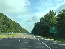
The welcome sign to the right marks Interstate 95's transition from North Carolina into Virginia. The state line is a few miles south of the community of Skippers in Greensville County. Photo taken 07-19-2025.

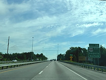
There is a Virginia welcome center just over the state line, traffic from which rejoins the Interstate to the right. Photo taken 07-19-2025.

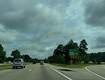
Church Road (SR 631) soon passes overhead. Photo taken 07-19-2025.

The cities of Emporia and Petersburg lie 10 and 52 miles to the north. Photo taken 07-19-2025.

The highway then crosses Beaver Pond Creek parallel to Hollyhock Trail. Photo taken 07-19-2025.

There is then a sign acknowledging Virginia's status as a Purple Heart State, acknowledging military personnel of the highest regard. Photo taken 07-19-2025.

A sign at right lists gas stations located at exit 4 up ahead. Photo taken 07-19-2025.
Exit 4 intersects Moore's Ferry Road (SR 629), serving Skippers, in one mile. Photo taken 07-19-2025.

Before exit 4, I-95 crosses Fountains Creek. Photo taken 07-19-2025.

Exit 4 is ahead on the right. Photo taken 07-19-2025.

The exit 4 offramp and gore sign. Photo taken 07-19-2025.

After that exit, I-95 crosses over an old, disused freight railroad grade. Photo taken 07-19-2025.

SR 639 (Rock Bridge Road) soon passes overhead. Photo taken 07-19-2025.

Emporia can be reached from exits 8 and 11A. Photo taken 07-19-2025.

One mile away, exit 8 leads to U.S. Route 301, which parallels I-95 along this corridor. Photo taken 07-19-2025.

Large trucks are prohibited in Emporia and must use bypass routes through the area. Photo taken 07-19-2025.

Exit 8, which intersects a connector to US 301, is ahead on the right. Photo taken 07-19-2025.

The Interstate subsequently receives traffic from the connector. Photo taken 07-19-2025.

The highway soon passes under Brink Road (SR 627). Photo taken 07-19-2025.

Emporia and Petersburg are now 2 and 44 miles away. Photo taken 07-19-2025.

Some of the services available at exit 11 are posted on the right. Photo taken 07-19-2025.

I-95 now makes its way into Emporia city limits. Photo taken 07-19-2025.

Exit 11 intersects U.S. Route 58, which has eastbound control cities of Emporia and Norfolk, and a westbound control city of South Hill. Photo taken 07-19-2025.

The Emporia Greensville Airport is off exit 11A. Photo taken 07-19-2025.

There is I-95 reassurance before the exit. Photo taken 07-19-2025.

The Interstate then crosses the Meherrin River, part of the Albermarle Sound watershed. Photo taken 07-19-2025.
Exit 11A's control cities are reiterated at right. Photo taken 07-19-2025.

Exit 11A is a sharp cloverleaf that presents a tipping hazard for large trucks. Photo taken 07-19-2025.

Exit 11A is ahead on the right, ¼ mile prior to exit 11B. Photo taken 07-19-2025.

Exit 11A contains separate access to eastbound U.S. Route 58 Business (Atlantic Avenue). Photo taken 07-19-2025.

Exit 11B, a cloverleaf ramp to US 58 west, is on the other side of this overpass. Photo taken 07-19-2025.

I-95 leaves Emporia soon after exit 11. Photo taken 07-19-2025.

Petersburg and Richmond are 41 ad 63 miles ahead of this sign. Photo taken 07-19-2025.

Exit 12, a northbound-only exit to US 301, is a mile away. Photo taken 07-19-2025.

Slagles Lake Road (SR 610) passes over I-95 here. Photo taken 07-19-2025.

Exit 12 is seen to the right. There are no onramps from US 301 to either direction of I-95 at this spot. Photo taken 07-19-2025.

Exit 13 intersects Otterdam Road (SR 614) in one mile. Photo taken 07-19-2025.

Gas options at exit 13 are displayed to the right. Photo taken 07-19-2025.

The highway goes on over Meherrin tributary Three Creek. Photo taken 07-19-2025.

This sign points the way to exit 13. Photo taken 07-19-2025.

The exit 13 gore sign. Photo taken 07-19-2025.

Otterdam Road passes over the Interstate here. Photo taken 07-19-2025.

Eventually, there is one-mile advance signage for exit 17, directly intersecting US 301. Photo taken 07-19-2025.

There is a bit of a break in the trees in the median before the exit. Photo taken 07-19-2025.

Exit 17 is right over the Greensville-Sussex county line. Photo taken 07-19-2025.

The exit 17 gore sign. Photo taken 07-19-2025.

I-95 then crosses US 301, which now begins running to its west. Photo taken 07-19-2025.

The Interstate receives traffic from I-95 and then curves to the left. Photo taken 07-19-2025.

Trees soon fill the highway's median again. Photo taken 07-19-2025.

Petersburg, Richmond and Washington, DC are now 34, 56 and 164 miles away. Photo taken 07-19-2025.

In one mile, I-95 intersects Henry Road (SR 631) leading to Jarratt. Photo taken 07-19-2025.

Exit 20 is just ahead on the right. Photo taken 07-19-2025.

After exit 20, there as signs warning of a "rough road" ahead. Photo taken 07-19-2025.

I-95 then passes under Henry Road. Photo taken 07-19-2025.

There is then I-95 reassurance. Photo taken 07-19-2025.

The highway continues on relatively straight with a median guardrail. Photo taken 07-19-2025.

Eventually, the highway reaches exit 24 with Owens Road (SR 645). Photo taken 07-19-2025.

Owens Road crosses the Interstate here. Photo taken 07-19-2025.

The cities of Stony Creek, Petersburg and Richmond are 6, 27 and 49 miles away from here. Photo taken 07-19-2025.

The Interstate soon curves left into more trees. Photo taken 07-19-2025.

After emerging from the trees, it crosses the Nottoway River. Photo taken 07-19-2025.

The next overpass is at Gee Farm Road (SR 648). Photo taken 07-19-2025.

A blank food options sign is placed ahead of exit 31. Photo taken 07-19-2025.

Exit 31, one mile away, intersects Virginia State Route 40 and leads toward Stony Creek and Waverly. Photo taken 07-19-2025.

Sussex Courthouse can be reached from this exit. Photo taken 07-19-2025.

Exit 31 is just ahead on the right. The longest state highway in Virginia, VA 40 runs 227 miles between Woolwine in Patrick County in the Appalachian foothills, and Spring Grove a distance east of here in Surry County. Photo taken 07-19-2025.

The exit 31 gore sign. Photo taken 07-19-2025.

Within exit 31, before it passes under VA 40, I-95 crosses the Southwestern Swamp. Photo taken 07-19-2025.

Immediately to the west, as I-95 collects an onramp from VA 40, VA 40 intersects US 301 at the east end of its Stony Creek business route. Photo taken 07-19-2025.

There is then a bridge over Stony Creek itself. Photo taken 07-19-2025.

Petersburg, Colonial Heights and Richmond are 20, 22 and 42 miles away. Photo taken 07-19-2025.

Exit 33, the northern Stony Creek exit, intersects SR 602 (Cabin Point Road) in one mile. Photo taken 07-19-2025.

Multiple lodging options are located at exit 33. Photo taken 07-19-2025.

Exit 33 is just ahead on the right. Photo taken 07-19-2025.

The exit 33 gore sign. Photo taken 07-19-2025.

There is an I-95 reassurance marker after the exit. Photo taken 07-19-2025.

There is soon a bridge over Rowanty Creek. Photo taken 07-19-2025.

Soon afterward, the highway leaves Sussex County for Prince George County. Photo taken 07-19-2025.

A northbound-only rest area sits one mile away. Photo taken 07-19-2025.

Johns Road (SR 667) then crosses the highway. Photo taken 07-19-2025.

This is the last rest area for 72 miles until mile marker 108, in Caroline County. Photo taken 07-19-2025.

The rest area entrance. Photo taken 07-19-2025.

The highway then comes upon exit 37 with SR 623 (Rowanty Road). Photo taken 07-19-2025.

The exit 37 gore. Photo taken 07-19-2025.

After exit 37 sits the Lansing Road (SR 631) overpass. Photo taken 07-19-2025.

A weigh station for large trucks sits ahead. Photo taken 07-19-2025.

The weigh station entrance is at right. Photo taken 07-19-2025.

Between exits, I-95 crosses the Jones Hole Swamp. Photo taken 07-19-2025.

Exit 41 intersects US 301, VA 35 and VA 156 with a control city of Courtland. Photo taken 07-19-2025.

At exit 41, US 301 once again crosses over I-95, shifting back to an eastern parallel. Photo taken 07-19-2025.

The onramp to I-95 north comes into the picture at right. Photo taken 07-19-2025.

More I-95 reassurance follows exit 41. Photo taken 07-19-2025.

As there is a maximum vertical height clearance of 13 feet, 10 inches in Petersburg, drivers of large vehicles who trigger the flashers on this sign must exit I-95 at I-295 at exit 46. Photo taken 07-19-2025.

Petersburg, Colonial Heights and Richmond are now 11, 13 and 33 miles away. Photo taken 07-19-2025.

However, according to this overhead variable message sign, Richmond is only 31 miles (28 minutes) away. Photo taken 07-19-2025.

The sign to the right displays a simple diagram showing Interstate 295's role as an eastern bypass of I-95 around Petersburg and Richmond. Photo taken 07-19-2025.

I-95 goes on to cross the Warwick Swamp. Photo taken 07-19-2025.

Some of the driver services available at exit 45 up ahead are displayed to the right. Photo taken 07-19-2025.

Exit 45 is another intersecting US 301, and is 1¼ miles away. Photo taken 07-19-2025.

Before the exit, I-95 passes under Garys Church Road (SR 608). Photo taken 07-19-2025.

The speed limit is about to drop to 65 miles per hour. Photo taken 07-19-2025.

In 2 miles, I-95 intersects the southern terminus of I-295 at exit 46. I-295's control city of Washington, DC indicates VDOT wants through drivers to use it instead of I-95 through the area. Photo taken 07-19-2025.

Exit 45 is ahead on the right. Photo taken 07-19-2025.
The exit 45 gore sign. Photo taken 07-19-2025.

US 301 now shifts back to I-95's west. Photo taken 07-19-2025.

To reach Fort Gregg-Adams, Hopewell or Williamsburg, one can follow I-295 north. Photo taken 07-19-2025.

Interests to Richmond International Airport (RIC) should look out for signs with the posted airport logo over the next several miles. Photo taken 07-19-2025.

Exit 46 is now half a mile away. Photo taken 07-19-2025.

Via I-295, the city of Ashland north of Richmond, which is along I-95, is 48 miles and 49 minutes away. Photo taken 07-19-2025.

A third lane opens up on the right for traffic bound for I-295 north. Photo taken 07-19-2025.

Airport-bound traffic is directed onto I-295. Photo taken 07-19-2025.

Within exit 46, blue services signs for exit 47 begin appearing. Photo taken 07-19-2025.

Gas options at exit 47 include a Wawa. Photo taken 07-19-2025.

Exit 47 intersects Rives Road (SR 629) in ¾ mile. Photo taken 07-19-2025.

Meanwhile, at mile marker 47, the southbound carriageway crosses the sweeping ramp from I-95 south to I-295 north. Photo taken 07-19-2025.

Petersburg is served by the next 5 exits. Photo taken 07-19-2025.

Exit 47 lies just ahead. Photo taken 07-19-2025.

At exit 47, I-95 enters Petersburg city limits. Photo taken 07-19-2025.

¾ mile away from here, exit 48 intersects Wagner Road. Photo taken 07-19-2025.

Exit 48A can be taken to northbound Virginia State Route 106 and the city of Prince George. Photo taken 07-19-2025.

Exit 48B meanwhile leads to Richard Bland College. Photo taken 07-19-2025.

There is I-95 reassurance approaching the exit. Photo taken 07-19-2025.

Driver services are available at each leg of exit 48. Photo taken 07-19-2025.

Exit 48A lies just ahead. Photo taken 07-19-2025.

A cloverleaf onramp from eastbound Wagner Road then enters on the right. Photo taken 07-19-2025.

Just behind the Wagner Road overpass and exit 48B, I-95 enters the Chesapeake Bay Watershed, where it will remain for about 237 miles until Elkton, Maryland. Photo taken 07-19-2025.

The exit 48B gore sign. Photo taken 07-19-2025.

Up ahead, exit 50B leads to a Petersburg tourist info center and the Petersburg National Battlefield. Photo taken 07-19-2025.

The speed limit is about to drop to 55 miles per hour. Photo taken 07-19-2025.

In 2¼ miles, exit 51 intersects southbound Interstate 85 and westbound U.S. Route 460. These highways have respective control cities of Durham, North Carolina and Blackstone, Virginia. Photo taken 07-19-2025.

In ¾ mile, at exits 50 A-D, I-95 has ramps to and from eastbound US 460, Crater Road (US 301), and Wythe and Washington streets. Photo taken 07-19-2025.

Exit 50A additionally accesses VA 109. Photo taken 07-19-2025.

Fort Gregg-Adams can also be reached from exit 50A. Photo taken 07-19-2025.

At the beginning of exit 50, on the next BGS for exit 51, Durham is swapped out for South Hill as the control city for I-85 south. Photo taken 07-19-2025.

Overhead signage along the exit 50 collector-distributor is seen at right. Photo taken 07-19-2025.
