
The epzik8 Webpage
Interstate 84 east

Eastbound Interstate 84 and southbound Interstate 380 head from exit 187 of Interstate 81, where both highways begin, toward exit 1 at Tigue Street in Dunmore, Lackawanna County, which is half a mile from the sign to the right. (6-14-2026)

At left, traffic entering from southbound I-81 and eastbound U.S. Route 6 merges in. (6-14-2026)

The highway's control cities in this direction are Mount Pocono via I-380, and Milford via I-84. (6-14-2026)

Exit 1 lies ahead on the right. (6-14-2026)

The exit 1 gore sign. (6-14-2026)

The Interstate curves right before the onramp from Tigue reaches it. (6-14-2026)

Exit 2, intersecting southbound Pennsylvania Route 435 toward Elmhurst, is ahead on the right. (6-14-2026)

The exit 2 gore sign. (6-14-2026)

The eastbound offramp to PA 435 flies overhead here. (6-14-2026)

The Interstate curves widely to the right, then crosses a railroad track and Roaring Brook. (6-14-2026)

A closer look at that bridge is given here. (6-14-2026)

Exit 4 up ahead is where I-84 and I-380 split, and a diagram depicts it on this overhead sign. (6-14-2026)

An Interstate marker on the right points left in the direction of I-84 east. (6-14-2026)

I-84 now diverts east toward Milford, while I-380 continues about 25 miles southeast to its parent, Interstate 80, just outside of the borough of Mount Pocono in Monroe County. (6-14-2026)

The gore signage at exit 4 implies that I-380 is the exiting route, even though it is I-84 that leaves this particular pavement onto a different one. (6-14-2026)

Eastbound I-84 curves wide to the left as it crosses the sweeping ramp from I-84 west to I-380 south. (6-14-2026)

The highway subsequently receives traffic coming in from I-380 north. (6-14-2026)

The Interstate has a long descent, then goes back uphill as seen in the distance. (6-14-2026)

The AM radio frequency 1610 is posted on the right for drivers to receive travel information from. (6-14-2026)

This stretch of I-84 is designated the Fallen Trooper Memorial Highway, in honor of Pennsylvania state police officers who have died in the line of duty. (6-14-2026)

Soon, the highway crosses Summit Woods Road and a freight railroad track. (6-14-2026)

PA 435 takes the opportunity to pass overhead shortly thereafter. (6-14-2026)

In 2 miles, exit 8 intersects Pennsylvania routes 247 and 348, which lead toward Mount Cobb and Hamlin. (6-14-2026)

Trucks weighing over 10½ tons are prohibited on PA 247 anywhere north of PA 348. (6-14-2026)

Exit 8 is the site of a park and ride lot. (6-14-2026)

The Interstate crosses Scott Road before exit 8. (6-14-2026)

Exit 8 is straight ahead on the right. This movement is part of a truck detour for northbound PA 435. (6-14-2026)

The PA 247 overpass is seen in the distance. (6-14-2026)

Soon after exit 8, I-84 reaches Pennsylvania mile marker 9. (6-14-2026)

Newfoundland (not the Canadian maritime province) and Milford are a respective 7 and 36 miles away. (6-14-2026)

Pennsylvania Route 590 (Hamlin Highway) soon zips overhead. (6-14-2026)

Rock formations line either side of the Interstate between exits. This is a fairly common sight along much of the territory traveled by the eastern I-84. (6-14-2026)

A bridge over Aberdeen Road comes next. (6-14-2026)

In the distance, I-84 lightly descends out of the surrounding trees. (6-14-2026)

Pennsylvania Route 690 (Madisonville Road) soon crosses the highway, again with no interchange. (6-14-2026)

As it eases its way leftward, I-84 enters Wayne County and Salem Township. (6-14-2026)

Subsequently, the Interstate crosses Wilcox Creek and Sepko Road at mile marker 13. (6-14-2026)

I-84's time in Salem Township is short, as at the end of the bridge it enters Sterling Township. (6-14-2026)

Just over the township line, drivers are welcomed to the Pocono Mountains. This subregion of the Appalachian Mountains covers a considerable swath of Northeastern Pennsylvania. (6-14-2026)

The distances to the three exits serving interests to Lake Wallenpaupack are posted to the right. (6-14-2026)

A wide curve to the left sits here. (6-14-2026)

Neville Road (SR 3007) then crosses the Interstate at a tilted angle. (6-14-2026)

Exit 17, which intersects Pennsylvania Route 191 and serves Newfoundland in Dreher Township, is 2 miles from this green sign. (6-14-2026)

A Comfort Inn is located at exit 17. (6-14-2026)

A sharp 45 MPH curve to the left lurks in the distance. (6-14-2026)

Exit 17 can be used to reach Honesdale, the seat of Wayne County. (6-14-2026)

The highway's curve to the left is here. (6-14-2026)

As I-84 straightens out, Pennsylvania Route 196 (Sterling Road) crosses it. Again, no interchange is located here. (6-14-2026)

At exit 17, trucks and cars have different assigned PennDOT color detours: orange (west) and blue (north) respectively. (6-14-2026)

The exit 17 gore sign. (6-14-2026)

I-84 then goes on over PA 191, a 111-mile route between Brodhead in Northampton County in the Lehigh Valley, and a bridge over the Delaware River into New York in Buckingham Township in Wayne County. (6-14-2026)

The bridge after that is over Butternut Creek. (6-14-2026)

2 miles away, at exit 20, I-84 intersects Pennsylvania Route 507 which leads to Lake Wallenpaupack and Greentown. (6-14-2026)

Exit 20 can be used to reach the Claws 'n' Paws Animal Park in Lake Ariel. (6-14-2026)

Forks Bridge Road (SR 3005) passes over the Interstate before it begins a descent. (6-14-2026)

At the bottom of the hill, I-84 crosses Wallenpaupack Creek into Greene Township, Pike County. This is the county in which I-84 will remain until it exits Pennsylvania. (6-14-2026)

Mile marker 19 is situated at the east end of the Wallenpaupack bridge. (6-14-2026)

A mile from exit 20, I-84 crosses Kuhn Hill Road. (6-14-2026)

Gas stations at exit 20 are listed to the right. (6-14-2026)

I-84 then reaches exit 20, and the gore sign is on the right. (6-14-2026)

I-84 reassurance precedes the highway's crossing of PA 507. (6-14-2026)

The Interstate now goes over PA 507. (6-14-2026)

Just past exit 20, I-84 goes under Beaver Dam Road (Township Road 389). (6-14-2026)

The Interstate is currently 5 miles from its interchange with Pennsylvania Route 390, and 24 from Milford. (6-14-2026)

I-84 goes past its mile marker 22 in between exits. (6-14-2026)

At a lefthand curve soon afterward, the Interstate enters Palmyra Township. (6-14-2026)

A rest area, which includes weigh station facilities for large trucks, is located 2 miles from the blue sign to the right. (6-14-2026)

As the highway eases to the right, rocks and a row of deciduous and pine trees line the median. Rock cover is also seen on the right. (6-14-2026)

Exit 26, where I-84 meets PA 390, is 2 miles away and provides connections to Tafton and Promised Land State Park. (6-14-2026)

The rest area and weigh station are straight ahead on the right. (6-14-2026)

The rest area entrance is to the right. (6-14-2026)

The blue food options sign for exit 26 is blank. (6-14-2026)

This green sign points the way to exit 26. (6-14-2026)

At the time of these photos, construction along the following segment of I-84 had reduced the highway to one lane in each direction, with all traffic confined to one carriageway. (6-14-2026)

I-84 reassurance is located just past exit 26. (6-14-2026)

Soon afterward, at mile marker 27.1, the Interstate enters Blooming Grove Township. (6-14-2026)

Blooming Grove and Milford are a respective 3 and 18 miles away. (6-14-2026)

The area of Pecks Pond can be reached from exit 30 up ahead. (6-14-2026)

Exit 30 intersects Pennsylvania Route 402 which runs between Blooming Grove and Porters Lake. (6-14-2026)

The exit 30 gore. (6-14-2026)

Once again, exit 30 is swiftly followed by I-84 reassurance. (6-14-2026)

I-84 intersects Pennsylvania Route 739, which has control cities of Lords Valley and Dingmans Ferry, at exit 34 in 2 miles. (6-14-2026)

Beforehand, the Interstate crosses Shohola Creek, which flows northeast into Piersons Pond. (6-14-2026)

Foodservices at exit 34 include McDonald's, Dunkin' and Subway. (6-14-2026)

At exit 34, there is a notation of PA 739 being a truck route for southbound PA 402. (6-14-2026)

After it crosses PA 739, the Interstate crosses McConnell Creek. (6-14-2026)

Milford now sits 11 miles away, and Port Jervis, New York 17. (6-14-2026)

The highway now heads through trees as it goes slowly downhill. (6-14-2026)

As the tree cover clears from the median, the descent becomes more conspicuous. (6-14-2026)

Once down the hill, I-84 crosses Rattlesnake Creek. (6-14-2026)

More trees and rocks proceed to close in on the highway. (6-14-2026)

The Interstate's next crossing is Raymondskill Creek. (6-14-2026)

Just past mile marker 42.5, Raymondskill Road passes overhead. It has two separate bridges over each carriageway of I-84. (6-14-2026)

In 2 miles, at exit 46, I-84 will intersect U.S. Route 6, which covers the remaining distance to Milford, the seat of Pike County. Nearly all of I-84 from here to Hartford, Connecticut was built along the corridor of US 6. (6-14-2026)

Exit 46 facilitates interests to the Milford Historic District and the Grey Towers Historical Site. (6-14-2026)

Meanwhile, large trucks are prohibited along U.S. Route 209 south of Milford. (6-14-2026)

A wide, 45 MPH curve to the left is up ahead. (6-14-2026)

Exit 46 lies straight ahead on the right. (6-14-2026)

I-84 reassurance immediately follows exit 46. (6-14-2026)

The Interstate proceeds to curve right before crossing Sawkill Creek. (6-14-2026)

The borough of Matamoras is 6 miles from this point, and Port Jervis 8. (6-14-2026)

The Interstate's next bridge is over Foster Hill Road and Vandermine Creek. (6-14-2026)
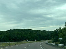
As it curves wide to the right, I-84 enters Westfall Township. (6-14-2026)

Drivers may tune their radios to 530 AM for local highway information. (6-14-2026)

A rather large wall of rock is then seen to the left, alongside the westbound lanes. (6-14-2026)

Subsequent to a light leftward curve, I-84 crosses Cummins Hill Road and Cummins Creek, at which point it begins to parallel the Delaware River as well as U.S. routes 6 and 209. (6-14-2026)

I-84 intersects US 6/209 in 2 miles at exit 53, the Matamoras exit. (6-14-2026)

A Pennsylvania welcome center is located 1½ miles away at exit 53. Going in this direction, it amounts to being a farewell center because I-84 is about to leave the state. (6-14-2026)

The next rest area along I-84 is 18 miles away, in the New Hampton area of Orange County, New York. (6-14-2026)

This blue sign points the way to the welcome center (and, by extension, exit 53), which is accessible from both directions of I-84 and is located off US 6/209. (6-14-2026)

Exit 53 is now in sight. From this interchange, US 6 east and US 209 north go straight through downtown Matamoras, then across the Delaware into Port Jervis. (6-14-2026)

Within the interchange, at exactly mile marker 53, I-84 enters Matamoras, the easternmost municipality in Pennsylvania. (6-14-2026)

I-84 uses this bridge to cross over US 6/209 (Pennsylvania Avenue). (6-14-2026)

Following exit 53 is the final I-84 reassurance shield in Pennsylvania. (6-14-2026)

Exit 1, I-84's first in New York, intersects US 6 and New Jersey Route 23 (by way of the stub Orange County Route 15) and bears control cities of Port Jervis and, for southbound NJ 23, Sussex. (6-14-2026)

I-84's bridge over the Delaware River, acknowledged on this one-mile advance sign for exit 1, comes just after a sharp leftward curve. (6-14-2026)

I-84 now crosses the Delaware from Pennsylvania into New York, the Empire State, missing New Jersey by about 50 feet. (6-14-2026)