
The epzik8 Webpage
Interstate 83 south - Jones Falls Expressway

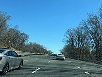
Interstate 83 splits from Interstate 695 (Baltimore Beltway) after an overlap of about a mile in the Brooklandville area west of Towson, Baltimore County, Maryland at this interchange (Exit 23/13). In all directions (both loops of I-695 and, via a straight-ahead movement, I-83 north), access to Maryland Route 25 (Falls Road) is provided. (3-28-2026)

Route markers in the gore sign where the ramps split point in the directions of each highway. (3-28-2026)

The southbound JFX ramp curves wide right and underneath the Beltway. (3-28-2026)

At right, traffic coming from the inner loop of the beltway prepares to join the southbound JFX. (3-28-2026)

Traffic entering from southbound Falls Road is then collected to the left. (3-28-2026)

Ruxton Road soon passes overhead; it has a partial interchange with I-83 (northbound exit/southbound entrance), exit 12. (3-28-2026)

Baltimore's Inner Harbor area, which features the Maryland Science Center and National Aquarium, is 10 miles' drive south of here. (3-28-2026)
As I-83 goes slightly uphill, it receives traffic from Ruxton Road. (3-28-2026)

Some of Baltimore's universities can be reached from exits 6 (MICA, Coppin State) and 5 (University of Baltimore). (3-28-2026)

The Interstate goes on to cross Pimlico Road. (3-28-2026)

The sports stadiums at Camden Yards - Oriole Park at Camden Yards (Orioles) and M&T Bank Stadium (Ravens) - can be reached from any of the exits 6 through 1. Among local residents, "Camden Yards" usually just refers to the Orioles' park due to their lack of corporate naming rights where the Ravens' stadium has a proper name. (3-28-2026)

The campus of the famed Johns Hopkins Hospital can be reached from exit 1. Further south and west, the Baltimore campus of the University of Maryland along with the University of Maryland Medical Center can be accessed partly by way of Lombard Street, two blocks south from the end of I-83. (3-28-2026)

The Pimlico horse racing course, the site of the Triple Crown's Preakness the third weekend of May every year, is off exit 10, and the Baltimore Zoo off exit 7. (3-28-2026)

Exit 10, at Northern Parkway, is a mile away. (3-28-2026)

I-83 now enters Baltimore city limits, a separate jurisdiction from Baltimore County. (3-28-2026)

The speed limit drops to 50 MPH in the city. (3-28-2026)

Exit 10 is now half a mile away, and in one mile, the JFX will encounter exit 9 at Cold Spring Lane, toward Loyola University. (3-28-2026)

Kelly Avenue then passes overhead beside the Mount Washington station of Baltimore Light RailLink. (3-28-2026)

The offramp to Northern Parkway is straight ahead. (3-28-2026)

The gore sign for exit 10. (3-28-2026)

There is a vertical height clearance of 11 feet, 9 inches along the shoulder at this flyover ramp. (3-28-2026)

To the right, traffic coming from Northern Parkway enters the southbound JFX. At the Northern Parkway overpass just ahead, the Interstate begins paralleling its namesake Jones Falls. (3-28-2026)

Baltimore's Hampden neighborhood is accessible from exit 9A (Cold Spring eastbound). (3-28-2026)

Meanwhile, during football season, charter buses to M&T Bank Stadium depart from a lot off exit 6. (3-28-2026)

Southbound I-83 then receives traffic from eastbound Northern Parkway. Rogers Avenue ends at the Northern Parkway end of this ramp but has no direct access to it. (3-28-2026)

Exit 9 is now half a mile to the south. (3-28-2026)

An I-83 shield sits along the side of the highway between exits. (3-28-2026)

In the southbound exit 9 gore, drivers are notified they are entering Baltimore's National Heritage Area which includes the Great Blacks in Wax Museum. (3-28-2026)

The exits for 28th Street and North Avenue are 2 and 3 miles from this overhead. (3-28-2026)

The highway collects southbound traffic from Cold Spring on the right. (3-28-2026)

I-83 reassurance, with the "south" on the bottom, is mounted to a light pole at right. (3-28-2026)

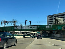
The Interstate soon curves left along a viaduct. (3-28-2026)

41st Street, the main east-west street through Hampden, uses this bridge to cross the JFX. (3-28-2026)

The highway curves right, then back left as the viaduct continues. (3-28-2026)

After two more curves, there is a sign stating that large trucks are not permitted on 28th Street and directing them to go one exit further south to exit 6. (3-28-2026)

At the half-mile advance sign for exit 7, the next three exits are stated to be situated within a mile-long span. (3-28-2026)

Also off exit 7 is the Baltimore Zoo. (3-28-2026)

The sign at right point to the southbound exit lane for exit 7. Meanwhile, right around this spot, I-83 north has an interchange with Falls Road, exit 8. (3-28-2026)

Exit 7 leaves the highway just ahead. From here, Druid Park Lake Drive winds its way west along the Druid Hill Park, the site of the Zoo, and out to Park Heights Avenue. (3-28-2026)

The exit 7 gore sign. (3-28-2026)

Exit 6, which intersects North Avenue (U.S. Route 1/Truck U.S. 40) is half a mile from this sign assembly. Meanwhile, all remaining exits along I-83 lead toward Oriole Park at Camden Yards. Directly overhead is 29th Street, while to the right sits part of the ramp from I-83 south to 29th Street eastbound. (3-28-2026)

The highway then goes under 28th Street and the flyover ramp from I-83 north to Druid Hill. (3-28-2026)

The onramp from westbound 29th Street to the southbound JFX soon turns into the southbound exit lane for North Avenue. The Interstate is now paralleling Mount Royal Terrace, which facilitates the movement from eastbound Druid Park to I-83 south by way of a couple hundred feet of North Avenue, as there is no direct ramp to it. (3-28-2026)

Exit 6 now lies straight ahead. (3-28-2026)

Exit 6 is actually a slip ramp to southbound Mount Royal, which drivers then take a distance to North Avenue. (3-28-2026)

The speed limit is still 50 MPH photo enforced. (3-28-2026)

Baltimore's Penn Station (MARC/Amtrak train service) is off the forthcoming exit. (3-28-2026)

Exit 5, a ramp to Maryland Avenue, is ⅓ mile away. (3-28-2026)

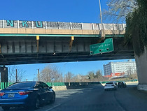
The JFX crosses over North Avenue at this point. (3-28-2026)

At the large Howard Street overpass, exits with St. Paul Street and Guilford Avenue are ⅓ and ¾ mile away respectively. (3-28-2026)
The Light RailLink then crosses the highway. (3-28-2026)

Exit 5 is on the other side of the Maryland Avenue overpass, while soon afterward, exit 4 leads to St. Paul Street (southbound Maryland Route 2). (3-28-2026)

The exit 5 gore sign. At left, there is a warning of sharp curves ahead. (3-28-2026)

The ramp to St. Paul is on the other side of Charles Street's crossing of the Interstate. Charles Street is the dividing line between west and east Baltimore, so going in either direction on east-west streets in the city, address numbers reach 0 at Charles and then start going back up. (3-28-2026)

The exit 4 gore sign. (3-28-2026)

Just before a sharp curve to the right, there is half-mile reassurance for exit 3 at Guilford. (3-28-2026)

The curve is just after Calvert Street's (MD 2 north) crossing of the highway. (3-28-2026)
Guilford Avenue is paralleling the JFX during its curve. (3-28-2026)

There is then an overpass under westbound-only Preston Street. (3-28-2026)

I-83 goes on to pass under Biddle Street and the Fallsway. (3-28-2026)

At exit 3, now with the JFX going due south, there is half-mile advance signage for Pleasant Street mounted to the Chase Street overpass. (3-28-2026)

The exit 3 gore sign. To the left sits the Maryland State Penitentary. (3-28-2026)

At the onramp from Guilford, Pleasant Street is revealed to be a left exit. (3-28-2026)

At the Pleasant Street exit, there is advance signage for Fayette Street at exit 1. Johns Hopkins is stated to be accessible through a left turn at Fayette in ¼ mile. (3-28-2026)

As U.S. Route 40 crosses the JFX via the Orleans Street Bridge beside the Mercy Medical Center, Fayette Street is said to be 2,000 feet away. (3-28-2026)

There is a fairly wide lefthand curve as I-83 continues to navigate one more viaduct and the Shot Tower appears in the distance. (3-28-2026)
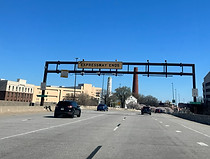
An overhead warning then announces that the end of the expressway is near, marking I-83's southern terminus. (3-28-2026)

I-83 comes to a rather inauspicious end at a traffic signal at Fayette. Several further miles of the JFX through Fells Point and Canton beside the Inner Harbor and tidal Patapsco River were cancelled in the 1970s due to community opposition. (3-28-2026)

Past Fayette Street, President Street picks up where I-83 leaves off, continuing several blocks further south to a roundabout at Aliceanna Street beside the Harbor East marina. (3-28-2026)