
The epzik8 Webpage
Interstate 80 west - Sacramento to San Francisco

In West Sacramento, Yolo County, California, Interstate 80 leaves behind California's capital city and its interchange with the western end of U.S. Route 50/I-80 Business, and approaches exit 81 at Enterprise Street and West Capitol Avenue. (5-7-2026)

Exit 81 is just ahead on the right. Enterprise Boulevard leads into a FedEx Freight facility to the south, while West Capitol parallels I-80 and US 50 to their north to Cabaldon Parkway, stopping a few blocks shy of the Sacramento River which separates it from downtown Sacramento. (5-7-2026)

An I-80 shield with an elongated directional banner follows exit 81. (5-7-2026)

The Interstate soon begins crossing Willow Slough and its adjoining swampland. (5-7-2026)
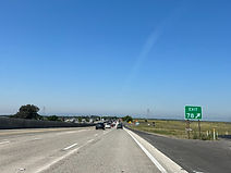
Eventually, I-80 reaches exit 78, a right-in/right-out with Chiles Road. Behind this photo, Chiles makes a 180 maneuver, crossing over I-80 and commencing to parallel it to its south. (5-7-2026)

The next exit, 75 (Mace Boulevard), is ¾ mile from the sign to the right. (5-7-2026)

This overhead sign points the way to Mace Boulevard. (5-7-2026)

Within exit 75, I-80 enters the city of Davis. (5-7-2026)

The University of California, Davis is 3 miles' drive away. (5-7-2026)

The Interstate then passes under Pole Field Road. (5-7-2026)
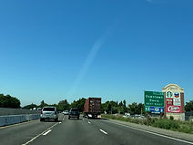
Exit 72B up ahead serves downtown Davis. (5-7-2026)

The exit 72B gore sign. (5-7-2026)

Exit 72A soon afterward leads to southbound Richards Boulevard. (5-7-2026)

The next two exits are located along the next 1½ miles, spaced ¼ mile apart. (5-7-2026)
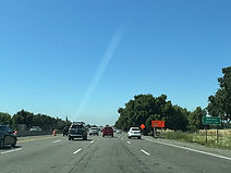
I-80 now leaves Yolo County for Solano County. (5-7-2026)

UC Davis is reiterated to be off the forthcoming exit. (5-7-2026)

UC Davis is exit 71, while exit 70 intersects California State Route 113 which leads to Woodland. Meanwhile, westbound I-80's control city is its western endpoint, San Francisco. (5-7-2026)
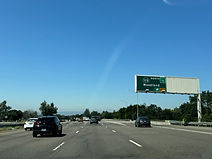
Exit 70 is located straight ahead on the right. (5-7-2026)

The exit 70 gore sign. (5-7-2026)

The next 10 miles of I-80 are part of the Pony Express Historic Route. (5-7-2026)

The highway proceeds under a flyover ramp that leads from I-80 east to CA 113 north. (5-7-2026)

The Interstate will intersect Kidwell Road at an interchange half a mile away. (5-7-2026)

Kidwell Road is exit 69, while exit 67 with Pedrick Road is 2 miles away. (5-7-2026)

The Kidwell overpass. (5-7-2026)

The Interstate goes on along a grove of pistachio trees. (5-7-2026)

Half a mile past exit 67 is exit 66B at Milk Farm Road. (5-7-2026)
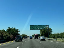
After Milk Farm comes exit 66A to southbound CA 113 (Currey Road). (5-7-2026)

Following exit 66A, which bears a control city of Dixon, by 2 miles is exit 64, Pitt School Road. (5-7-2026)

The exit 66A gore sign. (5-7-2026)

The Interstate receives a cloverleaf onramp from northbound CA 113 to the right as it passes under CA 113. (5-7-2026)

I-80 reassurance is posted between exits 66 and 64. (5-7-2026)

Food options at exit 64 are displayed on the right; there are so many that some have to be put onto the wooden poles below the sign. (5-7-2026)

Exit 64 is straight ahead. (5-7-2026)

Exit 64 is another RIRO, and the onramp component of the interchange enters at right. (5-7-2026)

Gas options at the next exit are displayed by a button copy sign on the right. (5-7-2026)

That exit (62) is at Dixon Avenue, which passes overhead up ahead. (5-7-2026)

I-80 subsequently crosses McCune Creek. (5-7-2026)

The cities of Vacaville, Fairfield and San Francisco are a respective 8, 19 and 62 miles away. (5-7-2026)

Midway Road and Lewis Road (exit 60) are a mile away. (5-7-2026)

At exit 60, I-80 makes its way into Vacaville. (5-7-2026)

I-80 signage again follows exit 60. (5-7-2026)

Meridian Road/Weber Road (exit 59) follows soon thereafter. (5-7-2026)

The Meridian/Weber exit gore sign omits the exit number, a typical situation on California Interstates. (5-7-2026)

I-80 goes on over Gibson Canyon Creek. (5-7-2026)
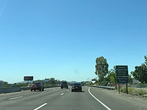
Off the following exit are Solano Community College along with downtown Vacaville. (5-7-2026)
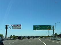
A mile from that exit, 57 (Leisure Town Road/Vaca Valley Parkway), a pair of median express lanes begins along I-80. One mile after exit 57 comes exit 56, a junction with the southern terminus of Interstate 505. (5-7-2026)

The exit 57 gore sign. (5-7-2026)

An overhead sign displaying express toll rates for the next few miles sits in front of the Vaca Valley overpass. There lanes are about 18 miles in length and opened in December 2025 after more than 3 years of construction. (5-7-2026)

I-80 will reach exit 56 momentarily. Meanwhile, Horse Creek is now running through the median of I-80. (5-7-2026)

This overhead sign points toward exit 56. I-505 is a 33-mile spur of Interstate 5 acting as a western bypass of Sacramento for motorists going between the I-80 and I-5 corridors, and accordingly has a northbound control city of Redding, located along I-5 at the northern tip of the Central Valley in Shasta County. Decades ago, before the Federal Highway Administration discouraged letter-suffixed Interstates, I-505 was I-5W. (5-7-2026)

The Interstate soon passes under the flyover ramp leading from I-80 east to I-505 north. (5-7-2026)

The next 4 exits all serve Vacaville. (5-7-2026)
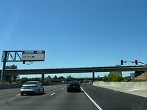
A 180-degree loop ramp from I-505 south to I-80 east then passes overhead. (5-7-2026)

A sign displaying the distances to the next 3 exits is posted onto the Nut Tree Road overpass, situated beside the Vacaville Premium Outlets. (5-7-2026)

I-80 reaches exit 55 (East Monte Vista/Allison Drive) 1¼ mile prior to exit 54B (Mason Street). (5-7-2026)

Westbound drivers leaving I-80 at exit 55 who need to reach Allison Drive must go a distance west on Monte Vista, which parallels I-80 to its north. (5-7-2026)
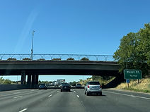
The Mason Street exit is ¾ from the Allison Drive overpass seen here. Unlike I-80 west, I-80 east does have direct access to Allison at exit 55. (5-7-2026)

The highway next crosses Ulatis Creek. (5-7-2026)

Half a mile after Mason Street, I-80 meets Davis Street at exit 54A. (5-7-2026)
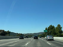
I-80 uses this bridge to pass over Mason/Davis. (5-7-2026)

The exit 54A gore sign. (5-7-2026)

Merchant Street and Alamo Drive are intersected at an interchange half a mile away. (5-7-2026)

There is more I-80 reassurance between exits. (5-7-2026)
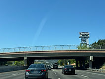
This overpass carries Alamo Drive over I-80. (5-7-2026)

The next exit, 52, intersects Cherry Glenn Drive. (5-7-2026)

The exit 52 gore sign. (5-7-2026)

The highway goes in a straight line toward Lagoon Valley Road at exit 51A. (5-7-2026)

The exit 51A gore sign. (5-7-2026)
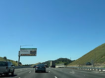
The express toll rate up to the Manuel Campos exit ahead is 75 cents. (5-7-2026)

Manuel Campos is at exit 48, which also intersects North Texas Street This is 2 miles before exit 47A (waterman Boulevard/Air Force Parkway. (5-7-2026)

At exit 48, I-80 enters Solano County seat Fairfield. (5-7-2026)

The express toll rate to West Texas is 75 cents, and to westbound CA 12 $1.50. (5-7-2026)

Exit 47A leads to the Travis Air Force Base and its Air Museum and Veterans' Affairs clinic. (5-7-2026)

Exit 47B (Waterman) is ¼ mile before 47A. (5-7-2026)

The exit 47B gore sign. (5-7-2026)

At exit 47A, I-80's posted westbound control cities are San Francisco and Vallejo. (5-7-2026)

Just further along, the Interstate reaches Travis Boulevard at exit 45. (5-7-2026)

¼ mile beyond the Travis Boulevard overpass comes the West Texas offramp, which also leads to Rockville Road. (5-7-2026)
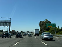
The West Texas/Rockville exit is numbered 44. (5-7-2026)

Afterward, the highway curves wide right and crosses Ledgewood Creek. (5-7-2026)

The next exit can then be taken to the Fairfield Auto Mall and Chadbourne Road. (5-7-2026)

That exit, 43, intersects eastbound California State Route 12, which leads to the city of Rio Vista, along with Suisun Parkway. (5-7-2026)

The exit 43 gore sign. CA 12 will overlap with I-80 for the next few miles. (5-7-2026)

4 miles away, westbound CA 12 splits off toward Napa and Sonoma. (5-7-2026)

A flyover ramp carrying westbound CA 12 traffic passes overhead here. (5-7-2026)

A weigh station is located at the next exit. (5-7-2026)

The overhead sign in the distance points the way to the weigh station. (5-7-2026)

An interchange with I-680 is a mile away, and the CA 12 split 1¾. (5-7-2026)

The Carquinez Bridge is 13 minutes' drive away, Berkeley 28, and Concord 20 via I-680 south. (5-7-2026)

Half a mile past exit 41 at Suisun Valley/Green Valley roads, exit 40 intersects the northern terminus of Interstate 680, a 70-mile highway running from San Jose at the south end of the San Francisco Bay Area and along the Calaveras Fault. I-680 has an additional control city of Benicia, on the north side of the Carquinez Strait. (5-7-2026)

Interests to I-680 south are to use the right 2 lanes. (5-7-2026)

Exit 40 to I-680 is straight ahead on the right. (5-7-2026)

At exit 40, I-80 crosses Green Creek. (5-7-2026)

The westbound CA 12 split toward Napa and Sonoma is exit 39B. (5-7-2026)

Westbound I-80 has 5 through lanes approaching exit 39B. (5-7-2026)

CA 12 now diverges toward the west, leaving I-80 on its own again. (5-7-2026)

To the right, westbound CA 12 passes over the onramp from Green Valley to I-80 west. (5-7-2026)

The movement from CA 12 east to I-80 east then passes overhead. (5-7-2026)

Up ahead, exit 39A leads to Red Top Road, and the express toll lanes end. (5-7-2026)
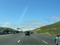
I-80 reassurance follows exit 39A. (5-7-2026)

Now out of Fairfield, I-80 begins ascending the Lynch Canyon. (5-7-2026)

Soon, the highway crosses Lynch Road. (5-7-2026)

An interchange with American Canyon Road (exit 36) is half a mile away. (5-7-2026)

Exit 36 can also be used to reach Hiddenbrooke Parkway. (5-7-2026)

Exit 36 is located near the top of a hillcrest. (5-7-2026)

I-80's next interchange, located at California State Route 37 which leads to San Rafael, is 2 miles away. (5-7-2026)

A vista point, which includes truck parking facilities, is a short distance ahead. (5-7-2026)

The vista point also includes a rest area for general purpose traffic. (5-7-2026)

After curving left, the Interstate encounters a dip, then proceeds straight back uphill. (5-7-2026)

The rest area entrance is situated at another hillcrest. (5-7-2026)

The CA 37 split is exit 33B, and this overhead sign adds an additional control city of Novato, where CA 37 has its other terminus at US 101. (5-7-2026)

The approaching city of Vallejo, the hometown of NASCAR great Jeff Gordon is served by a whopping 9 exits. (5-7-2026)

¼ mile after exit 33B, exit 33A intersects Columbus Parkway, which leads into the Vallejo Auto Mall. (5-7-2026)

The exit 33B gore sign. (5-7-2026)

Exit 33A swiftly follows. (5-7-2026)

Exit 32 a little further along intersects Redwood Street. (5-7-2026)

A mile after Redwood comes Tennessee Street at exit 31B. (5-7-2026)

Meanwhile, exits at Solano Avenue and Spring Road are a mile away, and Georgia Street 1¼ mile away. (5-7-2026)

Travel times to CA 4, Berkeley and Oakland are posted on this variable message sign. (5-7-2026)
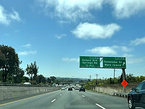
Exit 31B adds a control city of Mare Island. (5-7-2026)
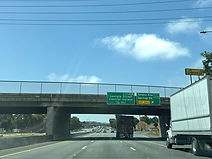
Coming ¼ mile after exit 31A, exit 30B (Georgia Street) serves downtown Vallejo. (5-7-2026)

The second exit from the next leads to Curtola Parkway and the Mare Island ferry terminal, facilitating ferry service to the north side of San Francisco along the San Pablo Bay. (5-7-2026)
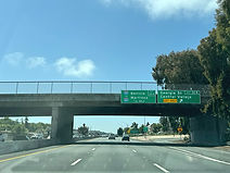
Half a mile after exit 30B, exit 30A intersects Interstate 780 toward I-680, Benicia and Martinez. (5-7-2026)

Exit 29B at Magazine Street comes ¾ mile after 30A. (5-7-2026)

Exit 29A meanwhile can be used to reach the California State University Maritime Academy. (5-7-2026)

An express HOV lane begins in the far-left lane up ahead, just prior to a parking lot entrance. (5-7-2026)

The highway's next 3 exits are spaced 3 miles apart from one another (4 total). (5-7-2026)

Prior to exit 27 (Pomona), I-80 begins crossing the Carquinez Strait along the Alfred Zampa Memorial Bridge. It also enters the city of Crockett. (5-7-2026)

Another vista point is located at exit 27. (5-7-2026)

The approximate midpoint of the cable-stayed Zampa Bridge is here. (5-7-2026)

A mile after exit 27, I-80 meets the Cummings Skyway at exit 26. (5-7-2026)

Following exit 27 is I-80 reassurance. I-80 is now in Contra Costa County, putting it squarely in the San Francisco Bay Area. (5-7-2026)

Exit 26 is the exit for California State Route 4, leading to Martinez and Concord. (5-7-2026)

The next 2 exits serve the community of Rodeo. (5-7-2026)
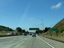
Meanwhile, Pinole and San Francisco are a respective 6 and 27 miles away. (5-7-2026)

Exit 26, also providing access to the Cummings Skyway, lies straight ahead. CA 4 runs 197 miles across the width of California, through the Central Valley - including Stockton - and out to Markleeville in Alpine County, in the Sierra Nevada mountain range near the Nevada state line. (5-7-2026)

I-80's next 3 exits fall within a 4-mile span, with 2¼ miles between the first and third. (5-7-2026)

The city of Hercules - named for the Hercules Powder Company once sited there - can be reached from either of the next 2 exits. (5-7-2026)

Exit 24 up ahead intersects Willow Avenue and serves Rodeo. (5-7-2026)

Exit 23 to Hercules follows exit 24 by half a mile. (5-7-2026)
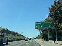
Meanwhile, exits at Pinole Valley Road and Appian Way are respectively 2 and 3 miles away. (5-7-2026)

Pinole Valley is exit 22 and is 1½ miles past exit 23. (5-7-2026)

The highway subsequently crosses Sycamore Avenue beside the Creekside Center. (5-7-2026)

The Interstate's next 3 exits all serve Pinole. (5-7-2026)

One mile after exit 22, Appian Way is intersected at exit 21. (5-7-2026)

The highway is now making its way into Pinole. (5-7-2026)

Exit 21 is straight ahead on the right. (5-7-2026)
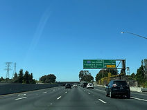
Coming ¾ mile after exit 21, exit 20 is I-80's northern junction with its auxiliary route Interstate 580, which leads north from there to its northern terminus at US 101 at San Rafael in Marin County. Exit 20 also provides access to Fitzgerald Drive. (5-7-2026)

Meanwhile, Hilltop Drive and El Portal Drive are intersected a respective 1¼ and 2 miles away. (5-7-2026)

At exit 20, I-580 begins an overlap of several miles with I-80, marking one of only a handful of instances in the U.S. of a concurrency between primary and auxiliary Interstates. Half a mile after exit 20 comes exit 19B at Hilltop. (5-7-2026)

The city of El Sobrante is served by each of the next 3 exits. (5-7-2026)

Exit 19A ¾ mile away intersects El Portal. (5-7-2026)

The next 2 exits can be taken to San Pablo. (5-7-2026)

The next 3 exits are within a 2-mile span from this bridge-mounted sign. (5-7-2026)

Exit 18 (San Pablo Dam Road) follows exit 19A by a mile. (5-7-2026)

I-80 curves right as it passes over El Portal. (5-7-2026)

Exit 17 (McBryde Avenue) is half a mile after exit 18. (5-7-2026)

A pedestrian pathway connecting two sections of Riverside Avenue passes overhead before exit 17. (5-7-2026)

In ¾ mile, I-80 encounters San Pablo Avenue at exit 16. (5-7-2026)
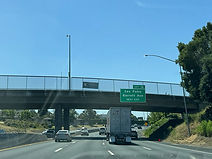
Exit 16 can also be used to access Barrett Avenue. (5-7-2026)

Then, I-80 approaches exit 15 at Cutting Boulevard and, after a mile, exit 14 at Carlson Boulevard. There is also separate HOV access to the left from I-80 west to Cutting. (5-7-2026)

From the sign at right, Central Avenue and the Albany exit are 1¼ and 2 miles. (5-7-2026)
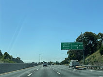
Carlson Boulevard is ¾ mile before Central Avenue (14A). (5-7-2026)

The Albany exit is exit 13, ¾ mile after exit 14A which also serves El Cerrito. (5-7-2026)
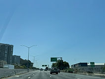
At the Albany city line, I-80 also enters Alameda County. (5-7-2026)

Following the Albany exit by a mile is exit 12 (Gilman Street). (5-7-2026)

Exit 12 used to lead to the Golden Gate Fields horse track, which closed in June of 2024. (5-7-2026)

I-580 makes its merge onto I-80 to the right. (5-7-2026)

The highway's next 3 exits are up to 2¼ miles away. (5-7-2026)

I-80 enters Berkeley right at exit 12. (5-7-2026)
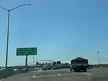
The next exit, University Avenue, is half a mile away. (5-7-2026)
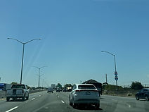
I-80 and I-580 shields are stacked top to bottom on a light pole at far right. (5-7-2026)

University Avenue, which leads to Berkeley College, is exit 11, coming 1¼ miles before exit 10 (CA 13, Ashby Avenue). (5-7-2026)

A spur of the Bay Trail out of the McLaughlin East Shore Park crosses the Interstate along this arch bridge. (5-7-2026)

I-80/580 are now 2 miles from their junction with I-880 at the MacArthur Maze. (5-7-2026)

I-580 splits from I-80 at the Maze, leading southeast toward Stockton (via Interstates 205 and 5) and Fresno (via California State Route 99). (5-7-2026)

The city of Alameda can be reached by way of I-880 south. (5-7-2026)

The next exit, 9, intersects Powell Street leading toward Emeryville. (5-7-2026)

At exit 9, 3 lanes on the left are marked for those exiting onto I-580 or Interstate 880, the latter leading to the Oakland International Airport as well as San Jose. These movements are exit 8B of I-80. I-80 through traffic toward the Bay Bridge and San Francisco is given the 3 right lanes. At far left, there is separate access to I-80 west for HOV traffic. (5-7-2026)
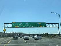
At the interchange, control cities of Hayward and Stockton are added for I-580, and Alameda for I-880. (5-7-2026)

Now oriented west again, I-80 has advance signage for exit 8A, the second exit from the next, leading to West Grand Avenue and Maritime Street. This is the highway's final exit serving Oakland. The Interstate's westbound HOV lane is seen to the left. (5-8-2026)
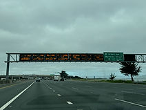
¼ mile after exit 8A, overhead electronic toll lane signs for the impending San Francisco-Oakland Bay Bridge begin appearing. The options for method of tolling are a FasTrak electronic transponder or video tolling, which involves drivers having a photo of their license plate taken and subsequently getting a bill for the toll in the mail. (5-8-2026)


Unusually for a tolled facility in the U.S., the toll rate for both FasTrak and invoice for the Bay Bridge is the same: $8.50. (5-8-2026)

The westbound Bay Bridge tollbooths are seen here. Crossing the bridge eastbound, from San Francisco into Oakland, is free of charge. (5-8-2026)

As traffic congestion occurs regularly on the bridge, drivers are warned by overhead electronic signs to prepare to stop. (5-8-2026)

The bridge has now begun. To the south of here, a parallel second span, designed to be more earthquake-proof, opened in 2013 after more than a decade of construction. (5-8-2026)

The speed limit along the bridge is 50 MPH. (5-8-2026)

Exit 4, serving Treasure Island and Yerba Buena Island (which sit along the middle of the bridge), is a mile from this overhead sign. (5-8-2026)

I-80 now makes its way into the consolidated city and county of San Francisco. (5-8-2026)

Steel cable surrounds the bridge at this point. (5-8-2026)
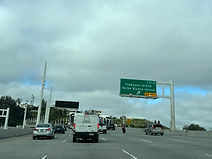
Exit 4 is ahead on the right. Treasure Island, located just off the bridge, is a man-made island built for the 1939 Golden Gate Exposition. (5-8-2026)

On Yerba Buena Island, I-80 goes through the Yerba Buena Tunnel. (5-8-2026)

Exits 2B (Harrison Street/Embarcadero) and 2C (Fremont/Folsom) are both 1¼ miles away. (5-8-2026)

The highway is slowly coming upon the end of the bridge. (5-8-2026)

Exit 2B is from the left side of the Interstate, and exit 2C from the right. (5-8-2026)
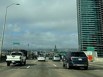
This final section of I-80 is dedicated the Willie Mays Highway, after the legendary San Francisco Giants center fielder. Appropriately enough, the next 3 exits all serve the city's major league sports venues, Oracle Park (Giants) and Chase Center (Golden State Warriors). (5-8-2026)
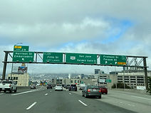
Exit 2A (Fifth Street) is from the left westbound lanes up ahead. Meanwhile, with I-80 about to end, overhead guide signs now display U.S. Route 101, which leads toward San Jose to the south and the Golden Gate Bridge to the north. (5-8-2026)

Exit 2B is seen on the left. (5-8-2026)

Following exit 2A by a mile is exit 1C, which intersects Ninth Street and leads to the San Francisco Civic Center. (5-8-2026)

2 miles after Ninth Street, US 101 has an interchange with Cesar Chavez Street. (5-8-2026)

A California Highway Patrol station is off the next exit. (5-8-2026)
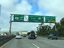
The ramp to US 101 north is exit 1B, while the through movement onto US 101 south is exit 1A. (5-8-2026)

This marks the end of I-80's 2,901-mile journey out of Teaneck, New Jersey. US 101 continues south from here through the east side of San Francisco, toward the San Francisco International Airport. (5-8-2026)
