
The epzik8 Webpage
Interstate 80 east - Cordelia to Vacaville

In Cordelia, Solano County, California, eastbound Interstate 80 proceeds from exit 39B with westbound California State Route 12, toward exit 40 with the northern end of Interstate 680. I-680 has southbound control cities of Benicia and Martinez, the latter located in Contra Costa County. Just behind this picture, I-80's Solano Express Lanes commence on the far-left side of the highway. Reserved for users of California's FasTrak electronic toll collection system, these lanes opened in December 2025 after more than 3 years of construction. (5-5-2026)

A closer look at the overhead exit sign for I-680 south. Traffic entering eastbound I-80 from Lopes Road, which passes overhead here (soon thereafter becoming Green Valley Road), uses the collector/distributor lanes at right to merge onto I-80. These same lanes facilitate direct movements from CA 12 east to I-680 south. CA 12 itself overlaps with I-80 for about the next 4 miles out to Fairfield. (5-5-2026)

¾ mile away, I-80 has an interchange with Suisun Valley Road. (5-5-2026)

This exit can be used to reach Solano Community College. (5-5-2026)
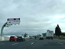
A sign on the left reveals the express lanes to only be restricted between the hours of 5AM and 8PM. (5-5-2026)
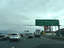
The Suisun Valley exit is numbered exit 41. Southeast of the interchange, the road becomes Pittman Road. Exit 41 is situated ¾ mile ahead of a weigh station. (5-5-2026)

At exit 41, FasTrak toll rates up to each of the next two exits are displayed above the express lanes. These rates are shown increasing in 75-cent increments. (5-5-2026)

The weigh station is ¾ mile away. Trucks detected to be exempt from weight restrictions are given a signal to proceed past the weigh station without stopping, but those not given the bypass signal must go through the weigh scales whenever they are open. (5-5-2026)
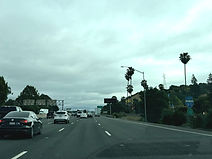
I-80 and CA 12 shields are posted to the right, stacked top-to-bottom. (5-5-2026)

The weigh station entrance is seen to the right. (5-5-2026)

CA 12 splits to the east at exit 43, bearing control cities of Suisun City and Rio Vista. Eastbound I-80 has posted control cities of Sacramento and Fairfield. Distances to the next three exits are displayed in the middle slot of this sign assembly. (5-5-2026)

A California welcome center is located at the next exit. (5-5-2026)

The Interstate subsequently crosses Suisun Creek. (5-5-2026)

The cities of Fairfield and Sacramento are a respective 3 and 45 miles from here. (5-5-2026)

One mile after exit 43, I-80 meets Suisun Parkway at exit 44A. (5-5-2026)

Eastbound CA 12 now splits off toward the Sacramento River Delta. (5-5-2026)

Exit 44A also provides access to Abernathy Road. (5-5-2026)

Meanwhile, to the right, CA 12 intersects Chadbourne Road beside the Fairfield Auto Mall at its own exit 56. (5-5-2026)
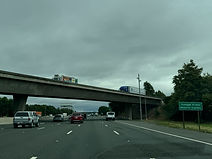
This next segment of I-80 is designated the Tuskegee Airman Memorial Highway. (5-5-2026)

This overhead sign points the way to exit 44A. (5-5-2026)

The exit 44A gore sign. (5-5-2026)

An interchange with West Texas Street serving downtown Fairfield, the Solano County seat, is half a mile away. (5-5-2026)

An I-80 reassurance shield is placed between exits. (5-5-2026)

The forthcoming exit serves downtown Fairfield. (5-5-2026)

The Fairfield/West Texas exit is exit 44B and is straight ahead. (5-5-2026)

I-80 then crosses Ledgewood Creek and West Texas in succession. (5-5-2026)

The Interstate goes slightly downhill as it nears an onramp from Beck Avenue. (5-5-2026)
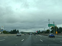
There is then an offramp to Travis Boulevard, exit 45, which then splits into two separate ramps to each direction of Travis. (5-5-2026)

Waterman Boulevard and Air Base Parkway are met at an interchange just over a mile beyond Travis. (5-5-2026)

More I-80 reassurance follows exit 45. (5-5-2026)

The cities of Vacaville and Sacramento are 9 and 41 miles from the faded green sign to the right. (5-5-2026)

Exit 47, the Waterman/Air Base exit, serves the Travis Air Force Base. (5-5-2026)
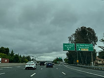
Exit 47 lies ahead on the right. (5-5-2026)

Vacaville has replaced Fairfield as one of I-80's eastbound control cities. (5-5-2026)

An I-80 shield with no directional banner follows exit 47. (5-5-2026)

In one mile, exit 48 intersects Manuel Campos Parkway and North Texas Street. (5-5-2026)

FasTrak toll rates up to Alamo Drive and I-505 are displayed to the left. (5-5-2026)
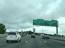
After exit 48, 3 miles pass before the next exit, 51A, intersecting Lagoon Valley and Cherry Glen roads. (5-5-2026)

Exit 48 sits beside the Paradise Valley retail complex. (5-5-2026)
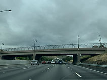
Manuel Campos uses this overpass to cross I-80, becoming Lyon Road a few feet to the west at Hillborn Road. (5-5-2026)

Exit 51A is now a mile away. (5-5-2026)

Interests to Lake Berryessa can get there from I-80 by taking I-505 north to California State Route 128. (5-5-2026)

Exit 51A is in the distance on the right. There is a stop sign at the end of the ramp which drivers are alerted to. (5-5-2026)

Lagoon Valley crosses I-80 at this spot. It becomes Cherry Glen just feet to the west. (5-5-2026)

Up ahead, exit 51B leads to Peña Adobe Road and Rivera Road. (5-5-2026)

The exit 51B gore sign. (5-5-2026)

I-80 then meets Alamo Drive and Merchant Street a mile away. (5-5-2026)

Posted below the next I-80 reassurance shield is notice of a $1,000 state fine for littering. (5-5-2026)
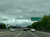
The Alamo/Merchant exit is 53. (5-5-2026)

The highway will have an interchange with Davis Street in half a mile. (5-5-2026)

Half a mile after Davis Street (exit 54A) comes exit 54B at Peabody Street and Elmira Street. (5-5-2026)

The Interstate proceeds over Davis here. (5-5-2026)

The distances to the next two exits (Nut Tree/Allison and I-505) are displayed overhead after 54B. (5-5-2026)

The Allison/Nut Tree exit (55) will come momentarily. (5-5-2026)

Exit 55 additionally leads to Monte Vista Avenue. (5-5-2026)

Those bound for Nut Tree Road are to be in the right lane. (5-5-2026)

In half a mile, I-80 will meet the southern end of Interstate 505 (formerly Interstate 5W), a spur of Interstate 5 with northbound control cities of Winters and Redding. (5-5-2026)

In addition to leading to I-505, exit 56 also provides access to Orange Drive. (5-5-2026)

Exit 56 has been reached. I-505 can be used as a bypass of Sacramento for drivers going between the Bay Area and the Shasta region of northern California, along with cities in Oregon and Washington state. (5-5-2026)