
The epzik8 Webpage
Interstate 80 east - Boston Heights to Pennsylvania line

Eastbound Interstate 80 runs along the Ohio Turnpike as it pulls away from its interchange with Ohio State Route 8 i Boston Heights, Summit County. (4-10-2026)

Trucks and slower traffic are to use the highway's right 2 lanes. (4-10-2026)

The cities of Streetsboro, Ravenna and Youngstown are a respective 8, 15 and 49 miles away. (4-10-2026)

The highway goes under a freight railroad track and then Prospect Road. (4-10-2026)

It then crosses Hudson Aurora Road. (4-10-2026)

The next overpass is Stow Road. (4-10-2026)

Exit 187, intersecting Interstate 480 and Ohio State Route 14 toward Cleveland and Streetsboro, is 2 miles away. (4-10-2026)

Approaching exit 187, I-80 enters Portage County. (4-10-2026)

Hotels available at exit 187 are displayed to the right. (4-10-2026)

I-480 passes over its parent just prior to the exit. (4-10-2026)

Exit 187 lies just ahead to the right. (4-10-2026)

The exit 180 gore sign. (4-10-2026)

I-80/Ohio Turnpike reassurance follows exit 187. (4-10-2026)

An interchange with Ohio State Route 44 is 5 miles away, the city of Warren is 26 miles ahead, and Youngstown 42. (4-10-2026)

The Turnpike soon crosses Ohio State Route 43. (4-10-2026)

The next overpass is Page Road. (4-10-2026)

A Turnpike service plaza sits 7 miles to the east. (4-10-2026)

Diagonal Road is the next overpass. (4-10-2026)

I-80 next crosses the Cuyahoga River. (4-10-2026)

Exit 193 at OH 44 is 2 miles away. (4-10-2026)

The Turnpike goes under Colt Road approaching exit 193. (4-10-2026)

Subsequently, there are bridges over Harris Creek and Infirmary Road. (4-10-2026)

Exit 193 sits just ahead on the right. (4-10-2026)

OH 44 passes overhead here. (4-10-2026)

2 miles away sits the Brady's Leap Service Plaza. (4-10-2026)

I-80 now crosses the divide between the Great Lakes and Mississippi River watersheds. (4-10-2026)

Some of the services available at the service plaza are displayed to the right. (4-10-2026)

The service plaza is on the other side of the Limeridge Road overpass. (4-10-2026)

I-80/Ohio Turnpike reassurance follows the service plaza. (4-10-2026)

Ohio State Route 700 goes on to cross the Turnpike. (4-10-2026)

Westbound toll scanners are seen to the left beside the Turnpike's Miram maintenance shed. (4-10-2026)

Subsequently, Nichols Road crosses the highway. (4-10-2026)

The current speed limit is 70 miles per hour. (4-10-2026)

A little further along, I-80 reaches an interchange with Ohio State Route 5 at exit 204. (4-10-2026)

The Turnpike makes its passage of OH 5 soon afterward. (4-10-2026)

Exit 204 is followed by more I-80/Ohio Turnpike reassurance. (4-10-2026)

A Turnpike toll plaza is located one mile away, with separate carriageways for E-ZPass and cash/credit payments. (4-10-2026)

Before the plaza, the Turnpike crosses the Mahoning River. (4-10-2026)

Lordstown is 6 miles away, the junction with Interstate 76 is 8, and Youngstown 20. (4-10-2026)

Before the toll plaza, I-80 crosses Warren Ravenna Road. (4-10-2026)

The toll plaza sits here. (4-10-2026)

The two carriageways consolidate back into one following the toll plaza. (4-10-2026)

The next crossing is of Newton Falls-Bailey Road. (4-10-2026)

If one misses the toll, the state of Ohio gives them 7 days to pay it online on their E-ZPass site. (4-10-2026)

The Turnpike's next service plaza is 25 miles away, after I-80 is swapped out for I-76. (4-10-2026)

Exit 215, serving Lordstown, is 2 miles away. It is an eastbound exit and westbound entrance. (4-10-2026)

I-80 crosses Carson-Salt Springs Road in the meantime. (4-10-2026)

Exit 215 lies straight ahead on the right. The exit road of the interchange leads to Ellsworth Bailey Road. It becomes Hallock Young Road to the east of that. (4-10-2026)

The exit 215 interchange overpass. (4-10-2026)

Going east, after the Turnpike becomes I-76, there is no access onto exit 234 (Interstate 680 north). Eastbound motorists bound for Youngstown must either exit the Turnpike onto the free portion of I-80, or at exit 232 (Ohio State Route 7) along I-76. (4-10-2026)

The I-76 junction (exit 218) is 2 miles away. Eastbound I-76 is marked as going toward the Pennsylvania Turnpike and Pittsburgh. (4-10-2026)

Interests to New York City are to continue to follow I-80 east. (4-10-2026)

I-80 now enters Mahoning County, its final county before exiting Ohio. (4-10-2026)

There is I-80/Turnpike reassurance approaching exit 218. (4-10-2026)

The highway goes on to cross Ohio State Route 45 (Salem Warren Road). (4-10-2026)

Mahoning Avenue (County Route 18) can also be reached from exit 218. (4-10-2026)

Lodging available at exit 218 is displayed to the right. (4-10-2026)

Exit 218 lies just in front of this overhead sign assembly. (4-10-2026)

The exit 218 gore sign. (4-10-2026)

A sign within the interchange points the ways to I-80 east and Mahoning Avenue. (4-10-2026)

Now a free highway, this next portion of I-80 is dedicated to Marine Sergeant James Prommersberger and Army Second Lieutenant Charles W. Brown. (4-10-2026)

An I-80 reassurance shield directly follows exit 218. (4-10-2026)

The highway curves left soon after the interchange. (4-10-2026)

It then crosses the Meander Reservoir. (4-10-2026)

The midpoint of the Meander bridge. (4-10-2026)

Afterward, the Interstate enters Austintown Township. (4-10-2026)

The I-680 junction is 3 miles away, Youngstown 10, and New York City 405. (4-10-2026)

Food options at exit 223 up ahead are displayed to the right. (4-10-2026)

Exit 223 intersects Ohio State Route 46 toward Niles in one mile. (4-10-2026)

A park and ride lot is available at exit 223. (4-10-2026)

The exit can also be used to reach the William McKinley National Memorial and the Hollywood Gaming Race Course. (4-10-2026)

Gas and lodging options at exit 223 are listed to the right before the exit. (4-10-2026)

Exit 223 is straight ahead on the right. (4-10-2026)

Exit 224A ahead leads to southbound Ohio State Route 11 and Canfield. At this interchange, northbound OH 11 joins eastbound I-80 for a concurrency. (4-10-2026)

Half a mile after exit 224A, exit 224B intersects the northern end of I-680. (4-10-2026)
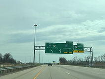
I-80 east/OH 11 north diverges from I-680 and OH 11 south using the left two lanes. (4-10-2026)

The overhead sign to the right points the way to exit 224A. (4-10-2026)

Staying east on I-80 takes one toward the cities of Girard, Hubbard and Sharon, PA. (4-10-2026)

The far right lane is marked for traffic exiting onto I-680 south, as a flyover ramp from OH 11 north to I-80 west passes overhead. (4-10-2026)

Exit 224B now goes off to the right. (4-10-2026)

This gore sign points toward I-80 and I-680. I-680 goes south through downtown Youngstown before reaching the Turnpike at I-76. (4-10-2026)

I-80 shields sit on each direction of the highway as it curves widely to the left. (4-10-2026)

The Interstate goes on under the movement from I-680 north to I-80 west. (4-10-2026)

I-80 and OH 11 shields sit side by side as the highway prepares to cross Fourmile Run. (4-10-2026)

In one mile, the Interstate will intersect Salt Springs Road at exit 226. (4-10-2026)

Exit 226 can also be used to reach McDonald. (4-10-2026)

Before exit 226, I-80 reenters Trumbull County, where it will spent the next 10 miles before the Pennsylvania line. (4-10-2026)

Food options at exit 226 are displayed to the right. (4-10-2026)

This overhead sign points the way to exit 226. (4-10-2026)

The exit 226 gore sign. (4-10-2026)

The next exit, 227, intersects U.S. Route 422 toward Girard, and is a mile away. (4-10-2026)

Approaching the exit, I-80 crosses the Mahoning River into Girard. (4-10-2026)

The Interstate crosses at least 3 railroad tracks on approach to exit 227. (4-10-2026)

1½ miles away, OH 11 parts with I-80 for Warren and Ashtabula at exit 228. (4-10-2026)
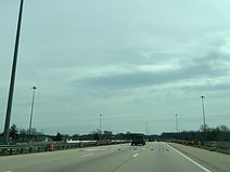
Pavement markings seen below tell drivers which lanes to be in if they are exiting onto northbound OH 11 or continuing east on I-80. (4-10-2026)

As I-80 receives an onramp from US 422, a pedestrian bridge connecting two disjoint sections of Girard's St. Clair Street passes overhead. (4-10-2026)

Northbound OH 11 can be used to reach the Youngstown-Warren Regional Airport. (4-10-2026)

One mile from this sign assembly, exit 229 intersects Ohio State Route 193 (Belmont Avenue). (4-10-2026)

Approaching exit 228, I-80 enters Liberty Township. (4-10-2026)

Exit 228 goes off to the left half a mile before exit 229. (4-10-2026)

Southbound Ohio State Route 711, which I-80 has no access to, passes overhead here. (4-10-2026)

At exit 228, there is notice that exit 229 can be used to access the Youngstown State University. (4-10-2026)
At exit 228, there is notice that exit 229 can be used to access the Youngstown State University. (4-10-2026)

Now on its own, I-80 comes upon exit 229. (4-10-2026)

Exit 229 is just ahead on the right. (4-10-2026)

The exit 229 gore sign. (4-10-2026)

I-80 then crosses Belmont. (4-10-2026)

Soon afterward, the Interstate passes under Shady Road. (4-10-2026)

I-80 reassurance follows exit 229. (4-10-2026)

The highway then crosses over Sampson Road. (4-10-2026)

Hubbard is 4 miles away, the Interstate 79 junction in PA 26, and New York City 396. (4-10-2026)

Soon, I-80 crosses Logan Way and then Crab Creek. (4-10-2026)

At Liberty Street (OH 304), I-80 enters Hubbard Township. (4-10-2026)

Food options at exit 234B up ahead include one of Ohio's only Waffle Houses. (4-10-2026)

Exit 234, I-80's last in Ohio, intersects U.S. Route 62 and Ohio State Route 7 toward Hubbard and Sharon, PA in a mile. (4-10-2026)

Before the exit, the Interstate crosses a freight railroad track. (4-10-2026)

Exit 234B to US 62 east and OH 7 north is the second right movement away from this sign. (4-10-2026)

Exit 234A sits just to the right. (4-10-2026)

The exit 234A gore sign. (4-10-2026)

Exit 234B follows soon afterward. (4-10-2026)

The final I-80 reassurance shield in Ohio is at the Hubbard-Masury Road overpass. (4-10-2026)

I-80's interchange with I-376 in Pennsylvania is 5 miles away, the I-79 interchange 20, and New York City 390. (4-10-2026)

At this point, I-80 makes its way into Mercer County, Pennsylvania. I-80 will spend about 311 miles in the Keystone State. (4-10-2026)