
The epzik8 Webpage
Interstate 80 Business east - Sacramento

Exit 82 along Interstate 80 in West Sacramento, Yolo County is where Sacramento's iteration of the Interstate 80 business loop begins. This is also the western terminus of the cross-country U.S. Route 50 as well as that of the unsigned Interstate 305. (5-6-2026)

The city of Placerville is 46 miles away, South Lake Tahoe 107, and Ocean City, Maryland - where US 50 has its eastern terminus - 3,073. (5-6-2026)

In one mile, US 50/I-80 Bus. meet Harbor Boulevard at exit 1. (5-6-2026)

A flyover ramp from I-80 west to US 50 east appears overhead. (5-6-2026)

The distances to the next 3 exits, which fall along a 2¾-mile span, are displayed above. (5-6-2026)

Exit 1 can be used to reach the Port of West Sacramento along the Sacramento River. (5-6-2026)

The eastbound offramp to southbound Harbor Boulevard is exit-only, whereas the northbound Harbor offramp lane branches off of the eastbound through lane. (5-6-2026)

Exit 3, the first of several serving downtown Sacramento, is ¾ mile away and intersects Jefferson Boulevard. (5-6-2026)

Exit 3 can be taken to Sutter Health Park, the temporary home of Major League Baseball's Athletics while they prepare for their move to Las Vegas. (5-6-2026)

A pedestrian overpass before exit 3 displays a graphic welcoming drivers to West Sacramento. (5-6-2026)

This overhead sign points the way to the Jefferson offramp. (5-6-2026)

Distances to the next 3 exits (I-5, 5th and 15th Streets) are posted overhead. (5-6-2026)

The interchange for Interstate 5 (exit 4A), which has control cities of Redding to the north and Los Angeles to the south, is a mile away. (5-6-2026)

A US 50 shield is painted onto one of the lanes for through traffic continuing east past I-5. (5-6-2026)

Drivers exiting onto either direction of I-5 are given the right lane to get into (the orange signs "RIGHT LANE ENDS" are another indication of this). The left 3 lanes all serve eastbound traffic for US 50 and I-80 Bus. (5-6-2026)

Prior to I-5, the highway crosses the Sacramento River into the city and county of Sacramento. (5-6-2026)
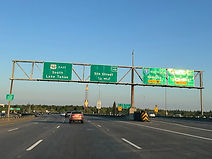
At I-5, US 50's eastbound control city is South Lake Tahoe, and there is ¼-mile advance signage for exit 4B with 5th Street. There is also a small sign on the left pole of this sign gantry dedicating exit 4A as the State Engineer Memorial Bridge. Additionally, while not acknowledged in the field, California State Route 99 parts with I-5 and joins US 50 and I-80 Bus. at this interchange for about a two-mile overlap, in doing so creating a four-way concurrency including the unsigned I-305. (5-6-2026)

Exit 5, at 15th Street, follows exit 4B by ¾ mile. (5-6-2026)

A mile past 15th, I-80 Bus. departs US 50 at an exchange that also involves CA 99 leaving the corridor in the other direction (south). (5-6-2026)

Then, just past 15th Street, US 50's partial interchange with 34th Street is revealed to be a mile away, half a mile after CA 99. (5-6-2026)

At CA 99, there are 5 through lanes for traffic remaining east on US 50. The control city for I-80 Bus. is Reno, Nevada by way of mainline I-80, while for southbound CA 99, Fresno has the honors. (5-6-2026)

Due to construction when these photos were taken, the movement from US 50 east to eastbound I-80 Bus. was down to one lane, compared to the two for the movement to southbound CA 99. Meanwhile, this interchange marks the secretive eastern end of I-305. (5-6-2026)

A firsthand look at the modified exit lane setup is given here. (5-6-2026)
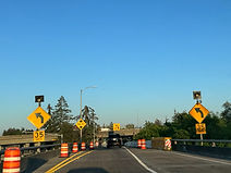
The exit ramp along I-80 Bus. away from eastbound US 50 contains a treacherous lefthand curve. (5-6-2026)

Ahead, the ramp goes under the ramp from US 50 west to CA 99 south, and then under both directions of CA 99. (5-6-2026)

The ramp curves under US 50, then back north, and merges with a ramp from US 50 west. (5-6-2026)

Downtown Sacramento and the California State Capitol can be reached from the next exit along with the Loncoln Law School. (5-6-2026)

The next exit can be used to reach the historic Sutter's Fort along with the California State Indian Museum. (5-6-2026)

The next two exits, N Street (7A) and H Street (7B), are spaced half a mile apart. (5-6-2026)

To the left, the highway picks up a slip ramp from parallel 39th Street. (5-6-2026)
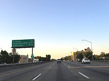
Along with a Business 80 reassurance shield, the distances to the next three exits, beginning with H Street, are posted in the median. (5-6-2026)

¼ mile after H Street, the highway's right lane ends. (5-6-2026)

The highway goes on to cross F and E streets, soon picking up an onramp from the latter. (5-6-2026)

Leaving downtown Sacramento, Business 80 curves to the right, then passes under McKinley Village Way. (5-6-2026)

The highway enters the American River Parkway, and the next three exits fall within the next 2¾ miles. (5-6-2026)

The California Exposition Center (Cal Expo) is off the next exit. (5-6-2026)

Through traffic remaining east on Business 80 is to stay in the right two lanes. (5-6-2026)

The area of Arden-Arcade to the north can also be reached from this exit. (5-6-2026)
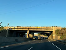
A pair of railroad tracks passes overhead here. (5-6-2026)

Then, it curves left and crosses the American River. (5-6-2026)

Exit 9A just ahead intersects Exposition Boulevard. (5-6-2026)

Exit 9B (Arden Way) quickly follows 9A. (5-6-2026)
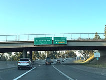
Exit 10 at El Camino Avenue follows Arden by 1¼ mile. (5-6-2026)

Once again, the distances to the next 3 exits are posted in the median. (5-6-2026)

An overhead exit sign for El Camino is to the right. (5-6-2026)

The exit 10 gore sign. (5-6-2026)

Attached to the El Camino overpass are the distances to the next 3 exits up to Watt Avenue. (5-6-2026)

Marconi Avenue (exit 11) is ahead on the right. (5-6-2026)

The Marconi overpass. A wide curve to the right sits just beyond. (5-6-2026)

Subsequently, Business 80 reaches exit 12A, a right-in/right-out at Howe Avenue. (5-6-2026)

The highway then has access to Auburn Boulevard and Bell Street at exit 12C. (5-6-2026)

The exit 12B gore sign. (5-6-2026)
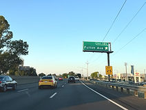
The next exit is 12C, located at Fulton Avenue. (5-6-2026)

Business 80 is 1½ miles from its eastern terminus at mainline I-80. (5-6-2026)
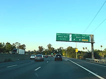
Each direction of Watt has its own exit numberm 14A and 14B. (5-6-2026)
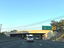
Exit 14B is a sharp, right loop ramp. (5-6-2026)
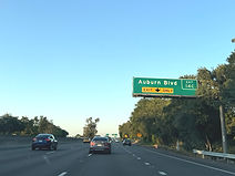
The final exit before eastbound through traffic defaults onto mainline I-80 is Auburn Boulevard (14C). (5-6-2026)