Interstate 795 north

Exit 19 off Interstate 695, the Baltimore Beltway, is where Interstate 795, the Northwest Expressway, begins just outside of Pikesville, Maryland, northwest of Baltimore. Photo taken 06-09-2024.

The ramp from the outer loop of I-695 has a very wide curve to the right. Photo taken 06-09-2024.

The right lane of the ramp ends ahead. Photo taken 06-09-2024.

A ramp from the inner loop of I-695 then comes in at left. Photo taken 06-09-2024.

Seen at left, the Baltimore Metro Subway runs in the median of I-795 for a few miles. It goes southeast through northwest Baltimore to a station beside the Johns Hopkins hospital. Photo taken 06-09-2024.

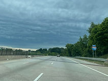
The speed limit is 60 miles per hour. Photo taken 06-09-2024.

The highway then crosses the old Baltimore and Hanover Railroad. Photo taken 06-09-2024.

The first northbound I-795 reassurance shield is seen here. Photo taken 06-09-2024.

The highway proceeds over Mount Wilson Lane. Photo taken 06-09-2024.

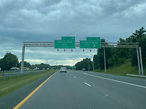
Owings Mills Boulevard, Franklin Boulevard, and Westminster Pike (Maryland Route 140) - where I-795 ends - are 2, 5 and 8 miles away. Photo taken 06-09-2024.

The Owings Mills Metro station is located off exit 4 ahead. Photo taken 06-09-2024.

McDonogh Road, a connector between Liberty Road (Maryland Route 26) in Randallstown and Reisterstown Road (MD 140's name from Reisterstown southward) which I-795 is a bypass of, crosses the Interstate here. Photo taken 06-09-2024.

Stevenson University is off the forthcoming exit 4 via Owings Mills Boulevard north. Photo taken 06-09-2024.

The Owings Mills Boulevard exit is in one mile. Photo taken 06-09-2024.

The Interstate once again crosses the B&H railroad before the exit. Photo taken 06-09-2024.

The Owings Mills Town Center as well as Randallstown can be accessed from exit 4. Photo taken 06-09-2024.

The far-right lane is about to become the northbound offramp to Owings Mills Boulevard. Photo taken 06-09-2024.

A second lane commences for exit 4 to accommodate traffic bound for Mill Station, which is on the site of the former Owings Mills Mall which closed in 2015. Photo taken 06-09-2024.

Across the Interstate from exit 4 is the Owings Mills Metro Centre, beside which the Baltimore Metro Subway terminates in the median at the Owings Mills station. Photo taken 06-09-2024.

The Owings Mills station is partially seen at left. Aside from the aforementioned landmarks, Owings Mills is known as the location of the headquarters and practice facilities of the Baltimore Ravens of the National Football League (and before that, the Colts). Photo taken 06-09-2024.

Now that I-795 has shrunk from six to four lanes, the highway's truck lane control ends, allowing drivers of such vehicles into the left lane. Photo taken 06-09-2024.

At right, traffic exiting the Metro Centre enters I-795 north. Photo taken 06-09-2024.

The next onramp to merge onto the northbound lanes is a cloverleaf from northbound Owings Mills Boulevard, whose crossing of I-795 is dedicated to Army Sergeant Kendall K. Frederick of Randallstown, lost in Iraq in 2005. Frederick's name was also displayed on a car during NASCAR's Coca-Cola 600 on Memorial Day in Concord, North Carolina in 2023. Photo taken 06-09-2024.

Then, the flyover portion of the ramp from I-795 north to southbound Owings Mills Boulevard and Mill Station passes over the Interstate. Photo taken 06-09-2024.

Finally, the onramp from southbound Owings Mills Boulevard merges in. Photo taken 06-09-2024.

The remainder of I-795 (displayed as six miles, though actually a little less) is a State Highway Administration-designated deer watch area. Photo taken 06-09-2024.

With the chaos of Owings Mills in the rearview, there is a I-795 reassurance shield. Photo taken 06-09-2024.

I-795 reaches MD 140 in three miles, and Maryland Route 30 (listed here as "Hanover Road", despite it actually being Pike) is in four. The link between MD 140 and MD 30 is an unsigned Maryland Route 795. Photo taken 06-09-2024.

Crossing next is Dolfield Boulevard, which is a continuation of Dolfield Road from between Deer Park Road and Lakeside Boulevard to the southwest. In 2022, plans were formalized for a new interchange (exit 6) to be constructed here. This bridge is situated between Dolfield's respective signals at Red Run Boulevard and Reisterstown Road. Photo taken 06-09-2024.

At this point, I-795 leaves Owings Mills and heads on to Reisterstown, and exit 7 (Franklin Boulevard) is a mile away. Photo taken 06-09-2024.

Historic Reisterstown can be reached from exit 7A. Photo taken 06-09-2024.

Exit 7A, which leads to eastbound Franklin Boulevard, is half a mile ahead. Photo taken 06-09-2024.

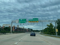
Exit 7A is announced on this overhead gantry, which also states exit 7B to Franklin Boulevard west is in ¼ mile. Photo taken 06-09-2024.

I-795 crosses over Franklin Boulevard itself prior to exit 7B. Photo taken 06-09-2024.

The exit 7B gore sign. Photo taken 06-09-2024.

The corresponding onramp from westbound Franklin enters ahead at right. Photo taken 06-09-2024.

I-795 reassurance follows exit 7. Photo taken 06-09-2024.

Prior to the Berrymans Lane overpass, there is a posted 60 MPH speed limit and an overhead sign displaying an AM radio frequency for travel information. Photo taken 06-09-2024.

I-795 is now approaching the interchange complex (exits 9A-B) for MD 140 west toward Carroll County seat Westminster, and MD 30 north toward Hanover, Pennsylvania (and also south a short distance to MD 140 east and downtown Reisterstown). Photo taken 06-09-2024.

I-795 ends in one mile. Westminster is 13 miles away via MD 140, and Hanover 25 miles away via MD 30 and Pennsylvania Route 94. Photo taken 06-09-2024.

At the Stocksdale Avenue overpass, there is a notation in the median for traffic bound for Mitchell Lane and the Reisterstown Regional Park and Sportsplex to be in the left lane. Photo taken 06-09-2024.

The Carroll County towns of Hampstead and Manchester are also accessible by using exit 9A and MD 30, which actually bypasses the former to the west. Photo taken 06-09-2024.

Warning signs on each side of the northbound carriageway urge traffic to slow down as I-795 is about to end. Photo taken 06-09-2024.

Before the exit, the highway passes over Cockeys Mill Lane. Photo taken 06-09-2024.

There is a single lane dedicated to exit 9A, and two for exit 9B. Photo taken 06-09-2024.

Then, the carriageway splits into each respective exit, which have two lanes apiece. Photo taken 06-09-2024.

I-795 is about to end and transition into unsigned MD 795. The speed limit reduces to 40. Photo taken 06-09-2024.

An impending traffic signal marks the highway's end. Photo taken 06-09-2024.

Two lanes are set aside for MD 30 north and Hanover, and the right lane is for MD 140 east (technically MD 30 south) and historic Reisterstown. Glyndon (which sits immediately east of Reisterstown and acts as a historic district in itself), Hampstead and Manchester are marked "straight ahead". It is just in front of these signs that the highway crosses over the northbound ramp to MD 140, marked as Westminster Pike. Photo taken 06-09-2024.

I-795 reaches its north end at the signal at MD 140, becoming MD 795 and continuing a short distance northeast to MD 30. Going straight at the MD 30 signal puts one onto Maryland Route 128 (Butler Road), which goes through Glyndon before turning left onto its own alignment, where the physical roadway continues east as Worthington Avenue. Photo taken 06-09-2024.
