
The epzik8 Webpage
Interstate 76 west - New Stanton to Ohio line

Following on from the New Stanton Interchange at exit 75, the westbound Pennsylvania Turnpike, here designated solely as Interstate 76 after Interstate 70 leaves it, passes under New Stanton's North Center Avenue. (4-9-2026)

A Toll I-76 shield sits on the right. (4-9-2026)

The next two interchanges, Irwin and Pittsburgh, are a respective 7 and 18 miles away. (4-9-2026)

A third westbound lane begins near mile 73.5. (4-9-2026)

Madison Road soon crosses the Turnpike at about a 45-degree angle. (4-9-2026)

The highway then eases leftward. (4-9-2026)
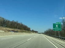
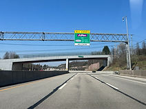
The Irwin Interchange (exit 67) intersects U.S. Route 30 (Lincoln Highway) and has control cities of Irwin and McKeesport, and is 2 miles from the sign on the right. (4-9-2026)

In the interim, Eisaman Road crosses the Turnpike, along an overpass that appears to be long enough to provide for future Turnpike widening. (4-9-2026)

The right lane of the westbound carriageway will end at exit 67. (4-9-2026)

Hotels at exit 67 are posted on the right. (4-9-2026)

Exit 67 also serves Westmoreland County's North Huntingdon Township. (4-9-2026)

Food options at the exit are then displayed. (4-9-2026)

Approaching exit 67, Monroeville is added as a westbound control city for I-76, displacing Cleveland. (4-9-2026)

Wendel Road passes overhead before the exit. (4-9-2026)

The Turnpike reaches the Irwin interchange, for which signage is posted on this overpass. (4-9-2026)

The highway then curves to the right. (4-9-2026)

After Irwin, the Turnpike's Pittsburgh and Allegheny Valley interchanges are a respective 11 and 20 miles away. (4-9-2026)

US 30 is crossed over by the Turnpike here. (4-9-2026)

The highway now straightens out. (4-9-2026)

The Turnpike next crosses Broadway Street, which heads east into Westmoreland City, and a freight railroad track. (4-9-2026)

The highway then eases its way to the right. (4-9-2026)

There is a parking area a little further along whose exit is to the right. (4-9-2026)

After the surrounding tree cover increases, the highway crosses Lyons Run Creek. (4-9-2026)

A variable message sign to the right warns of construction ahead. (4-9-2026)

The Turnpike then comes upon the Trafford Road overpass. (4-9-2026)

Continuing straight past more trees, the Turnpike crosses Turtle Creek into Allegheny County. (4-9-2026)

In 2 miles at exit 57, the Pittsburgh Interchange, the Turnpike meets Interstate 376 and U.S. Route 22, which lead toward Pittsburgh and Monroeville. (4-9-2026)
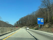
This sign to the right displays Pittsburgh-area attractions that can be reached from exit 57. (4-9-2026)

Exit 57 is ahead on the right. (4-9-2026)

Northern Pike goes over the Turnpike approaching the interchange. (4-9-2026)

The exit 57 gore sign. (4-9-2026)

I-376, whose south end is here, is one of 5 children of I-76 (6 if Turnpike 576 is to be counted). At the Pittsburgh interchange, mainline US 22 prefers to join I-376, leaving its surface alignment to pass through Monroeville as US 22 Business. (4-9-2026)

The Turnpike now crosses US 22. (4-9-2026)

The Allegheny Valley and Butler Valley interchanges are 9 and 18 miles away respectively. (4-9-2026)

The highway soon crosses Beatty Road. (4-9-2026)

Center Road then crosses the Turnpike at an oblique angle. (4-9-2026)

The Turnpike curves right, then has a dip in the road in the distance. (4-9-2026)

Then, it reaches a toll scanner at mile marker 53.9. (4-9-2026)

The next overpass is Saltsburg Road, which crosses at a slightly downward angle. (4-9-2026)

Unity Trestle Road then passes overhead at a curve. (4-9-2026)

The Turnpike goes on into more trees with rock walls on either side. (4-9-2026)

Soon, the highway crosses Repp Road. (4-9-2026)

Exit 48 - the Allegheny Valley interchange - intersects Pennsylvania Route 28 toward New Kensington and Pittsburgh in 2 miles. (4-9-2026)

A wide curve to the left approaches in the meantime. (4-9-2026)

At mile marker 49, along a curve to the right, the Turnpike crosses a railroad track. (4-9-2026)

The Turnpike is now approaching the Allegheny River, which is part of the Ohio River Basin. The Ohio is formed by the confluence of the Allegheny and Monogohela rivers in downtown Pittsburgh. (4-9-2026)

Hulton Road soon crosses the highway. (4-9-2026)

Just a few dozen feet afterward, the Turnpike passes under a pair of golf cart paths that run through the surrounding Oakmont Country Club. (4-9-2026)

Gas and food establishments at exit 48 are displayed to the right. (4-9-2026)

Exit 48 is now "next right", and includes access to the Allegheny Valley Hospital in Natrona Heights. (4-9-2026)

The Turnpike has now reached its crossing of the Allegheny River. (4-9-2026)

This is roughly the midpoint of the Allegheny bridge. (4-9-2026)

Exit 48 lies straight ahead after the bridge. (4-9-2026)

Gulf Lab Road passes overhead along a high overpass at the interchange. (4-9-2026)

There is an I-76 reassurance shield at the exit. (4-9-2026)

PA 28 makes its passage of the Turnpike here. (4-9-2026)

The next two interchanges, Butler Valley and Cranberry, are respectively 8 and 19 miles away. (4-9-2026)

At mile 46.9, the Turnpike crosses Deer Creek. (4-9-2026)

The highway then goes under Rich Hill Road. (4-9-2026)

A pair of curves follow. (4-9-2026)

Pennsylvania Route 910 (Gibsonia Road) soon crosses the highway. (4-9-2026)

Two overpasses later, Saxonburg Boulevard crosses the Turnpike while going uphill. (4-9-2026)

PA 910 then crosses again along an uphill curve. (4-9-2026)

Exit 39, the Butler Valley Interchange, intersects Pennsylvania Route 8 in 1 mile, and has control cities of Pittsburgh and Butler. (4-9-2026)

Middle Road crosses the Turnpike before the exit. (4-9-2026)

On the right approaching exit 39 is PTPA's Gibsonia maintenance facility. (4-9-2026)

The right lane was closed for construction when these were taken, so this portable sign helps direct drivers to the offramp. (4-9-2026)

This overhead sign points the way to exit 39. (4-9-2026)

The gore sign for exit 39. (4-9-2026)

PA 8 uses this overpass to cross the Turnpike. (4-9-2026)

After Butler Valley, the next interchanges are Cranberry in 11 miles and Beaver Valley in 26. (4-9-2026)

An I-76 reassurance shield sits ahead of the West Hardies Road overpass. (4-9-2026)
The speed limit all this time has been 70 MPH. (4-9-2026)

The Turnpike proceeds uphill and passes under Hardt Road. (4-9-2026)

At mile 36.3, PA 910 then crosses the Turnpike for the fourth time. (4-9-2026)

There is a wide lefthand curve in the distance. (4-9-2026)

In the middle of the curve, the Turnpike crosses Old State Road, which immediately to the south crosses the parallel Montour Run. (4-9-2026)

Babcock Boulevard crosses the highway at mile 34.7. (4-9-2026)

The Turnpike straightens out momentarily before drivers have to deal with another wide lefthand curve. (4-9-2026)
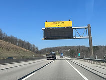
The Turnpike's Warrendale toll plaza is 2 miles from this overhead VMS. (4-9-2026)

The highway goes on to cross Graham Road which then begins paralleling the highway. (4-9-2026)

There is then a crossing of Warrendale Road. (4-9-2026)

Before the Warrendale plaza, there are toll scanners at about mile marker 31. (4-9-2026)
As with the entire Turnpike system, cash is no longer accepted at the Warrendale plaza. (4-9-2026)

The Warrendale toll plaza is seen here. (4-9-2026)

Exit 28, the Cranberry interchange, intersects Interstate 79 and U.S. Route 19, with control cities of Pittsburgh and Erie, in 2 miles. (4-9-2026)

Exit 28 can be taken to the Old Economy Village State Historic Site along the Ohio River several miles to the west. (4-9-2026)

I-79 crosses the Turnpike a mile prior to exit 28. At the north end of this overpass, northbound I-79 has an exit ramp that goes to northbound US 19. (4-9-2026)

The Turnpike passes over US 19 at mile 29.7. (4-9-2026)

The westbound right lane will end at the forthcoming interchange, becoming the physically eastbound lane of the connector road of the interchange. (4-9-2026)

At exit 28, the Turnpike crosses from Allegheny into Butler County. (4-9-2026)

The exit 28 gore sign. (4-9-2026)

Signage along the offramp states that it leads to Pennsylvania Route 228 (Freedom Road) by way of US 19 north. (4-9-2026)

Along the Cranberry Interchange connector, while the westbound Turnpike has direct access to US 19, eastbound traffic must follow the connector a distance to a cloverleaf offramp to US 19. Traffic from each direction of the Turnpike faces each other coming onto US 19. (4-9-2026)

This I-76 reassurance shield follows exit 28. (4-9-2026)

PA 228 makes its passage of the Turnpike at this spot. (4-9-2026)

I-76 has two interchanges left in Pennsylvania: Beaver Valley in 16 miles and New Castle in 18. The Turnpike is a free highway at this point, but still maintained by PTPA. (4-9-2026)

The Turnpike here crosses Rochester Road, a residential through street in Cranberry. (4-9-2026)

At mile marker 25, the highway passes under Powell Road. (4-9-2026)

After entering Beaver County, the Turnpike crosses Harkins Mill Road. (4-9-2026)

The next overpass is Wallace City Road. (4-9-2026)

Then, at mile marker 20, there is a truck parking area along the shoulder. (4-9-2026)

Tulip Drive now crosses the Turnpike at a perpendicular angle. (4-9-2026)

The highway goes on to cross Wises Grove Road. (4-9-2026)

This is followed by a sharp bend to the left. (4-9-2026)

Still curving, the highway passes under Glendale Road. (4-9-2026)

The Turnpike now comes upon two-mile advance signage for the Beaver Valley Interchange (exit 13), intersecting Pennsylvania Route 18 and serving Ellwood City and Big Beaver. Ellwood City is the namesake of the primary setting of the legendary book series and PBS show Arthur. (4-9-2026)

The highway passes under Mercer Road in the meantime. (4-9-2026)

There is a blank food service sign for exit 13 to the right. (4-9-2026)

There was a major construction project going on at exit 13 when these photos were taken. (4-9-2026)

After Beaver Valley, the New Castle Interchange is 2 miles away. (4-9-2026)

Exit 10 intersects a tolled portion of Interstate 376, which goes north to New Castle and south to Pittsburgh. I-376 reconnects with its parent at this interchange after 46 miles. (4-9-2026)

Exit 10 serves southbound interests to the Pittsburgh International Airport (PIT). (4-9-2026)

Exit 10 is I-76's last in Pennsylvania. (4-9-2026)

A sign at right states that cash tolls are not accepted along I-376. (4-9-2026)

Shenango Road crosses the Turnpike right before exit 10. (4-9-2026)

Exit 10 is ahead on the right. This portion of I-376 used to be part of Pennsylvania Route 60, the majority of which (from about Oakdale northward) was absorbed into I-376 in 2009. This resulted in the redesignation of PA 60 Business on the north side of the Pittsburgh airport as I-376 Business. (4-9-2026)

I-376 crosses I-76 just before the westbound offramp. (4-9-2026)

The westbound offramp at exit 10 is not accompanied by a gore sign. (4-9-2026)

The New Castle Interchange connector road crosses at this spot. (4-9-2026)

The Turnpike receives traffic from I-376 to the right. (4-9-2026)

Pennsylvania Route 351 (Fairlane Boulevard) then crosses the highway. (4-9-2026)

The Ohio state line, where I-76 becomes the Ohio Turnpike, is 9 miles away. I-76 is also leaving Appalachia proper for the unglaciated Allegheny Plateau. (4-9-2026)

Roslyn Road is the highway's next overpass. (4-9-2026)

At mile marker 8, I-76 enters its final Pennsylvania county, Lawrence County. (4-9-2026)

Pennsylvania Route 168 then crosses the Turnpike just south of its intersection with Beaver Dam Road. (4-9-2026)

The highway goes over Beaverdam Run soon afterward. (4-9-2026)

The final toll scanners in Pennsylvania are at mile marker 5. (4-9-2026)

Huston Road subsequently passes overhead. (4-9-2026)

The highway's right lane will end soon. (4-9-2026)

The Turnpike's first eastbound tollbooth is seen to the right. (4-9-2026)

The Ohio state line and Turnpike are now a mile away. (4-9-2026)

The highway curves right approaching the state line. (4-9-2026)

The Commonwealth of Pennsylvania and PTPA bid drivers farewell with a sign to the right. (4-9-2026)

I-76 now makes its way into the state of Ohio, bound for Youngstown and then Akron. (4-9-2026)