
The epzik8 Webpage
Interstate 70 west - Maryland line to Breezewood

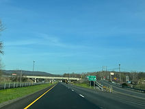
After 91 miles, Interstate 70 leaves Maryland for the Commonwealth of Pennsylvania at Bethel Township, Fulton County. Buck Valley Road (SR 3001) passes overhead just over the state line. (4-9-2026)

The Interstate curves slightly to the left soon afterward. (4-9-2026)

There is a Pennsylvania welcome center a mile away, which was closed when these photos were taken. (4-9-2026)

The entrance to the closed welcome center. (4-9-2026)

At exit 168, U.S. Route 522, which overlaps with I-70 from Maryland into Pennsylvania, departs the Interstate in 1½ miles. (4-9-2026)

The variable message sign on the right warns drivers to watch for loose livestock as there was a bull on the loose in the area on the morning of these pictures. (4-9-2026)

The speed limit along this portion of I-70, up to Breezewood, is only 55 MPH, owing to tight curves and elevation changes throughout. (4-9-2026)

Before exit 168, Pennsylvania Route 484 (Pigeon Cove Road) crosses I-70. (4-9-2026)

Exit 168 sits ahead on the right. (4-9-2026)
From exit 168, US 522 winds its way north to Fulton County seat McConnellsburg, and then to an interchange with the Pennsylvania Turnpike at Fort Littleton. (4-9-2026)

US 522 passes overhead at this spot. Off-picture to the left is a short connection west to PA 484. (4-9-2026)

I-70 is now on its own, and its first westbound reassurance shield in Pennsylvania is to the right. (4-9-2026)

The Interstate soon crosses Potomac River tributary the Little Tonoloway Creek. (4-9-2026)

The towns of Amaranth and Breezewood sit a respective 4 and 20 miles from here. (4-9-2026)

Drivers now have to navigate a wide curve to the right. (4-9-2026)

Then, curving back left, the highway crosses Klondike Road beside White Oak Run. (4-9-2026)

There is a much sharper curve to the left up ahead that poses a tipping hazard for large trucks. (4-9-2026)

A view from around the bend reveals an S-curve as the Interstate curves back right up ahead. (4-9-2026)

The highway now curves wide right. (4-9-2026)

Momentarily straightening back out, it passes under Mill Hill Road (SR 3006). (4-9-2026)

A second crossing of the Little Tonoloway is here. (4-9-2026)

Exit 163, intersecting southbound Pennsylvania Route 731 toward Amaranth, is 2 miles away. (4-9-2026)

Exit 163 is ahead on the right. (4-9-2026)

There is a lefthand curve just before the exit. (4-9-2026)

The exit 163 gore sign. (4-9-2026)

PA 731 goes southwest from here to PA 484 in Union Township. (4-9-2026)

At mile marker 163, I-70 crosses McKees Run. (4-9-2026)

There is then I-70 reassurance. (4-9-2026)

Town Hill and Breezewood are a respective 8 and 15 miles away. (4-9-2026)

There is a sharp curve to the right coming up. (4-9-2026)

As the curve begins, the Interstate crosses Indian Grave Run and Fairview Road. (4-9-2026)

The highway straightens out once again. (4-9-2026)

I-70 now makes its way into Brush Creek Township. (4-9-2026)

Layton Road soon passes overhead. (4-9-2026)

The Interstate curves again before entering a fog area. (4-9-2026)

The eastbound carriageway is now situated significantly higher than the westbound. (4-9-2026)

I-70 meets Pennsylvania Route 643 toward Town Hill at exit 156 in 2 miles. (4-9-2026)

The highway climbs uphill before reaching an S-curve. (4-9-2026)

A set of overhead flashers closer to the curve warns drivers of it. (4-9-2026)

Exit 156, which awaits drivers beyond the curve, has a 15 MPH speed limit due to its tight nature. (4-9-2026)

This sign to the right provides additional notice of the situation. (4-9-2026)

There are signs still prior to exit 156 warning motorists to watch for ice, at least in the winter months. (4-9-2026)

Along exit 156, there is a stop sign at the end of the offramp which is very short. (4-9-2026)

The exit 156 gore contains a massive right pointer arrow. (4-9-2026)

I-70 soon receives a cloverleaf onramp from PA 643. (4-9-2026)

PA 643 then proceeds to pass overhead. (4-9-2026)

Directly following exit 156 is I-70 reassurance. (4-9-2026)

The highway's speed limit remains 55 MPH as it starts running along a ridge with a dip in the distance. (4-9-2026)

Crystal Spring and Breezewood are 4 and 8 miles away respectively. (4-9-2026)

What appears to be a runaway truck ramp can then be seen to the right. (4-9-2026)

In 2 miles, Crystal Spring can be reached from exit 151, which intersects Pennsylvania Route 915. (4-9-2026)

Food is available at this exit. (4-9-2026)

A wide curve to the left once again lies ahead. (4-9-2026)

Exit 151 is a cloverleaf offramp located just beyond I-70's crossing of PA 915 (Valley Road). (4-9-2026)

The exit 151 gore sign. (4-9-2026)

After exit 151, I-70 enters Bedford County and East Providence Township. (4-9-2026)

Soon afterward, overhead flashers warn drivers to watch for stopped traffic as there is a congested area ahead. (4-9-2026)

The next 4 miles are declared a congestion area by PennDOT. (4-9-2026)

In 1¾ miles, exit 149 leads from westbound I-70 to westbound U.S. Route 30 and the borough of Everett. This interchange has a low vertical clearance of 14 feet, 3 inches. (4-9-2026)

Driver services are available at exit 149. (4-9-2026)

The area of South Breezewood can be reached from this exit. (4-9-2026)

At exit 149, there is advance signage for I-70's at-grade junction with US 30 and interchange with the Pennsylvania Turnpike at exit 147. (4-9-2026)

The exit 149 gore sign. (4-9-2026)

This is followed by I-70 reassurance. (4-9-2026)

Exit 147 is 1½ miles away. (4-9-2026)

The expressway will end shortly at a traffic signal at I-70. (4-9-2026)

The Breezewood signal is a mile away. (4-9-2026)

The Pennsylvania Turnpike itself passes overhead behind this sign assembly. (4-9-2026)

The speed limit is preparing to drop to 35 MPH. (4-9-2026)

Westbound I-70 joins the Turnpike in Breezewood, proceeding toward Pittsburgh. (4-9-2026)

There are then "T" diagram signs on either side of the highway. (4-9-2026)

Flashers then warn of the impending signal. (4-9-2026)

Final overhead signage for the movements up ahead is posted here. (4-9-2026)

The highway glides downhill toward the signal with service signs towering overhead. (4-9-2026)

At Breezewood, westbound I-70 through traffic is required to make two right turns respectively onto and off surface US 30, then take an approximately mile-long connector road and go through a Turnpike tollbooth. The westbound Turnpike has an alternate control city posted here of New Stanton, where I-70 leaves it and becomes a free highway again. (4-9-2026)
