
The epzik8 Webpage
Interstate 70/76 west - Breezewood to New Stanton

The mainline of the Pennsylvania Turnpike, carrying Interstates 70 and 76, heads west away from the Breezewood interchange (exit 161), where I-70 joins it. The Turnpike continues to use I-76's mile markers and exit numbers along the ensuing 86-mile overlap between the two highways because I-76 is the through route along the corridor. (4-9-2026)

Soon, the Turnpike curves wide to the right. (4-9-2026)

The highway straightens out, but curves again up ahead. (4-9-2026)

Pointer Road crosses the Turnpike within the second curve. (4-9-2026)

The Turnpike then goes slightly downhill toward a wide curve to the left, where the recommended speed is 60 MPH. Traffic cones have also appeared between each lane of the westbound carriageway as there was roadwork going on in the left lane when these pictures were taken, one of many construction projects going on along the Turnpike at the time. (4-9-2026)

A sign to the right warns motorists to watch for fallen rocks. This is a hallmark of Pennsylvania's highway system, especially on Interstates. (4-9-2026)

Ritchey Road East crosses the Turnpike next. (4-9-2026)

Along here, the vertical height clearance on the shoulder is 13 feet, 1 inch. (4-9-2026)

The highway soon passes under Ritchey Road West. (4-9-2026)

A light curve to the right is in the distance at mile marker 155.8. (4-9-2026)

Half a mile later, the Turnpike passes under Dogwood Lane. (4-9-2026)

The highway prepares to straighten out again at mile 154.6. (4-9-2026)

The Turnpike goes very slightly uphill, then S-curves. (4-9-2026)

A bridge over a service road which, just to the south, parallels the Mid-State Trail is then encountered. (4-9-2026)

The Turnpike dips downward, then goes back up and to the right, before passing under Ashcom Road. (4-9-2026)

Just past mile marker 151, the highway prepares to curve left again. (4-9-2026)

This portion of the Turnpike is a deer watch area. (4-9-2026)
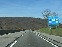
The Turnpike's North Midway Service Area is located two miles from this blue sign. (4-9-2026)

In the meantime, the highway crosses the Juniata River, a tributary of the Susquehanna River which begins dozens of miles to the north and east at Duncannon in Dauphin County. (4-9-2026)

Service signs for the forthcoming exit 146 now start appearing. (4-9-2026)

The Turnpike's next bridge is over the Juniata's Raystown Branch. (4-9-2026)

The highway becomes straight and flat just over a mile from the service plaza. (4-9-2026)

The Turnpike then comes upon 2-mile advance signage for the Bedford interchange at exit 146, which can be used to access Interstate 99, its associated surface highway U.S. Route 220, and the cities of Bedford and Altoona. (4-9-2026)

Exit 146 can be used to reach Cumberland, Maryland via southbound US 220. (4-9-2026)

The North Midway plaza is now fast approaching. This sign advertises the facility's offering of E-ZPass transponders. (4-9-2026)

Two state parks, Blue Knob and Shawnee, can be reached from exit 146. (4-9-2026)

The blue sign on the right points the way to the service plaza. (4-9-2026)

A sign to the right displays the hefty gas and diesel prices per gallon at the Sunoco pumps at the plaza. (4-9-2026)

The North Midway plazas on each side of the Turnpike are seen here. (4-9-2026)

At the service plaza exit, a sign on the right displays hazardous materials which are prohibited in the Allegheny Mountain tunnel a few miles away. (4-9-2026)

A series of winding curves awaits drivers ahead. (4-9-2026)

As the Turnpike comes upon exit 146, Briar Valley Road crosses it. (4-9-2026)

Exit 146 is situated along a lefthand curve. (4-9-2026)

This interchange is the southern terminus of I-99, which runs mainly concurrent with US 220 to Altoona, State College, and to a northern end at Interstate 80 in Bellefonte in Centre County. A different segment of I-99 runs along U.S. Route 15 from Williamsport to Corning, New York. (4-9-2026)

The westbound Turnpike receives a cloverleaf onramp from US 220 up ahead. (4-9-2026)

US 220 crosses the Turnpike at mile marker 145.3 just south of the official southern terminus of I-99. (4-9-2026)

Just afterward, an I-70/76 shield assembly with "TOLL" notation is posted to the right. (4-9-2026)

An overhead toll scanner, one of many installed along the Turnpike with the discontinuation of cash tolls, is at mile marker 145. (4-9-2026)

The next interchange, Somerset, is a good 36 miles away, followed by Donegal in 55 miles. (4-9-2026)

At mile marker 141.8, the shoulder's vertical clearance becomes 12 feet, 8 inches. (4-9-2026)

Diehl Road then passes overhead. (4-9-2026)

Watson Road (SR 4005) crosses soon afterward along an unmarked overpass. (4-9-2026)

Heading toward mile marker 139.6, drivers are faced with a wide righthand curve. (4-9-2026)

A mile and a half passes before Shawnee Road (Pennsylvania Route 96) crosses the Turnpike at an oblique angle beside Shawnee State Park. (4-9-2026)

A complete, if brief, break in the tree cover lining the highway can be seen in the distance. (4-9-2026)

The Turnpike goes on to a crossing at Boozer Road. (4-9-2026)

A little further along, the highway comes to an overpass at Cider Lane. (4-9-2026)

On the right soon afterward sits a Turnpike Authority maintenance shed. (4-9-2026)
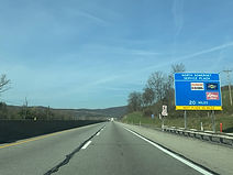
The next service plaza, North Somerset, sits 20 miles away, with the next being 35 miles after that. (4-9-2026)

Expanding to three lanes in each direction, the Turnpike crosses New Baltimore Road. (4-9-2026)

The highway then enters Somerset County. (4-9-2026)
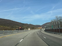
A sound barrier soon appears on the right. (4-9-2026)

Findley Street then crosses the highway. (4-9-2026)

The Turnpike curves left at mile 128.7 as the sound barrier ends. (4-9-2026)

The highway straightens out, then curves to the right in the distance. (4-9-2026)

A distance later, the speed limit drops to 55 MPH. (4-9-2026)

A wide curve to the right then greets traffic. (4-9-2026)

The next mile consists of winding curves. (4-9-2026)

The Allegheny Mountain Tunnel is now approaching. (4-9-2026)

The westbound left lane ends before the tunnel entrance. (4-9-2026)

Drivers are urged to turn on their headlights entering the tunnel. (4-9-2026)

The highway is back down to 2 lanes in each direction. (4-9-2026)

The Allegheny Mountain Tunnel entrance is seen here. (4-9-2026)

This is the westernmost of the three tunnels along the Turnpike mainline. (4-9-2026)

The end of the tunnel is up ahead. (4-9-2026)

The speed limit goes back up to 70 MPH on the other side of the tunnel. (4-9-2026)

The Turnpike soon passes under Shanksville Road. (4-9-2026)

A crossing of the Stony Creek River follows. (4-9-2026)

Horse Track Road then crosses the Turnpike. (4-9-2026)

A third lane begins on the left, then quickly disappears. (4-9-2026)

After a hillcrest, the Turnpike curves slight left. (4-9-2026)

The highway subsequently passes under Cranberry Road. (4-9-2026)

The next crossing is of Menser Road. (4-9-2026)

The North Somerset service plaza is now a mile away. (4-9-2026)

The service plaza entrance is on the right. (4-9-2026)

The Turnpike curves slightly to the right at the service plaza exit. (4-9-2026)

Glades Pike West subsequently passes overhead. (4-9-2026)

The Somerset Interchange (exit 110), intersecting U.S. Route 219 and bearing control cities of Somerset and Johnstown, is 2 miles away. (4-9-2026)

Hotels at exit 110 are displayed by the blue sign at right. (4-9-2026)

Drivers are treated to a view of downtown Somerset as the Turnpike curves right before the exit. (4-9-2026)

The Flight 93 Memorial, a National Park Service monument paying tribute to the victims of one of the plane crashes of September 11, 2001, can be reached from this exit. (4-9-2026)

The Turnpike crosses Pennsylvania Route 281 (Stoystown Road) and then a freight railroad track just prior to the exit. (4-9-2026)

North Center Avenue then zips overhead. (4-9-2026)

Exit 110 is ahead on the right. (4-9-2026)

The connector road between the Turnpike and US 219 has its own overhead signage. (4-9-2026)

The exit 110 gore sign. (4-9-2026)

The westbound lanes receive traffic from US 219 on the right. (4-9-2026)

As a third lane again begins, I-70/76 reassurance appears. This time, the I-76 shield is above I-70. (4-9-2026)

The next two interchanges, Donegal and New Stanton, are respectively 19 and 34 miles away. (4-9-2026)

The highway curves left as it goes slightly uphill. (4-9-2026)

This is quickly followed by an S-curve. (4-9-2026)

For a brief moment, with trees along its left, the highway straightens out somewhat. (4-9-2026)
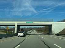
After curving left and then straightening out again, the Turnpike passes under Coxes Creek Road. (4-9-2026)

The highway then dips downward with another lefthand curve in the distance. (4-9-2026)

The next overpass in Bakersville Edie Road. (4-9-2026)

At mile marker 102.5, the Turnpike approaches another wide curve left. (4-9-2026)

The Laurel Highlands Hiking Trail passes overhead soon afterward. (4-9-2026)

The Turnpike's westbound carriageway will soon consolidate back into 2 lanes. (4-9-2026)

There is a leftward curve where the right lane ends. (4-9-2026)

The Turnpike now makes its way from Somerset County into Westmoreland County. (4-9-2026)

There are constant tight curves over the next 5 miles. (4-9-2026)

At around mile marker 99.6, motorists are greeted by another toll scanner. Signage on it rounds the mile marker up to 100. (4-9-2026)

Truckers are warned by the sign to the right that there are treacherous descents along the next 5 miles. (4-9-2026)

The Turnpike then curves widely to the right with rock along its right side. (4-9-2026)

Curving back left, the Turnpike passes under Pennsylvania Route 381. (4-9-2026)

Old Franklin Road then crosses in quick succession. (4-9-2026)

The highway makes its way downhill toward a dip in the distance. (4-9-2026)
A third lane begins to the right, but won't last very long. (4-9-2026)

Two miles away, exit 91, the Donegal Interchange, meets Pennsylvania routes 31 and 711, serving Ligonier and Uniontown. (4-9-2026)

The right lane ends just beyond the Jones Mill Road overpass. (4-9-2026)

Meanwhile, the New Stanton Service Plaza, the last on the westbound mainline Turnpike, is 15 miles away. (4-9-2026)

The highway takes time to curve wide right. (4-9-2026)

Donegal's Main Street crosses the Turnpike on approach to exit 91. (4-9-2026)

Exit 91 lies just ahead on the right. (4-9-2026)

The westbound offramp for exit 91 is a sharp cloverleaf. (4-9-2026)

The exit 91 gore sign. (4-9-2026)

Main Street again passes overhead after exit 91. (4-9-2026)

The Turnpike is respectively 15 and 23 miles away from the New Stanton and Irwin interchanges. (4-9-2026)

More tricky descents face drivers up ahead. (4-9-2026)

At Clay Pike Road, there is again a set of flashers to the right warning of sharp curves ahead. (4-9-2026)

The Turnpike soon passes by PTPA's Donegal maintenance facility. (4-9-2026)

Straightening out, the Turnpike goes past a farm field. (4-9-2026)
Freeman Falls Road soon crosses overhead. (4-9-2026)

A sound barrier lines the westbound carriageway along another righthand curve. (4-9-2026)

Another set of S-curves approaches at mile 86.5. (4-9-2026)

The Turnpike winds its way along another hillside. (4-9-2026)

Some of the surrounding tree cover briefly backs off before a curve to the right. (4-9-2026)
Pennsylvania Route 982 uses the overpass seen here to cross the Turnpike. (4-9-2026)

The Turnpike itself then passes over Slope Hill Road. (4-9-2026)
After only about a quarter-mile, the highway crosses Pennsylvania Route 981. (4-9-2026)

At the beginning of a righthand curve sits the Hecla Road overpass. (4-9-2026)

Pennsylvania Route 981 zips across at the next crossing. (4-9-2026)
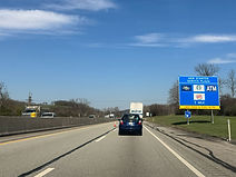
The Turnpike is now just a mile away from the New Stanton service plaza. (4-9-2026)

The next toll scanners are about 21 miles on from the previous ones, at about mile marker 79. (4-9-2026)

The service plaza is just ahead on the right side of the highway. (4-9-2026)

A sign at the service plaza exit states that parking on the shoulder (at least for the sake of it) is prohibited. (4-9-2026)

At the Sportsman Road overpass, there is 2-mile advance notice for exit 75, the New Stanton interchange. I-70 leaves the Turnpike at this interchange, heading west toward Wheeling, West Virginia. The exit also provides access to U.S. Route 119 and Turnpike 66 (part of a PA state route) with a control city of Westmoreland County seat Greensburg. I-76 retains Pittsburgh as a control city and also picks up a second in Cleveland, Ohio. (4-9-2026)

Exit 75 is now a mile away. (4-9-2026)

Food options available at exit 75 are listed to the right. (4-9-2026)

Approaching exit 75, the cities of Washington, Pennsylvania and Columbus, Ohio are added as control cities for westbound I-70. (4-9-2026)

Exit 75 is just ahead on the right. (4-9-2026)

The exit 75 gore sign. (4-9-2026)

The interchange connector road subsequently passes overhead. (4-9-2026)
